According to storm and low pressure news, the latest low pressure from the Joint Typhoon Warning Center (JTWC), low pressure with symbol 93W is moving near the East Sea.
On the night of January 26 (local time), the center of the low pressure was located east of Mindanao Island (Philippines). The low pressure moved northwest, towards the mainland of central Philippines.
The strongest wind near the center of the low pressure reaches 30 km/h. However, the low pressure has little chance of strengthening into a tropical depression in the next 24 hours.
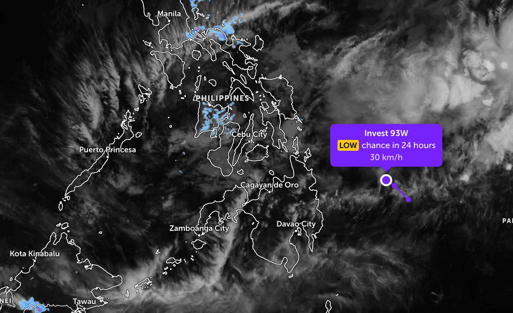
Because it is still quite far away, the low pressure has not affected the mainland area of the Philippines much. Currently, the low pressure has weakened.
In the East Sea, according to the National Center for Hydro-Meteorological Forecasting, on January 27, northeast of the Northern East Sea area: Northeast wind level 6, gusts level 7-8; rough seas; waves 2.0-4.0m high.
From the night of January 27 and January 28, 2026, the sea area north of the Northern East Sea area will have strong Northeast winds of level 6, gusts of level 7-8; rough seas; waves 2.0-4.0m high. Level of natural disaster risk at sea: level 2.
All ships operating in the above areas are at high risk of being affected by strong winds and big waves.
People and tourists who plan to visit these areas should pay attention to weather forecasts. Follow local instructions to avoid rain, wind, and big waves at sea that are dangerous.
It's a bit of a bit of a bit of a bit of a bit of a bit.


