According to storm news, the latest low pressure from the Joint Typhoon Warning Center (JTWC), a new low pressure has formed near the East Sea.
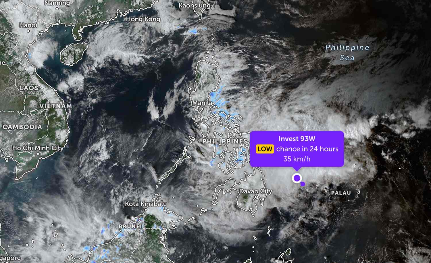
As of 1 pm today (Vietnam time), the position of the low pressure center with symbol 93W is located in the east of Mindanao Island of the Philippines. The strongest wind near the low pressure center reaches 35 km/h.
The low pressure area is forecast to have little chance of developing into a tropical depression in the next 24 hours.
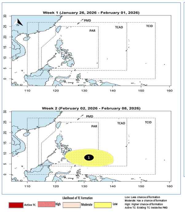
Previously, the Philippine Atmospheric, Geophysical and Astronomical Services Administration (PAGASA) forecast that there would be a low pressure area appearing in the Philippine area of responsibility in the week from February 2nd to February 8th. The low pressure position almost coincides with low pressure 93W. Therefore, the low pressure area has formed earlier than forecast.
Due to being quite far from the mainland, the low pressure has not had much impact on the mainland Philippines.
Meanwhile, in the East Sea, on January 26, the sea area northeast of the Northern East Sea area had strong Northeast winds at level 5, sometimes level 6.
Forecast for the night of January 26 and day of January 27, the Northeast of the Northern East Sea area will have Northeast wind level 6, gusts level 7-8; rough seas; waves 2.0-4.0m high.
From the night of January 27 and January 28, 2026, the sea area north of the Northern East Sea area will have strong Northeast winds of level 6, gusts of level 7-8; rough seas; waves 2.0-4.0m high. Level of natural disaster risk at sea: level 2.
All ships operating in the above areas are at high risk of being affected by strong winds and big waves.
People and tourists who plan to visit these sea areas should pay attention to weather forecasts. Follow local instructions to avoid dangerous storms.


