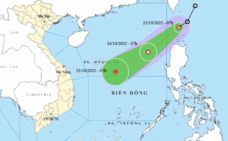
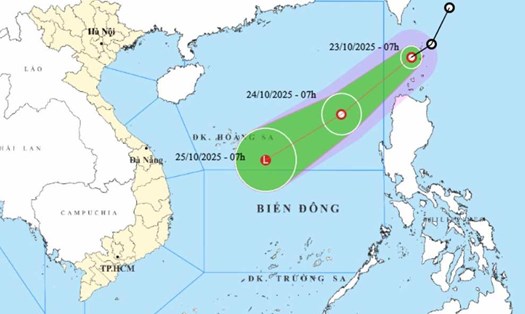
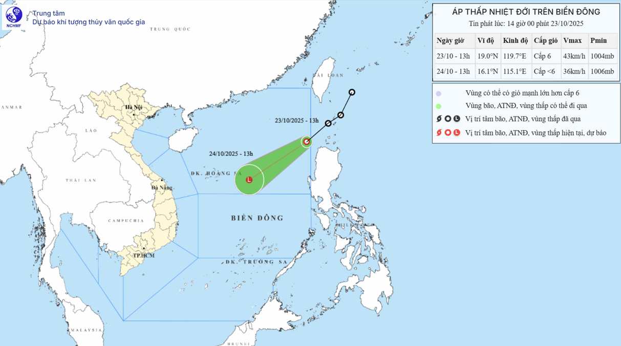
According to the National Center for Hydro-Meteorological Forecasting, at 1:00 p.m., the center of the tropical depression was at about 19.0 degrees North latitude - 119.7 degrees East longitude. The strongest wind near the center of the tropical depression is level 6 (39-49km/h), gusting to level 8. The low pressure is moving southwest at a speed of about 25km/h.
It is forecasted that by 1:00 p.m. on October 24, the tropical depression will move southwest at a speed of about 25 km/h. The center of the low pressure is located at about 16.1 degrees North latitude - 115.1 degrees East longitude, in the North East Sea. The intensity of the tropical depression will gradually weaken into a low pressure area with winds smaller than level 6. Natural disaster risk level: Level 3 for the eastern sea area of the North East Sea.
Due to the influence of the tropical depression combined with the strengthening of cold air, the eastern sea of the North East Sea will have strong winds of level 6-7, gusts of level 9, waves 3.0-5.0m high. Strong seas.
On the night of October 23 and 24, in the sea area from South Quang Tri to Ca Mau, from Ca Mau to An Giang, the Gulf of Thailand, the North and Central East Sea (including the special zone of Hoang Sa) and the South East Sea (including the special zone of Truong Sa), there will be scattered showers and thunderstorms. During thunderstorms, there is a possibility of tornadoes, strong gusts of wind of level 6-7 and waves over 2.0m high.
On the night of October 24 and October 25, the sea area north of the North East Sea will have strong northeast winds of level 6, sometimes level 7, gusting to level 8-9, rough seas, waves 3.0-5.0m high.
The sea area from South Quang Tri to Quang Ngai will have strong northeast winds of level 6, gusting to level 7-8. Rough seas, waves 2.0-4.0m high. Sea natural disaster risk level: level 2; in the eastern sea area of the North East Sea, level 3.
Ship operating in the above-mentioned dangerous area are likely to be affected by thunderstorms, whirlwinds, strong winds, and large waves.
Meanwhile, high tides are affecting the southern sea areas of our country.
The highest water level of the day at Vung Tau station is changing slowly. On October 22, the highest peak tide at Vung Tau station reached 4.17m at 3:00 p.m. and in the early morning of October 23, it reached 4.16m at 2:00 a.m.
In the next 24 hours, the highest water level at Vung Tau station will be 4.15 - 4.20m high.
In the next 24 - 48 hours, the water level in the eastern coast of the South will continue to change slowly. The highest water level at Vung Tau station is likely to reach 4.10 - 4.15m.
People and tourists coming to these coastal areas should pay attention to weather forecasts. Follow local instructions to avoid rough seas, big waves, and high tides that are dangerous.
Due to the impact of high tides, the eastern coastal areas of the South need to pay attention to the high risk of flooding and overflowing dykes in low-lying coastal areas, along rivers, outside dykes affecting traffic, agricultural production, aquaculture, water pollution and the daily life of people in the eastern coastal areas of the South.