New low pressure forecast near the East Sea will become a storm right after storm No. 12

Ninh Phương |

The new low pressure is likely to strengthen into storm Salome near the East Sea when storm No. 12 Fengshen weakens. Weather forecast for heavy rain.

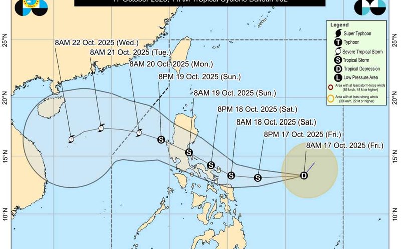
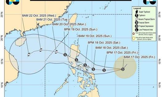
According to the latest weather forecast from the Philippine Meteorological Agency (PAGASA), a low pressure area located about 370km from Batanes, Philippines is likely to strengthen into a tropical depression in the next 24 hours.

This tropical depression is likely to develop into tropical storm Salome.

The depression is currently moving southwest.

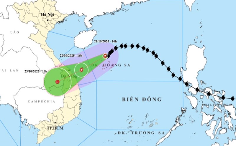
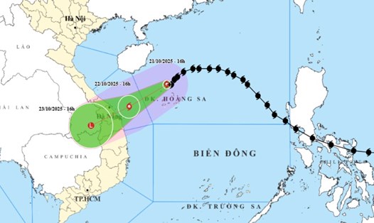
In the next few hours, the low pressure is forecast to change direction to the west, with a high probability of approaching or making landfall in the Batanes area on the night of October 22 or early morning of October 23 - the time when storm No. 12 Fengshen approaches central Vietnam.

Currently, the low pressure forecast is still uncertain due to the strong influence of the northeast monsoon.

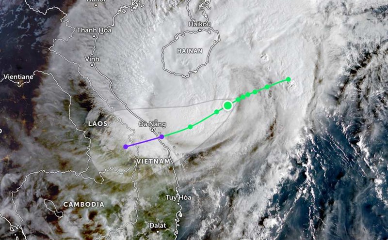
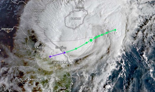
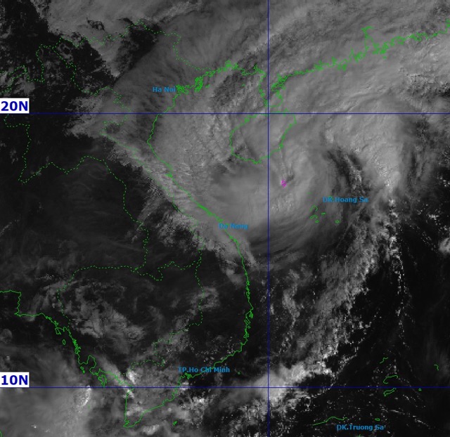
Meanwhile, storm No. 12 Fengshen is more than 200km from Da Nang. Strongest wind: Level 10 (89-102km/h), gust level 12.

Bao so 12 Fengshen di chuyen theo huong Tay, toc do khoang 10km/h huong ve Da Nang. Anh: NCHMF
Storm No. 12 Fengshen moves westward, at a speed of about 10km/h towards Da Nang. Photo: NCHMF

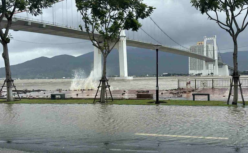
According to the weather forecast of the National Center for Hydro-Meteorological Forecasting, due to the influence of storm No. 12, on the night of October 21 and the morning of October 22, the area from Ha Tinh to Quang Ngai and the South will have scattered showers and thunderstorms, locally heavy to very heavy rain. Total rainfall is generally from 100-250mm, locally over 350mm.

In particular, the area from South Quang Tri to Da Nang City will have heavy to very heavy rain, total rainfall is generally 400-600mm, locally over 800mm.

On the morning of October 22, in the area from Ha Tinh to Da Nang, there were scattered showers and thunderstorms with rainfall from 10-30mm, locally heavy rain over 70mm.

In the afternoon and evening of October 22, the area from Dak Lak to Lam Dong and the South will have scattered showers and thunderstorms with rainfall from 15-30mm, locally heavy rain over 80mm.

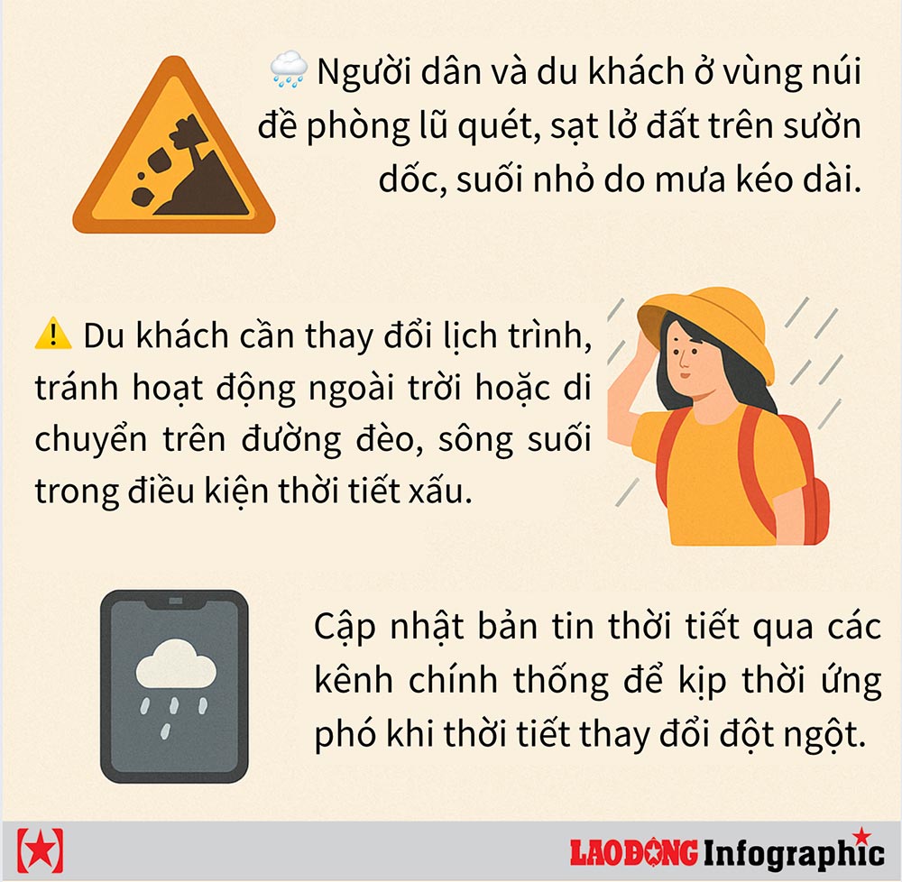
Heavy rain is at risk of causing flooding in low-lying areas; flash floods on small rivers and streams; landslides on steep slopes.

High-intensity rain in a short period of time can cause flooding in urban areas and industrial parks.

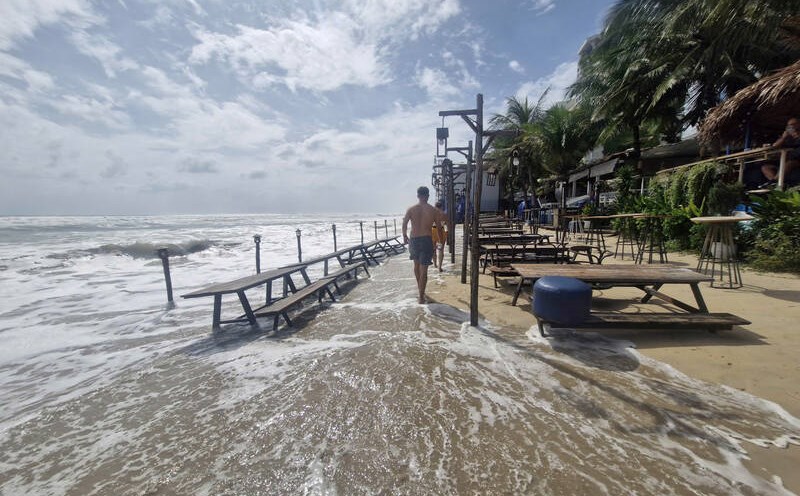
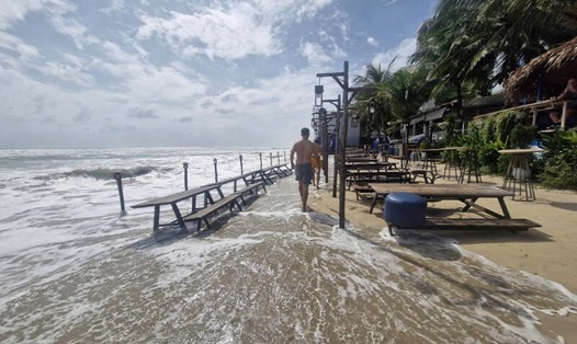
Strong winds and large waves affect the operation of ships and other activities at sea.

Cold weather at night and in the morning can affect health, especially for the elderly and children.

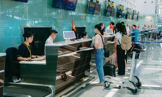
People and tourists are advised to limit travel to areas directly affected by the storm, following the instructions of local authorities.

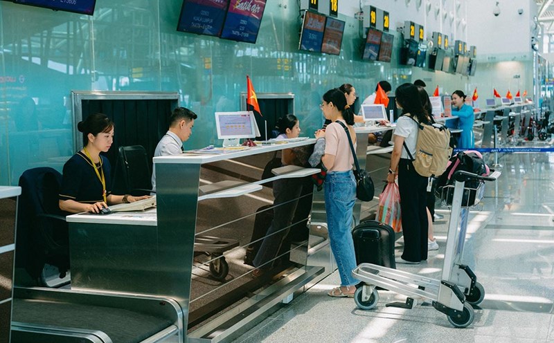
Proactively check flight schedules, trains, and tour information to proactively change plans if necessary, ensuring safety.

Khuyen cao danh cho nguoi dan va du khach truoc dien bien thoi tiet thay doi do bao so 12 Fengshen. Do hoa: Thanh Son
Recommendations for people and tourists in the face of weather changes caused by storm No. 12 Fengshen. Graphics: Thanh Son
Ninh Phương
TIN LIÊN QUAN

Storm No. 12 is 270 km from Da Nang, with heavy rain over 900 mm

|

Storm No. 12 Fengshen is forecast to make landfall tomorrow, October 23, causing widespread heavy rain.

Storm No. 12 Fengshen affects 3 airports in the Central region

|

The airports are forecast to be located in areas directly affected by storm No. 12 Fengshen, including: Phu Bai, Da Nang and Chu Lai.

Weather changes due to the double impact of storm No. 12 and cold air

|

The weather forecast for the North and Central regions is affected by cold air combined with the circulation of storm No. 12 Fengshen.

Storm No. 12 accelerates to make landfall, forecasts dangerous weather from October 22

|

Storm No. 12 Fengshen is strong at level 9-10, gusting to level 12 towards Da Nang. Weather forecast for heavy rain, strong winds and rising water from October 22.

Da Nang relocates all tourist boats and fishing boats at the end of the Han River to avoid storm No. 12

|

All tourist boats and fishing boats anchored at Han River Port and Inland Water Port, Da Nang evacuated to safe shelters on the afternoon of October 21.

Tropical depression is about to strengthen into a storm approaching the East Sea

|

The tropical depression near the East Sea is forecast to strengthen into a storm in the next 24 hours.

Storm No. 12 is 270 km from Da Nang, with heavy rain over 900 mm

Chí Long |

Storm No. 12 Fengshen is forecast to make landfall tomorrow, October 23, causing widespread heavy rain.

Storm No. 12 Fengshen affects 3 airports in the Central region

Ninh Phương |

The airports are forecast to be located in areas directly affected by storm No. 12 Fengshen, including: Phu Bai, Da Nang and Chu Lai.

Weather changes due to the double impact of storm No. 12 and cold air

Ninh Phương |

The weather forecast for the North and Central regions is affected by cold air combined with the circulation of storm No. 12 Fengshen.

Storm No. 12 accelerates to make landfall, forecasts dangerous weather from October 22

Ninh Phương |

Storm No. 12 Fengshen is strong at level 9-10, gusting to level 12 towards Da Nang. Weather forecast for heavy rain, strong winds and rising water from October 22.

Da Nang relocates all tourist boats and fishing boats at the end of the Han River to avoid storm No. 12

An Thượng |

All tourist boats and fishing boats anchored at Han River Port and Inland Water Port, Da Nang evacuated to safe shelters on the afternoon of October 21.

Tropical depression is about to strengthen into a storm approaching the East Sea

Chí Long |

The tropical depression near the East Sea is forecast to strengthen into a storm in the next 24 hours.