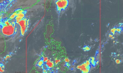
According to the new weather forecast from the National Center for Hydro-Meteorological Forecasting, early this morning (October 23), after entering the coastal waters of Hue City - Da Nang, the tropical depression (weakened from storm No. 12) has weakened into a low pressure area.
At 7:00 a.m., the center of the low pressure area was at about 16.1 degrees North latitude - 108.5 degrees East longitude. The strongest wind in the center of the low pressure area drops below level 6 (under 39km/h).
It is forecasted that in the next 12 hours, the low pressure area will continue to move mainly in the Southwest direction, weakening and gradually dissipating.
Due to the influence of the strengthening cold air combined with the disturbance of the East wind and the circulation after the storm, the situation of heavy rain in the Central region, strong winds at sea is still complicated, it is necessary to pay attention to the forecasts of heavy rain and strong winds at sea.
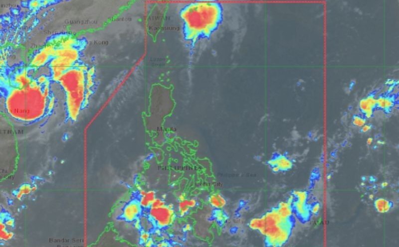
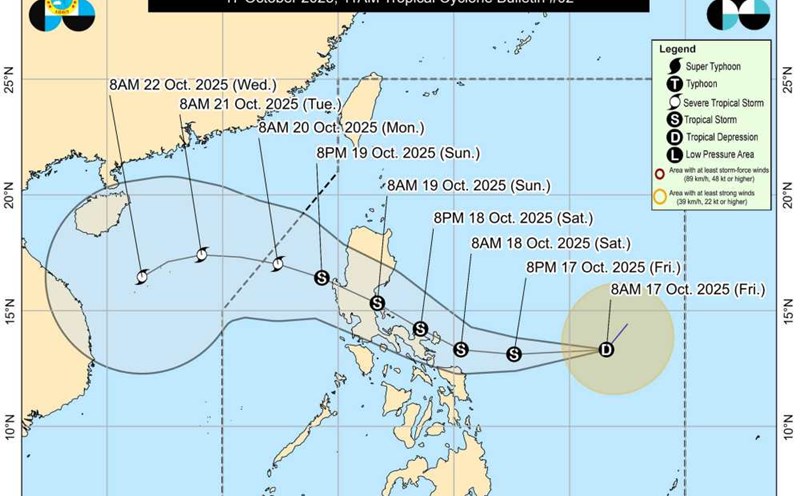
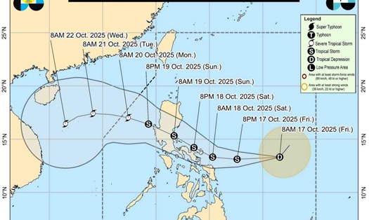
Meanwhile, a new tropical depression is preparing to enter the East Sea.
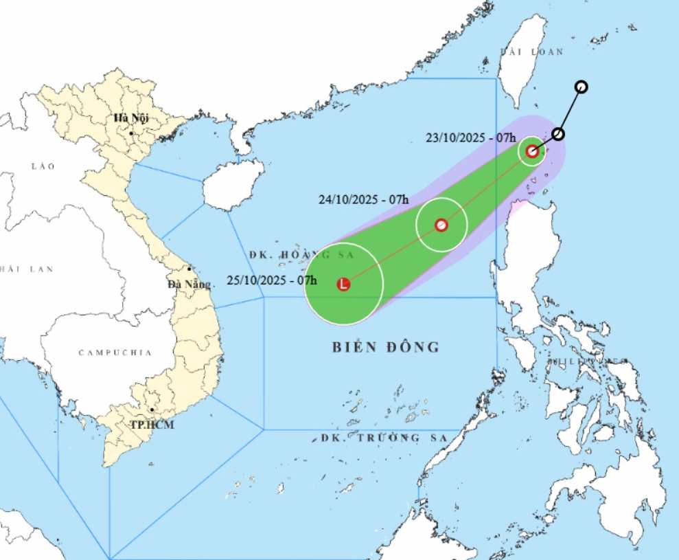
At 7:00 a.m. on October 23, the center of the tropical depression was at about 20.4 degrees North latitude - 121.4 degrees East longitude. The strongest wind near the center of the tropical depression is level 7 (50-61km/h), gusting to level 9. Moving southwest at a speed of about 20km/h.
It is forecasted that by 7:00 a.m. on October 24, the tropical depression will move in the South-Southwest direction at a speed of about 20km/h. The center of the low pressure is located at about 17.7 degrees North latitude - 117.9 degrees East longitude, in the eastern sea of the North East Sea.
The strongest wind near the center of the tropical depression will reach level 6, gusting to level 8. Natural disaster risk level: level 3 for the eastern sea area of the North East Sea.
At 7:00 a.m. on October 25, the tropical depression moved southwest at a speed of about 20 km/h. The center of the low pressure is located at about 15.5 degrees North latitude - 114.1 degrees East longitude, about 250km east of Hoang Sa Special Zone with gradually weakening intensity. The strongest wind is less than level 6.
Due to the influence of the tropical depression combined with the strengthening of cold air, the eastern sea of the North East Sea will have strong winds of level 6-7, gusts of level 9, waves 3.0-5.0m high. Strong seas.
Ship operating in the above-mentioned dangerous areas are likely to be affected by thunderstorms, whirlwinds, strong winds, and large waves. People and tourists to these areas should pay attention to weather forecasts and follow local instructions to avoid dangerous storms and big waves.