According to the latest weather forecast from the Philippine Atmospheric, Geophysical and Astronomical Services Administration (PAGASA), on the morning of January 13, a low pressure area is moving towards the East Sea.
By 8 am this morning (local time), the center of the low pressure was located at about 5.1 degrees North latitude - 135.4 degrees East longitude, about 1,100 km east-southeast of Mindanao. The strongest wind near the center of the low pressure reached 30 km/h.
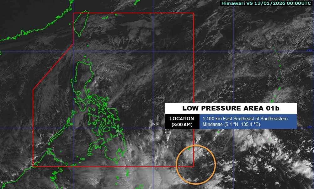
PAGASA forecasts that the low pressure area is likely to moderately strengthen into a tropical depression in the next 24 hours. If it forms, the tropical depression will be named Ada.
It is forecast that the low pressure will move deeper towards the mainland of the Caraga and Davao regions this week. By the week from January 16-21, the low pressure may move to the area between Eastern Visayas and the Caraga region in the middle of next week.
Due to being quite far away, the low pressure has not affected the mainland areas of the Philippines.
In the East Sea, according to the National Center for Hydro-Meteorological Forecasting, on the morning of January 13, in Phu Quy special zone, there were gusts of level 7; Huyen Tran station had strong Northeast winds of level 6.
During today and tonight, the sea area northeast of the Northern East Sea area, the sea area from Gia Lai to Ho Chi Minh City and the sea area west of the South East Sea area (including the sea area west of the Truong Sa special zone): Northeast wind level 6, gusts level 7-8; rough seas; waves 2.0-3.0m high.
Day and night of January 14, sea area in the Northeast of the Northern East Sea area: strong Northeast wind level 6, gusts level 7-8; sea waves 2.0-3.0m high; rough seas.
The sea area from Khanh Hoa to Ho Chi Minh City and the western sea area of the South East Sea (including the western sea area of the Truong Sa special zone): strong Northeast wind level 5, sometimes level 6, gusts level 7-8; waves 2.0-3.0m high; rough seas.
People and tourists who plan to visit these sea areas should pay attention to weather forecasts. Follow local instructions and do not go out when the sea is rough to avoid strong winds and big waves causing danger.