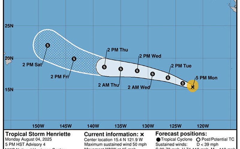
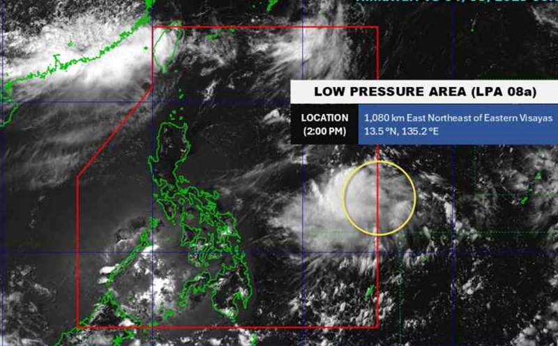
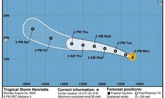
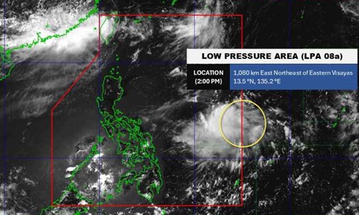
According to the latest weather forecast from the Philippine Atmospheric, Geophysical and Astronomical Services Administration, as of 8:00 a.m. on August 6 (local time), a low pressure near the East Sea has moved near the Philippine mainland.
The center of the low pressure is located at about 13.6 degrees North latitude - 125.8 degrees East longitude, about 170 km east of Virac, Catanduanes. The low pressure is forecast to have little chance of developing into a storm in the next 24 hours.
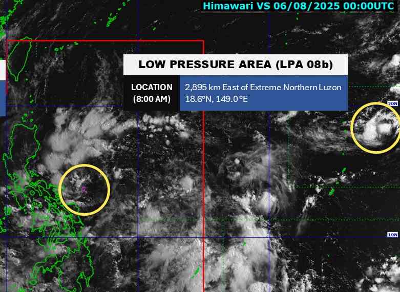
Meanwhile, another low pressure has been detected outside the Philippines' responsibility area. The center of the low pressure is located at about 18.6 degrees North latitude - 149.0 degrees East longitude, about 2,895 km east of the northernmost tip of Luzon. The low pressure is also unlikely to develop into a storm in the next 24 hours.
Due to the influence of the low pressure near land, the Cagayan Valley, Bicol, Aurora, Quezon, Marinduque, Romblon, Northern Samar, Samar, Eastern Samar, Biliran, and Leyte regions will have gloomy skies and scattered thunderstorms.
In the East Sea, according to the National Center for Hydro-Meteorological Forecasting, the northern Gulf of Tonkin and the northern sea of the North East Sea will have showers and thunderstorms. In the Gulf of Tonkin, there are strong southwest winds of level 5, sometimes level 6, gusting to level 7.
The Gulf of Tonkin region is forecast to have scattered showers and thunderstorms on the day and night of August 6. During thunderstorms, there is a possibility of tornadoes and strong gusts of wind.
The North Gulf of Tonkin area, the sea area west of the North and Central East Sea (including Hoang Sa special zone) has strong southwest to south winds of level 5, sometimes level 6, gusting to level 78; rough seas; waves 1.53.0m high. The sea area from Da Nang to Khanh Hoa: southwest wind level 5, gust level 67.
Ship operating in the above areas are at high risk of being affected by tornadoes and strong gusts of wind.
People and tourists planning to visit these areas should pay attention to weather forecasts. Tuan followed local instructions to ensure safety throughout the journey.