The low pressure area operating in the Philippine Meteorological Responsibility Area (PAR) is likely to strengthen into a tropical storm on Tuesday, June 10 or in the next few days, according to information from the Philippine Atmospheric, Geophysical and Astronomical Services Administration (Pagasa).
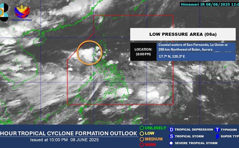
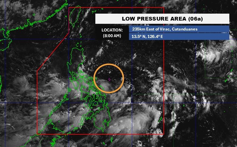
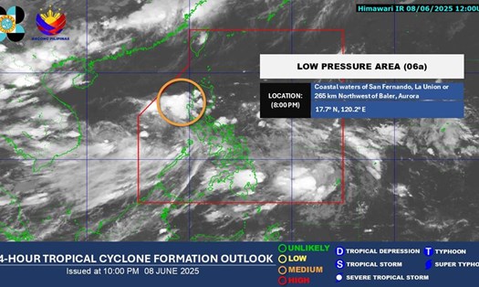
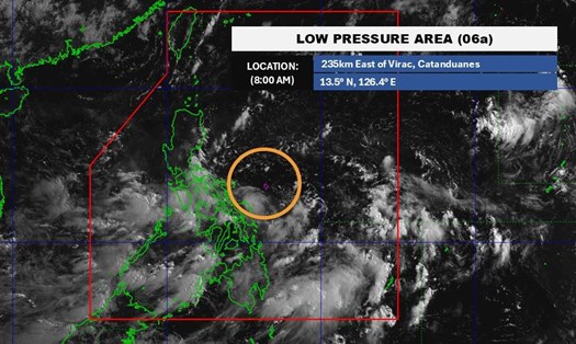
At 2:00 a.m. on June 9 (local time), Pagasa determined that the low pressure was at 17.1 degrees North latitude, 119.9 degrees East longitude, in the North East Sea.
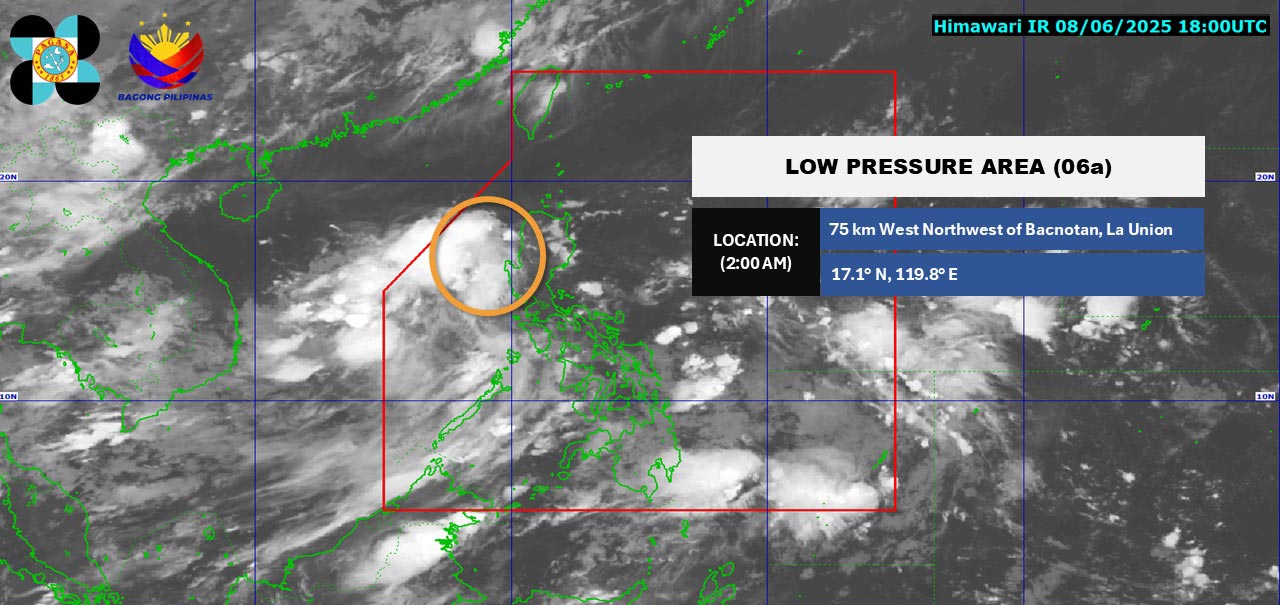
In the morning bulletin of June 9, Pagasa said the low pressure area is currently determined to be located about 85 km west-northwest of Bacnotan (La Union).
This low pressure area could develop into a tropical storm, either tomorrow or in the coming days. According to current forecasts, the system will move westward, away from the Philippine mainland and may exit the PAR area in the next few days, said weather expert Obet Badrina.
Mindanao continues to see scattered or localized showers, accompanied by thunderstorms, while the Cagayan Valley is likely to see lower rainfall.
Other than this low pressure area, Pagasa has not recorded any other weather disturbances within or outside the Philippines.
No strong wind warnings have been issued for the Philippine waters.
If the depression strengthens into a tropical storm, it will be named Auring during its time in the PAR, he added.
If it forms, the tropical storm is likely to intensify the activity of the southwest monsoon.
According to the National Center for Hydro-Meteorological Forecasting, on the morning of June 9, there was a low pressure trough with an axis passing through the North East Sea connecting with the low pressure area located at 1:00 a.m. this morning at about 16.5-17.5 degrees North latitude, 117.5-118.5 degrees East longitude.
The southern sea area of the North East Sea (including the Hoang Sa archipelago), the central and southern East Sea (including the Truong Sa archipelago), the sea area from Binh Thuan to Ca Mau, Ca Mau to Kien Giang and the Gulf of Thailand are having showers and thunderstorms. At Huyen Tran station, gusts of wind of level 8-9 were recorded.
On the day and night of June 9, the following sea areas will continue to have showers and thunderstorms: South of the North East Sea (including the Hoang Sa archipelago); Central and South East Sea (including the Truong Sa archipelago); The sea area from Binh Dinh to Ca Mau; The sea area from Ca Mau to Kien Giang; Gulf of Thailand.
On the night of June 9, the Gulf of Tonkin will have scattered showers and thunderstorms. During thunderstorms, there is a possibility of tornadoes, strong gusts of wind of level 6-7 and waves over 2m high.
In addition, the sea area from Binh Thuan to Ca Mau, the south of the area between the East Sea and the South East Sea (including the Truong Sa archipelago) will have strong southwest winds of level 5, sometimes level 6, gusting to level 7-8; rough seas. Waves are 1.5-3m high.
People and tourists planning to travel by sea or to coastal provinces such as Quang Ninh, Hai Phong, from Binh Dinh to Ca Mau... need to monitor weather forecasts and follow the instructions of local authorities. Limit outdoor activities, sea and island sightseeing, diving... in thunderstorms to ensure safety.