According to the Philippine Atmospheric, Geophysical and Astronomical Services Administration (PAGASA), at around 8:00 p.m. on August 9 (local time), the center of the storm was located at about 19.5 degrees North latitude - 116.5 degrees East longitude, about 535 km east of Calayan, Cagayan, towards mainland China.
The low pressure is forecast to be unlikely to develop into a tropical depression.
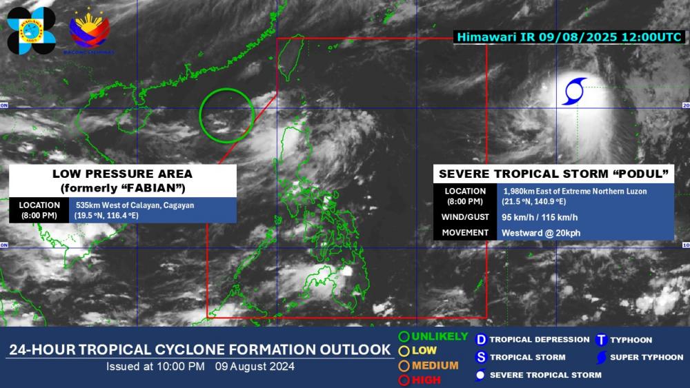
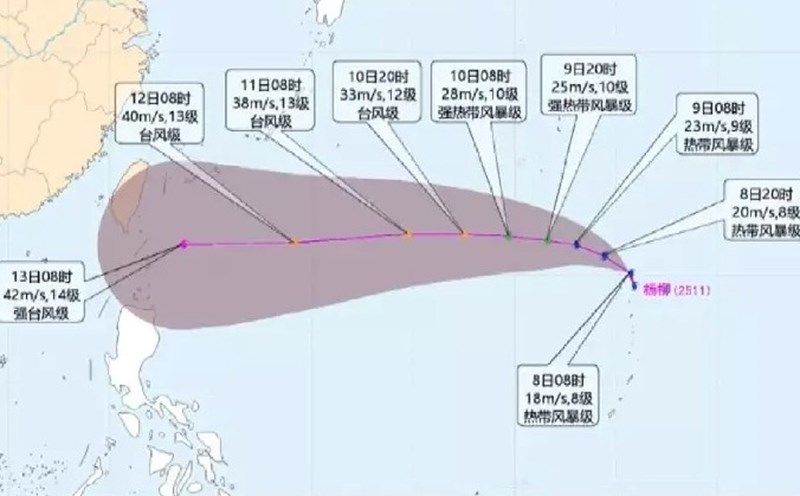
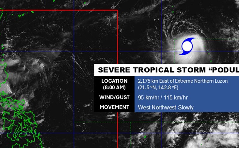
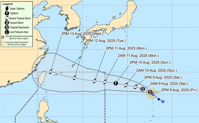
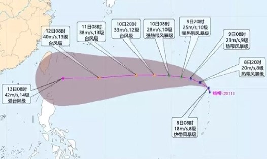
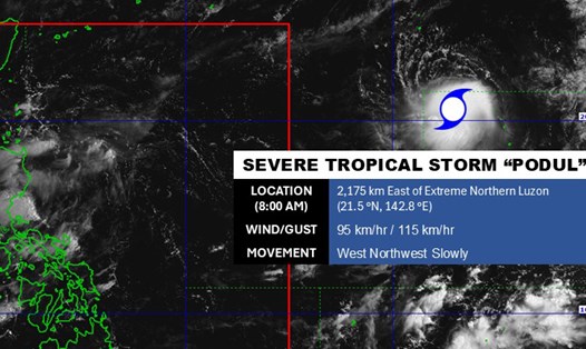
Meanwhile, Typhoon Podul continues to strengthen outside the Philippine Area of Responsibility (PAR). The center of the storm is located at about 21.5 degrees North latitude - 140.9 degrees East longitude, about 1,980 km east of the northernmost tip of Luzon.
At 10:00 p.m. on August 9 (local time), the center of the storm was at about 21.6 degrees North latitude, 140.6 degrees East longitude, about 1950 km east of the northernmost tip of Luzon.
The strongest wind near the center of the storm reached 95 km/h, gusting up to 115 km/h. The storm is moving west at a speed of 20 km/h and is forecast to continue to strengthen in the next 24 hours. Waves are up to 6.1 m high, with a radius of strong winds extending up to 280 km.
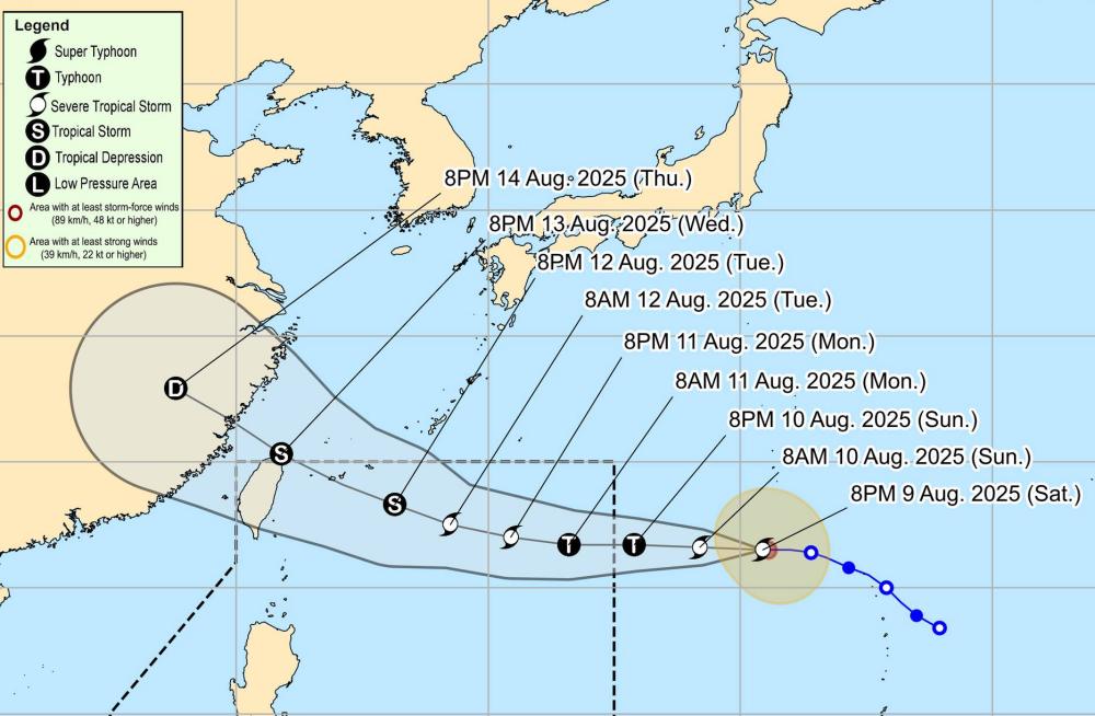
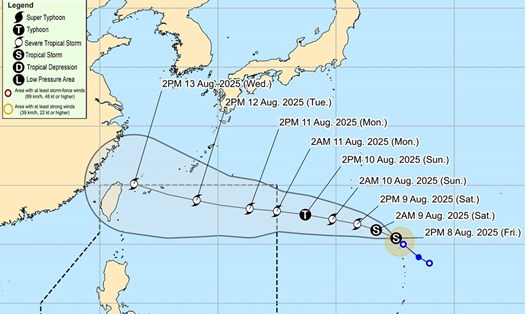
The storm is forecast to peak at 130 km/h in the next 36 hours. After that, the storm will gradually weaken as it enters the East Sea and the mainland of Guangzhou province (China).
According to the National Center for Hydro-Meteorological Forecasting, on August 10, the North East Sea and South East Sea (including Truong Sa archipelago), the sea area from Lam Dong to Ca Mau, Ca Mau to An Giang and the Gulf of Thailand will have scattered showers and thunderstorms.
During thunderstorms, there is a possibility of tornadoes and strong gusts of wind. Waves are 2.0-3.0m high. Ship operating in the above areas are at risk of being affected by tornadoes, strong gusts of wind and high waves.
People and tourists planning to visit these waters or areas where storms have passed should pay attention to weather forecasts, check flight schedules and follow local instructions to avoid storms.