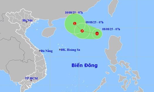
Typhoon Podul is currently off the Pacific Ocean but the circulation has begun to expand, posing a potential risk of heavy rain and strong winds in many parts of East Asia in the coming days.
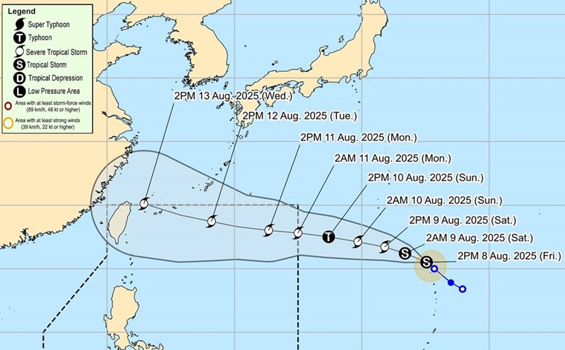
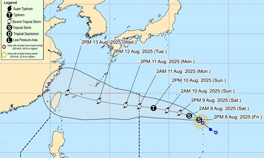
According to the Taiwan Meteorological Station (China), the movement of Typhoon Podul has changed, possibly passing north of Taiwan (China), the sea area between the island and Japan next week.
If this scenario occurs, areas such as Taipei, Yilan and Hualien will be most affected by the storm.
Typhoon Podul could also affect Fujian and Guangdong (China) next week.
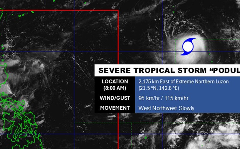
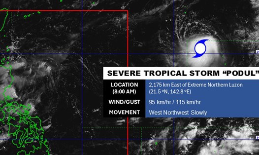
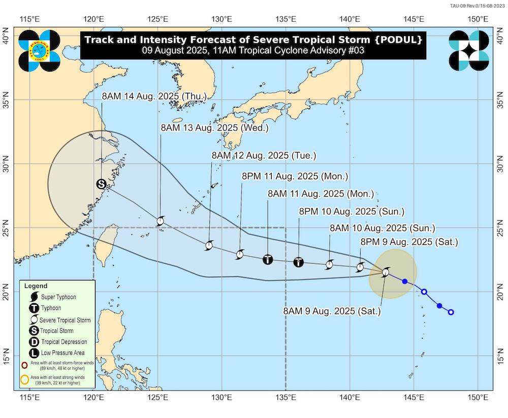
The Philippine Atmospheric, Geophysical and Astronomical Services Administration (PAGASA) said Podul had strengthened into a severe tropical storm, with wind speeds reaching 95km/h and gusts of 115km/h. The storm is expected to enter the Philippine Area of Responsibility for Typhoons (PAR) on Sunday or Monday.
Meanwhile, the Thai Meteorological Department (TMD) said that although the storm is not directed to Thailand, the country still needs to closely monitor to proactively respond to thunderstorms caused by the storm's circulation.
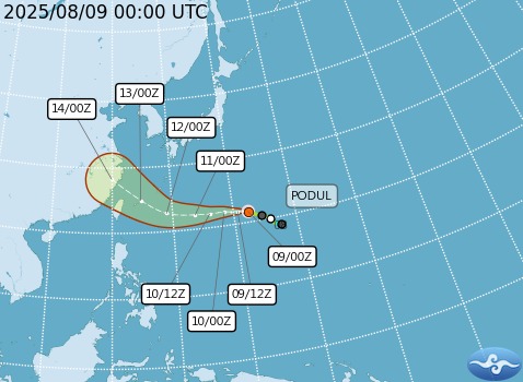
The Joint Typhoon Warning Center (JTWC) forecasts that under favorable conditions, Typhoon Podul may strengthen to maximum winds of about 120 km/h in the next 2 days.
Typhoon Podul is forecast to weaken to about 55 km/h when it makes landfall in mainland China around August 14.
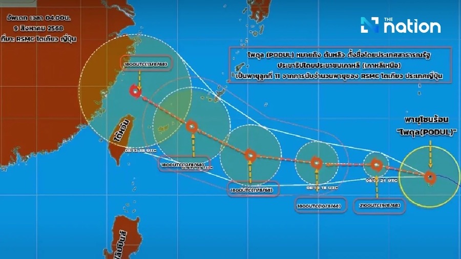
The name Podul means lychee, contributed by the DPRK to the list of typhoon names in the Northwest Pacific and East Sea.
This is the 11th named storm of 2025 in Japan, according to the Tokyo Regional Special Meteorological Center (RSMC) under the Japan Meteorological Agency (JMA).
This is not the first time the name Podul has been used.
Podul is the name of storm No. 4 in 2019, making landfall in the Central region of Vietnam on August 30, 2019. The storm caused heavy damage at that time. Some areas were flooded, many flights and sea tourism activities had to be temporarily suspended.
Next week, tourists planning to visit areas potentially affected by Typhoon Podul, especially tourist destinations such as the Philippines, Taiwan, Guangdong and Fujian, should continuously monitor local weather warnings.
When planning a trip, you should keep a flexible schedule and have a backup plan in case of bad weather, while keeping the phone number of the authorities, hotels and rescue services.
During the time the storm approaches land, visitors are advised to limit coastal activities such as swimming, rowing, diving or yachting.
In addition, it is necessary to regularly update announcements from airlines, ferries and accommodation to promptly adjust plans when there are changes in travel schedules.
Proactive response and careful preparation will help the trip be safer and more convenient during the unstable weather period.