Typhoon Bakung is currently located about 419 km west of Cocos Islands, according to the latest typhoon information from the Joint Typhoon Warning Center (JTWC).
The storm moved slowly in a south-southwest direction at a speed of about 7 km/h. The largest significant wave height reached about 4.6 m, rough seas in the storm-affected areas.
Typhoon Bakung is forecast to be in a weak guide environment, so its trajectory tends to move slowly to the north, with slight fluctuations to the east and west.
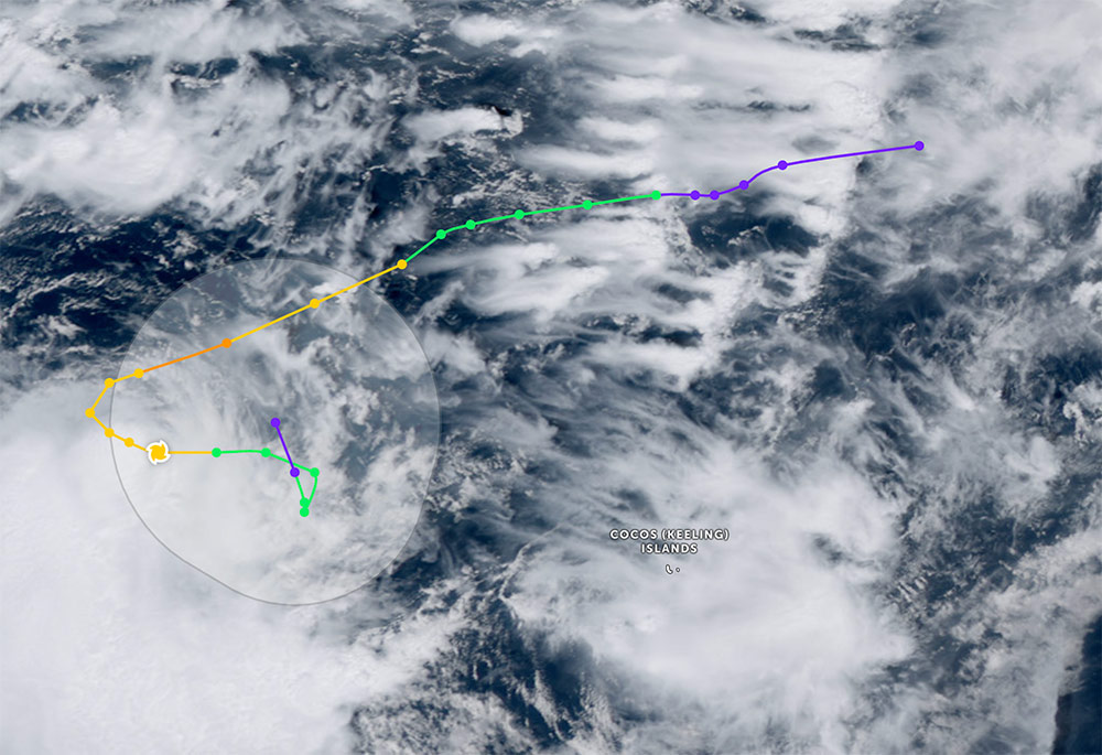
After a previous phase of interaction with another low-level depression, Typhoon Bakung has slowed down significantly, but is expected to accelerate again when affected by the subtropical high pressure in the southwest.
The storm's path has changed continuously in the second half of the forecast cycle, with a sudden turning point to the north. The storm is forecast to continue to change direction as it weakens.
The storm is forecast to weaken as it moves further north and gradually dissipate at sea over the next 36 hours, with winds dropping below 65 km/h.
Tourists staying or planning to travel in the Cocos Islands and neighboring waters east of the Indian Ocean should be cautious. The weather forecast for the locality is that there will be heavy rain lasting at least the next 36 hours until December 17 (local time).
Strong seas and high waves can affect ships, yachts, diving activities and offshore tours.
You should closely monitor official weather reports, consider adjusting sea travel schedules, limit going out to sea during the time the storm is still affecting, and follow safety instructions from local authorities.


