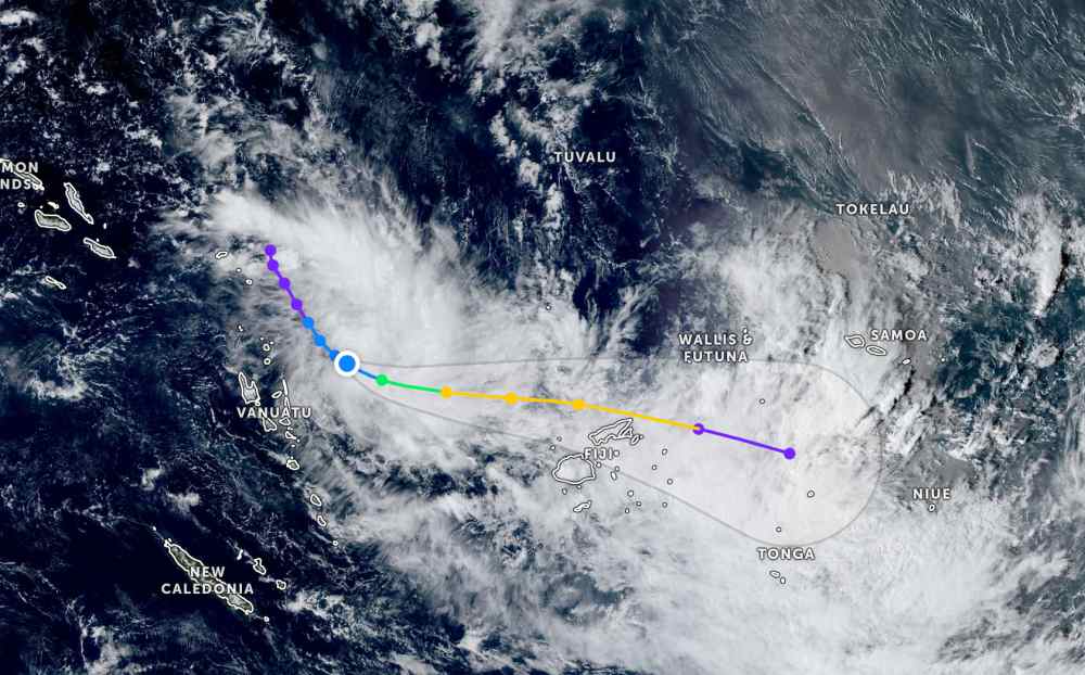
According to the latest storm information from the Joint Typhoon Warning Center (JWTC), on the morning of December 15, tropical depression 08P is currently located about 432 km north-northeast of Port Vila (Vanuatu). The low pressure is moving southeast at a speed of 13 km/h. The largest significant wave height is 4.3 m.
It is forecasted that in the next 12 hours, the tropical depression will continue to move in the Southeast direction, then turn East, moving north of the island nation of Fiji.
In terms of intensity, tropical depression 08P is forecast to gradually strengthen in the next 36 hours. Tomorrow, December 16, the tropical depression will officially strengthen into a storm. The storm will then continue to strengthen into a Category tropical storm as it approaches the north of the island nation of Fiji.
According to the Fiji Times, the local meteorological agency forecasts that the tropical depression will soon strengthen into a storm and enter the Fiji Sea Area on Tuesday (16.12) and leave the Lau Islands by the end of Wednesday (17.12).
During this time, the low pressure trough will affect Fiji, causing cloudy skies and prolonged intermittent rain. There are forecasts of strong north winds, an average speed of 50 km/h with gusts of up to 70 km/h in the next 2 days.
Strong winds and large waves will especially affect the northern areas of Vanua Levu, Yasawa and Mamanuca Islands, the northern Lau Islands and Lomaiviti and Koro Islands.
Unstable weather forecast will remain across Fiji until December 16 due to the influence of the tropical depression, with increased rainfall as the tropical depression approaches from the West. After December 16, the rain will start to decrease.
Tourists planning to visit the Philippines during this time should pay attention to weather forecasts. Check the flight schedule and follow local instructions to ensure safety.


