Storm Bakung suddenly changes direction
According to the latest storm information from the Joint Typhoon Warning Center (JTWC), in the past 6 hours, Typhoon Bakung has been moving slowly eastward at a speed of about 6 km/h. In areas directly affected by the storm, waves can reach 4.9 m, with rough seas.
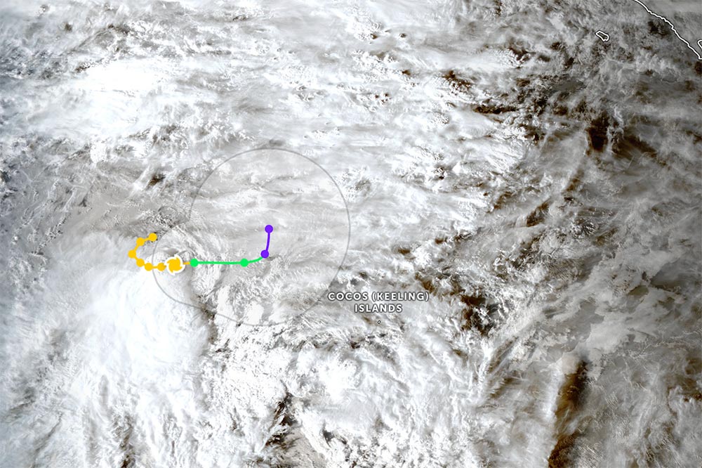
Currently, Typhoon Bakung continues to move slowly eastward along the southern edge of the northernmost extended pressure strip. This movement trend is likely to continue in the next 24 hours, as the high pressure strip remains stable along the equator, west of Sumatra Island.
After the 24-hour mark, as the storm weakens, it tends to turn north towards the end of the forecast period.
Typhoon Bakung is forecast to continuously weaken over the coming period due to prolonged strong wind shear and the intrusion of dry air. The storm is expected to gradually dissipate over the next 2 days, with the strongest winds decreasing to about 55 km/h over the next 2 days.
The storm is forecast to move in the East Northeast direction in the next 24-36 hours, before turning strongly north after about 2 days.
Tourists planning to travel or participate in sea tourism activities in the South Indian Ocean, especially the sea around Cocos Islands, should continue to monitor official updates.
The impact of the storm could spread to Indonesia. However, the impact is not as severe as Senyar in late November 2025.
The Indonesian Meteorological Agency forecasts that the circulation of Typhoon Bakung may cause moderate to heavy rain in Bengkulu and Lampung, strong winds in Bengkulu.
In addition, the storm is likely to cause high waves over many sea areas, including the Indian Ocean west of the Nias Islands; west of Bengkulu province to Lampung; south of the Korean Strait; the sea area south of Indonesia's Banten province... extending into the Indian Ocean.
Tourists are advised to limit sea activities, boats, yachts and diving tours while the rough seas remain. Sea and air routes through this area may have their schedules adjusted due to the indirect impact of extreme weather.
Travelers should proactively contact travel agencies to update information and arrange appropriate plans, prioritizing safety during the period when Typhoon Bakung is weakening but still causing rough seas.
Storm/tropical depression forecast in the East Sea
Meanwhile, in Vietnam, the National Center for Hydro-Meteorological Forecasting predicts that from now until early June 2026, there is little chance of storms or tropical depressions appearing in the East Sea.
During this period, there will be about 0.8 tropical cyclones in the East Sea and 0.1 storm will make landfall in Vietnam, an average of many years.
Tourists planning to travel by sea and island should still regularly monitor official weather reports, especially when traveling by sea.
Be flexible in travel planning, prioritize safety and proactively update weather information to promptly adjust your journey when necessary.
It is forecasted that on the night of December 15 and December 16, the North East Sea area (including Hoang Sa special zone) will have strong northeast winds of level 6, sometimes level 7, gusting to level 8-9, rough seas; waves from 3.0-5.0 m high.
The sea area from Khanh Hoa to Ca Mau and the western sea area of the South China Sea (including the western sea area of Truong Sa) will have strong northeast winds of level 6, gusting to level 7-8, rough seas; waves 2.0-3.0 m high.
The South East Sea area (including Truong Sa special zone) and the Gulf of Thailand will experience scattered showers and thunderstorms; thunderstorms may cause tornadoes and strong gusts of wind.


