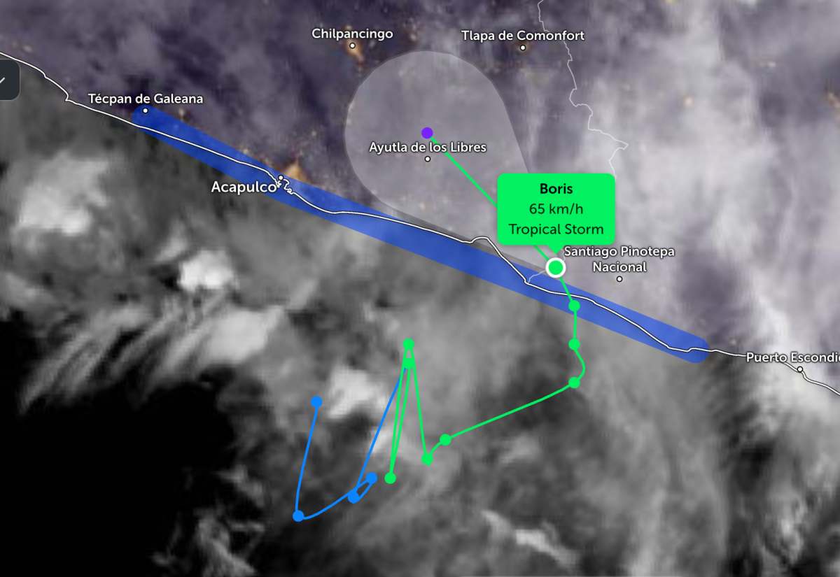
The center of Typhoon Boris is located at about 16.4 degrees North latitude - 98.4 degrees West longitude, about 170 km east-southeast of Acapulco city and about 25 km east-northeast of Punta Maldonado.
Storm Boris is moving north-northwest at a speed of about 9 km/h. It is forecast that in the afternoon of June 9, the storm will turn northwest and accelerate as it continues to go deep into Guerrero state of Mexico.
The strongest wind near the storm center reached about 65 km/h, gusting more strongly. The Joint Typhoon Warning Center (JTWC) forecasts the strongest wind up to 75 km/h.
Forecasters predict that Boris will weaken rapidly when interacting with the mainland terrain and is likely to dissipate in the afternoon of June 9. However, the storm's circulation can still cause significant impact in southern Mexico.
Currently, tropical storm warnings are still maintained for the coastal area from Laguna de Chacahua to Tecpan de Galeana.
The biggest threat from Typhoon Boris is heavy rain. The storm is forecast to cause additional rainfall from 25 to 100 mm in coastal areas of the two states of Guerrero and Oaxaca on June 9.
Prolonged heavy rain increases the risk of flash floods, localized flooding and landslides, especially in hilly and steep terrain areas.
People and tourists are advised to continue to closely monitor weather forecasts and natural disaster warnings during the storm's weakening.
Tourists planning to come here should pay attention to checking their flight schedules and follow local instructions to avoid storms affecting their journey.


