According to the US National Hurricane Center (NHC), on June 8 (local time), the center of Hurricane Boris was located about 135 km southeast of Acapulco city and about 80 km southwest of Punta Maldonado.
The storm has the strongest sustained wind of about 65 km/h. The storm is moving slowly in a northeast direction at a speed of about 3 km/h.
Experts predict storm Boris will turn north in the coming hours and make landfall in Guerrero state on the evening of June 8. After making landfall, the storm will quickly weaken and gradually dissipate on June 9.
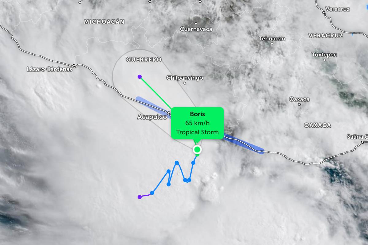
Due to the influence of the storm's circulation, the coastal states of Guerrero and Oaxaca may record common rainfall from 100-250 mm until the end of June 8.
The US National Hurricane Center warned that heavy rainfall could cause flash floods and landslides that threaten lives, especially in hilly and steep areas in southern Mexico.
Authorities have issued a tropical storm warning for the area from Laguna de Chacahua in Oaxaca to Tecpan de Galeana in Guerrero. Dangerous weather conditions due to tropical storms are forecast to appear in the warning area in the next 24 hours.
According to the NHC, Boris is currently the second named storm of this year's Pacific hurricane season, starting from May 15. Previously, tropical storm Amanda formed offshore on June 3 but did not affect land.
Not far away, a tropical depression with the symbol 03-E formed off the coast of Nicaragua on the evening of June 8 (local time) with the strongest winds of about 75 km/h.
The tropical depression is moving north at a speed of about 9 km/h and is forecast to strengthen into a storm.
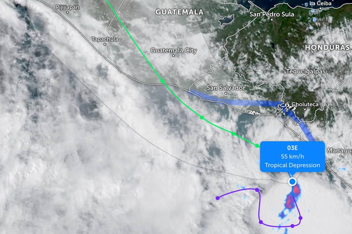
This storm will turn northwest in the coming days, moving parallel to the Central American coast before going deep into mainland Guatemala after about 72 hours.
The storm may affect coastal areas of Nicaragua, Honduras and El Salvador from the beginning of June 9. JTWC forecasts that the storm will reach maximum winds of about 95 km/h in the next 60 hours before rapidly weakening when entering the mainland.
Experts warn that heavy rain related to tropical depression 03E will affect central American coastal areas until the end of June 11, increasing the risk of flash floods and landslides threatening lives, especially in hilly and steep terrain areas.
The Atlantic hurricane season has started since June 1, but so far no named storms have appeared in this area.
Meteorologists say Hurricane Boris is not forecast to affect Mexico's cities hosting World Cup matches in the near future.
However, people and tourists planning to watch the World Cup should still pay attention to weather forecasts. Regularly check flight schedules and follow local instructions to avoid dangerous storms.


