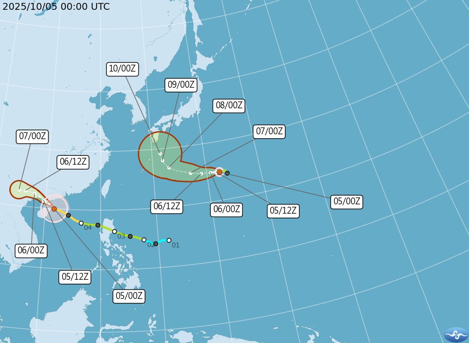
According to the latest storm information from the Joint Typhoon Warning Center (JTWC), Typhoon Halong is about 102 km east of Iwo To Island (Japan), moving west-northwest at a speed of about 7 km/h in the past 6 hours.
The maximum wave height in the storm's affected area is currently about 5.5 m.
In the next 24 hours, Typhoon Halong is forecast to continue moving slowly westward. After about 4 days, the storm is likely to turn north.
The storm is forecast to rapidly intensify over the next 24-48 hours, with maximum sustained winds of about 215 km/h as it approaches the Ryukyu Islands (Japan).
Halong is the name of the fourth tropical storm and third strongest storm of the 2008 Pacific typhoon season. The storm will form in the South China Sea, move out of the South China Sea and affect the weather in the Philippines and Japan.
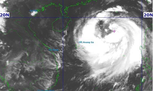
Meanwhile, Typhoon No. 11 of 2025 ( Matmo) officially made landfall on Zhuizhou Peninsula, China this afternoon, October 5. The maximum sea waves are about 11 m high, the wind may decrease slightly in the next 12 hours.
After that, Typhoon No. 11 Matmo will make landfall in southern China and weaken rapidly. Matmo is forecast to disband about 2 days after making landfall.
People and tourists should update weather bulletins from the Vietnam Center for Hydro-Meteorological Forecasting, local agencies or reputable weather forecasting applications.
If you have a schedule to go to sea, ship, or island, you should consider postponing or changing your schedule to days without the risk of bad weather due to the impact of the storm.
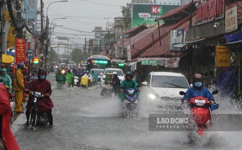
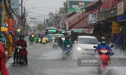
Avoid low-lying areas, riverside areas, and areas at risk of flooding when water rises due to storms. For coastal tours, islands, ships... check with the organizer to temporarily suspend or change the schedule if necessary.