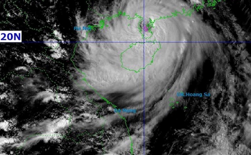
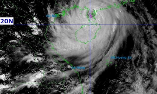
According to the latest storm news from the National Center for Hydro-Meteorological Forecasting, on the morning of October 4, the center of storm No. 11 ( Matmo) was at about 18.1 degrees North latitude; 116.9 degrees East longitude, about 530 km East Northeast of the Hoang Sa archipelago.
The strongest wind near the storm center is level 11 (103-117 km/h), gusting to level 14. The storm is moving west-northwest at a speed of about 25 km/h.
In the next 24-60 hours, the storm is forecast to continue moving in the West-Northwest direction, likely to strengthen as it approaches the Lusian Peninsula (China).
Then it will enter the Northern Gulf of Tonkin on October 6 and gradually weaken as it moves deeper inland in the Vietnam - China border area.
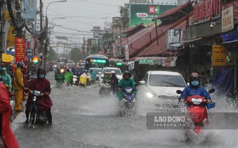
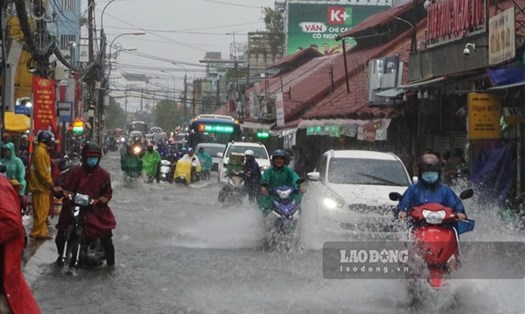
Due to the impact of storm No. 11 ( Matmo), from October 6, Hanoi will have a prolonged period of heavy rain, with strong winds and the risk of local flooding.
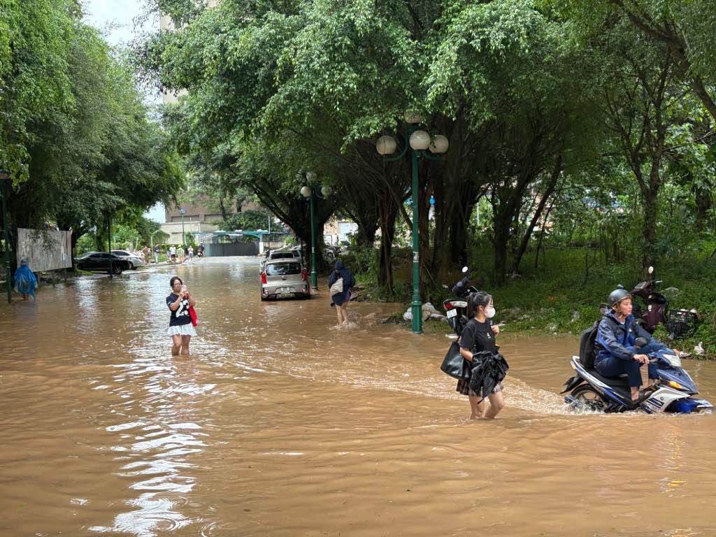
From early morning on October 6, there was very heavy rain in some places with a total rainfall of 100-200 mm, locally over 300 mm for two days of October 6-7.
According to AccuWeather, the whole day and night of October 6 will be cloudy with continuous rain with an average rainfall of about 91.6 mm during the day and 24.1 mm at night. The highest temperature of the day is about 27 degrees Celsius, the lowest is 24 degrees Celsius.
Heavy rains will be concentrated from early morning to late afternoon on October 6.
From 3am to around 9am on October 6, the rain will increase rapidly with a probability of 62-90% rain, dense clouds, and 100% coverage. From late morning to early afternoon, there will be occasional intermittent rain, but the humidity will remain extremely high, the sky will be gloomy.
From 3:00 p.m. to the evening of October 6, the rain bands from the storm's circulation will continue to be affected, with a chance of rain of 59-74%, with winds gradually increasing, especially from 5-21 p.m. The total rainfall for the day is expected to be about 7 hours, continuously lasting all night.
The rain will gradually decrease from October 7 as storm No. 11 Matmo weakens into a low pressure area.
Previously, the heavy rain at the end of September caused many places in Hanoi to record over 300 mm of rainfall such as Quoc Oai (308.8 mm), Kim Anh (307 mm), while the water level of Tich River and Bui River exceeded alert level II.
In the context of storm No. 11 Matmo preparing to directly affect the Northern region, including Hanoi, tourists need to pay special attention to safety recommendations on October 5-7.
Proactively monitor forecasts, limit travel through deeply flooded areas, do not take shelter under tree canopy, and advertising signs when there are strong winds.
Limit outdoor activities, especially sightseeing, long walks or use of public transport during peak hours. Heavy rain combined with gusts of wind can cause fallen trees and rapid flooding in low-lying areas, affecting traffic and safety.
Avoid traveling through flooded areas, underpasses, and riverbanks when there is prolonged heavy rain. Some inner-city streets of Hanoi such as Lang Ha - Thai Ha, Truong Chinh, Nguyen Xien, Pham Hung - Me Tri, Pham Van Dong, Thanh Xuan - Ha Dong area... are often flooded with heavy rain.