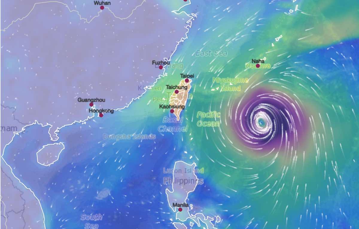
According to the latest storm news from the Joint Typhoon Warning Center (JTWC), Typhoon Jangmi (name Domeng in the Philippines) is currently located 411 km south of Kadena Air Base.
In the past 6 hours, this typhoon has moved north at a speed of 19 km/h. The strongest wind near the storm center reached 140 km/h. Meaningful maximum wave height reached 12.2 m.
The storm is expected to continue moving north and make landfall from the south of Okinawa Island tomorrow, June 1, and the Amami Islands on June 2, before turning east.
According to the Japan Meteorological Agency (JMT), Typhoon Jangmi is expected to bring heavy rain to western and eastern Japan, along the Pacific coast this week, causing airlines to cancel flights.
Due to a block of cold air stagnating in the northern center of the storm, rain may occur in some areas even before the storm makes landfall. The meteorological agency noted that the rainfall time may be prolonged, leading to high total rainfall. Some areas are expected to have rainfall from 200mm to 300mm.
The agency said warning-level heavy rain could occur from Kyushu Island in the Southwest to Kanto region, including Tokyo, along the Pacific coast until June 3. People are advised to be cautious of strong winds, tsunamis, landslides and floods.
Japan Airlines and All Nippon Airways have announced a series of flights to and from Okinawa to be canceled.
Rainfall forecast for 24 hours until noon on June 1 is 100mm in Okinawa and 80mm in Amami and southern Kyushu. By noon on June 2, rainfall is expected to reach 300mm in Okinawa, Amami and southern Kyushu.
People and tourists planning to visit Okinawa Island and southern Japan in the coming days should pay attention to weather forecasts. Check your flight schedule and follow local instructions to avoid storms affecting your journey.


