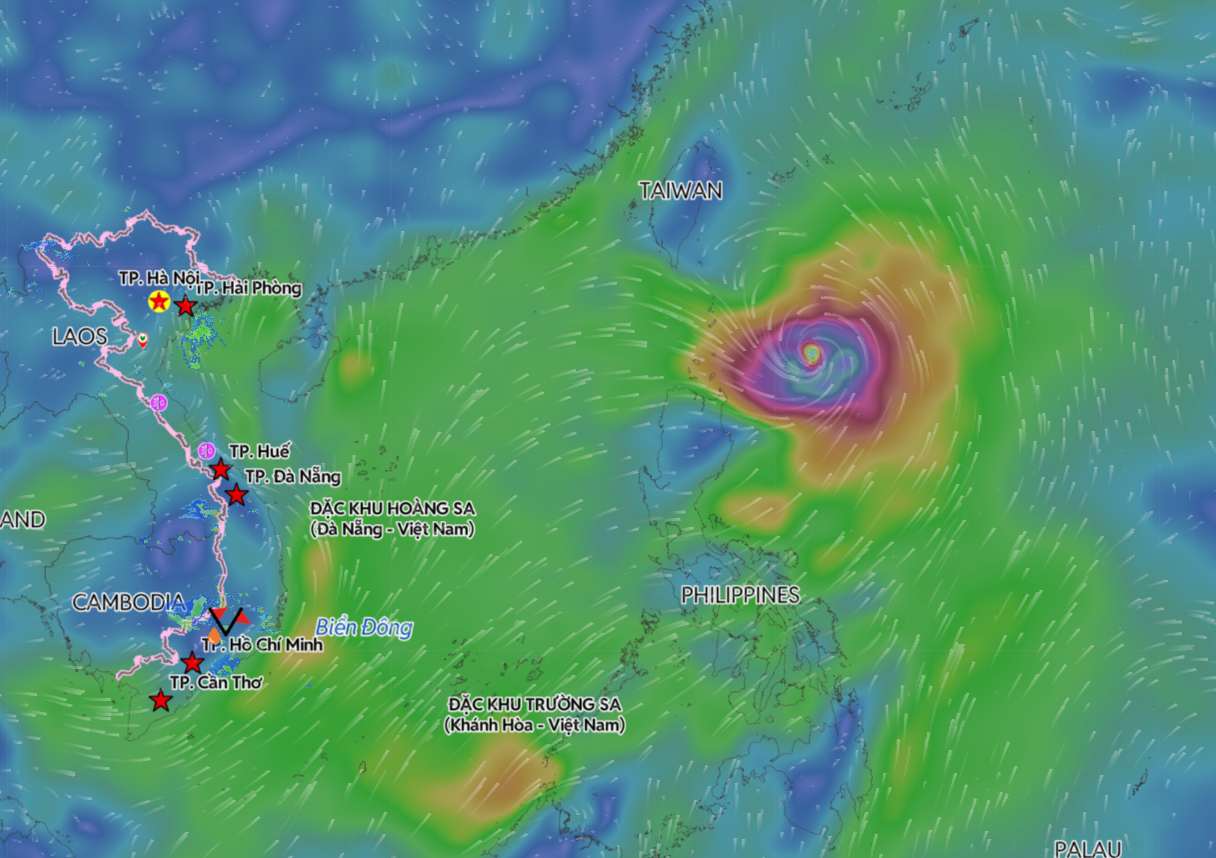
According to the latest storm and low pressure bulletin from the Philippine Atmospheric, Geophysical and Astronomical Services Administration (PAGASA), Typhoon Mekkhala has weakened slightly while slowing down in motion in the sea area east of the northernmost point of Luzon Island.
As of 11 pm on June 23 (local time), the storm's center was determined to be about 320 km east of Calayan Island, Cagayan province, at 19.7 degrees North latitude - 124.5 degrees East longitude. The storm changed direction and moved slowly from Northwest to North.
The strongest sustained wind near the storm center reached 165 km/h, gusting to 205 km/h. Although it has slightly weakened, Typhoon Mekkhala still maintains very strong typhoon intensity when operating in the sea area east of the Babuyan archipelago.
PAGASA said that the possibility of raising the wind warning to level 2 has now decreased significantly as the storm has begun to turn north instead of continuing to approach the Philippines as previously forecast.
Although the eye of the storm is still far from the mainland, the Mekkhala circulation combined with the Southwest monsoon is causing widespread impact. On June 23, most of Luzon Island, the Visayas region, Zamboanga peninsula, North Mindanao, Dinagat archipelago and Davao Occidental and Davao Oriental provinces recorded the risk of strong gusts to typhoon level, especially in coastal areas and high mountainous areas.
By June 24, the range of strong winds will continue to cover most of Luzon and Visayas, along with the localities of Misamis Occidental, Lanao del Norte, Camiguin, Dinagat Islands, Davao Occidental and Davao Oriental.
On June 25, strong winds are still likely to appear in most of Luzon Island, Panay Island, Negros Occidental province and Northern Samar.
PAGASA notes that areas within the level 1 wind warning zone may record light to small impacts due to strong winds. In coastal and mountainous areas, actual winds may be stronger due to terrain influences.
At sea, strong wind warnings are still maintained for the northern and northeastern Luzon sea areas. Dangerous sea waves continue to appear in many areas.
In addition to the impact of strong winds, the Southwest monsoon (habagat) is continuing to cause rain in many areas of the Philippines. According to PAGASA, the circulation of Typhoon Mekkhala combined with the Southwest monsoon will bring scattered rain in the MIMAROPA, West Visayas, Negros Islands, Zamboanga Peninsula and Sulu Islands.
On June 24, the provinces of Batanes, Cagayan, Occidental Mindoro, Palawan and Antique are forecast to have moderate to heavy rain. Moderate to heavy rain may last until June 25 in Batanes, Occidental Mindoro and Palawan.
The Philippine meteorological agency believes that Typhoon Mekkhala may continue to strengthen the activity of the Southwest monsoon in the middle days of the week, leading to scattered rain in the western Luzon island area, including the capital Metro Manila.
According to PAGASA's forecast, Mekkhala will continue to move northward in the night of June 23 and June 24 before gradually shifting to North-Northeast and then Northeast from the afternoon of June 24, heading towards the Ryukyu Islands area and the southern sea of Japan.
It is expected that the storm will leave the Philippine Area of Responsibility (PAR) on the evening of June 25 or the morning of June 26. During its stay in PAR, Mekkhala is forecast to continue to weaken gradually but still maintain storm intensity.
People and tourists planning to travel to the Northern Philippines or the Southern region of Japan in the coming days should pay attention to weather forecasts. Check flight schedules regularly to avoid storms causing impact.


