According to the latest storm and low pressure bulletin from the Philippine Atmospheric, Geophysical and Astronomical Services Administration (PAGASA), Typhoon Mekkhala is strengthening at sea and approaching the cyclone threshold.
As of 10 am this morning (local time), the storm's center was located at about 15.9 degrees North latitude - 132.5 degrees East longitude, about 1,170km east of the southeast of Luzon Island.
The strongest wind in the area near the storm center reaches 110km/h, gusting up to 135km/h. Currently, the storm is moving in the Northwest direction at a speed of 25km/h. The area of strong winds from tropical to storm level expands within a radius of about 420km from the storm center.
PAGASA predicts Mekkhala will continue to strengthen in the coming hours and is likely to reach typhoon level on June 21. During its movement in the sea area east of the Philippines, the storm is expected to continue to increase in intensity and reach its peak on June 22 or 23 before gradually weakening.
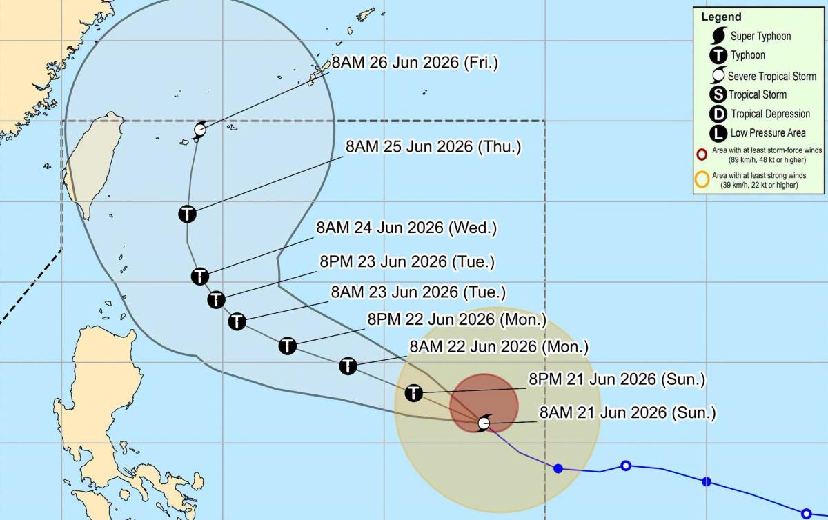
Typhoon Mekkhala is likely to remain active in the Philippine Sea throughout the forecast period. However, the possibility of the typhoon approaching the northernmost Luzon area has not been ruled out if the trajectory continues to move westward.
From now until June 23, the storm will mainly move in a West-Northwest direction, then slow down and gradually move in a Northward direction.
Although it has not directly affected the weather in the Philippines on June 21, the typhoon's circulation is forecast to increase the activity of the Southwest monsoon, causing heavy rain in Northern Luzon and some western areas of Luzon and Visayas from June 22.
The Philippine meteorological agency also warned that level 1 storm wind signals could be sent to some localities in North and East Cagayan, Babuyan Islands and Batanes from the morning of June 22 if the storm continues to strengthen and get closer.
People and tourists in high-risk areas need to closely monitor the next forecast bulletins. At the same time, it is necessary to proactively take measures to prevent heavy rain, strong winds and rough seas due to the impact of Typhoon Mekkhala.


