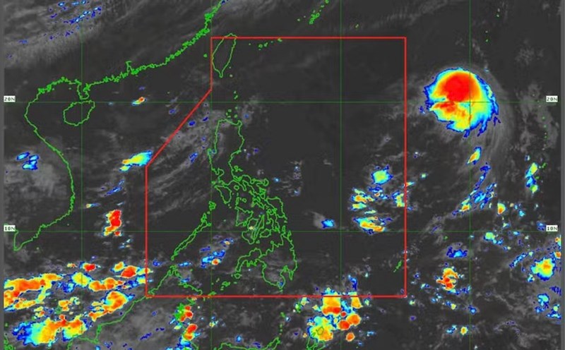
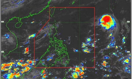
According to the latest storm information from the Philippine Atmospheric, Geophysical and Astronomical Services Administration (PAGASA), by 5:00 a.m. on August 11 (local time), typhoon Podul had intensified rapidly near the East Sea. The storm has entered the Philippine area of responsibility and has been named Gorio by the country.
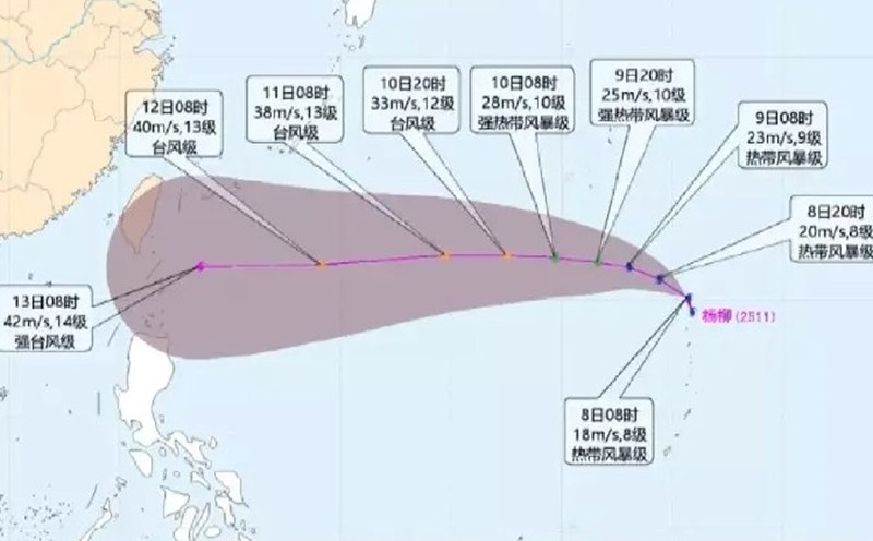
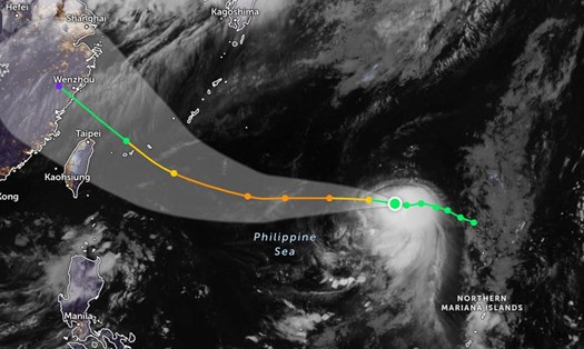
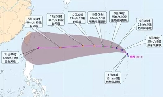
The center of the storm is located at about 21.1 degrees North latitude - 134.4 degrees East longitude, 1,305 km east of Luzon's northernmost tip. The strongest wind near the center of the storm reached 110 km/h, gusts of up to 135 km/h.
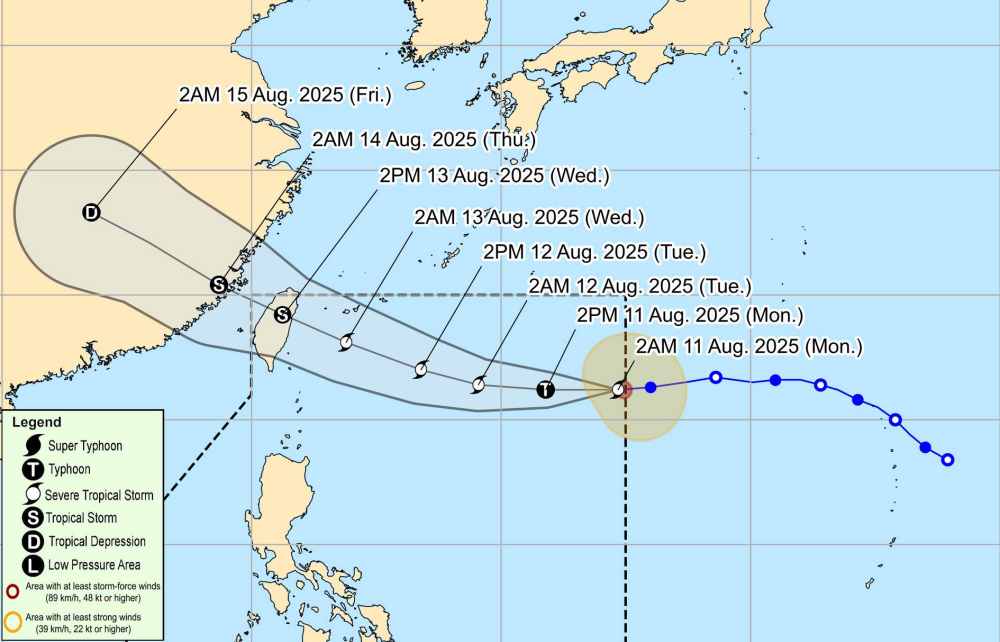
The storm is moving west at a speed of about 40 km/h. The strong wind radius extends up to 280 km.
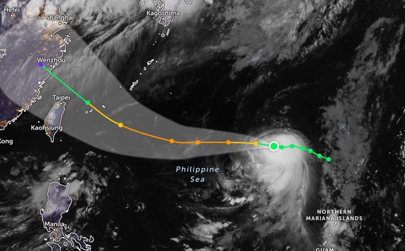
Typhoon Podul is forecast not to make landfall in the Philippines in the next 3 days.
Typhoon Podul is forecast to move westward over the next 24 hours, then deviate to the Northwest. The storm is likely to make landfall in the northeastern mainland of Taiwan (China) on August 13, then gradually weaken.
The South East Sea area (including Truong Sa archipelago), the sea area from Lam Dong to An Giang and the Gulf of Thailand are experiencing scattered showers and thunderstorms.
According to the National Center for Hydro-Meteorological Forecasting, during the day and night of August 11, the North East Sea (including Hoang Sa archipelago), South East Sea (including Truong Sa archipelago), the North of the Gulf of Tonkin, the sea area from Lam Dong to Ca Mau, Ca Mau to An Giang and the Gulf of Thailand will have scattered showers and thunderstorms. During thunderstorms, tornadoes, strong gusts of wind, and waves 2-3 m high may occur.
Ship operating in the above areas are at risk of being affected by tornadoes, strong gusts of wind and high waves.
People and tourists planning to visit these sea areas and the areas where the storm passes should pay attention to weather forecasts. Tuan followed the local instructions to avoid thunderstorms that affected the entire journey.