According to new storm information from the Joint Typhoon Warning Center (JTWC), tropical storm Podul (Storm No. 11 as known in Japan) is currently about 383 km south-southwest of Iwo To Island, moving west at a speed of about 17 km/h in the past 6 hours.
The highest waves were recorded at up to 7 m, endangering ships.
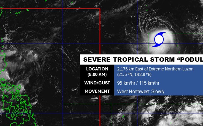
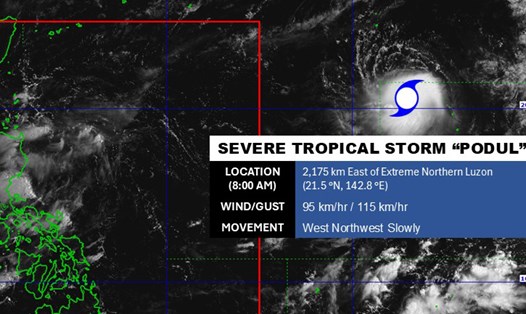
According to the Philippine Atmospheric, Geophysical and Astronomical Services Administration, Typhoon Podul has the strongest winds near the center reaching 95km/h, gusting to 115km/h. When Typhoon Podul enters the Philippine Area of Responsibility, it will be locally named Goryo.
In the next few days, the storm will continue to move westward and is likely to accelerate slightly.
Typhoon Podul is forecast to reach its peak intensity in about 36 hours.
Typhoon Podul is expected to gradually weaken, making landfall in China after about 4 days and dissipating after 5 days.
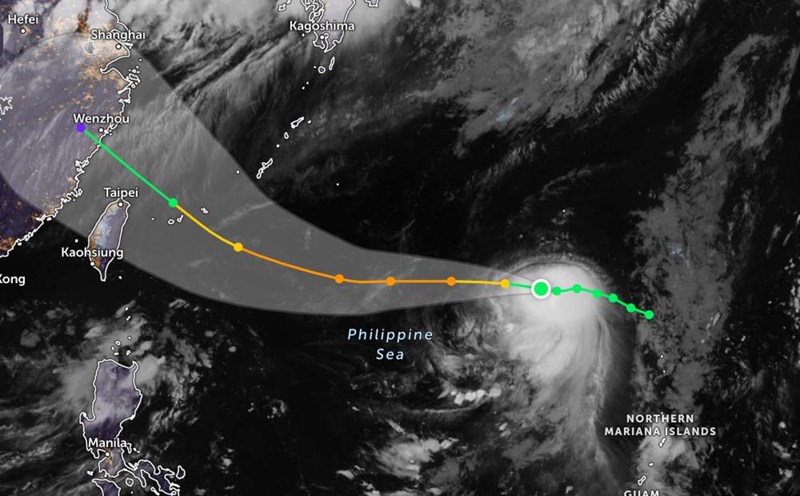
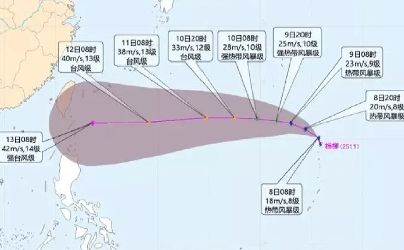
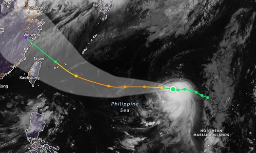
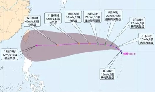
According to the Central Meteorological Station's typhoon forecast, Typhoon Podul will continue to strengthen as it moves into the warm waters east of Taiwan and southeast China.
This forecast is for August 11-12, the storm is likely to reach level 13 intensity (38-40 m/s), moving near Taiwan (China) or through the sea south of the island, causing high waves and strong winds.
Typhoon Podul is forecast to reach maximum sustained winds of level 14 (42 m/s) on August 13 before approaching the coast of Fujian or Guangdong province (China), then gradually weakening into a low pressure area when it makes landfall.
The islands of Yaeyama, Ishigaki, Miyako (Japan) and the northern part of Taiwan (China) may be in the area affected by strong winds and heavy rain.
Tourists need to prepare safety measures in advance of forecasts of heavy rain, strong winds, rough seas; there is a possibility of interruption of flights and ferries from August 11-13.
Temporary suspension of sea activities from August 10 in the waters east of Taiwan (China) and northwest of the Philippines.