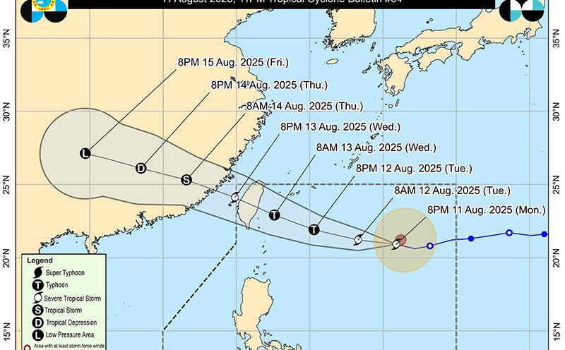
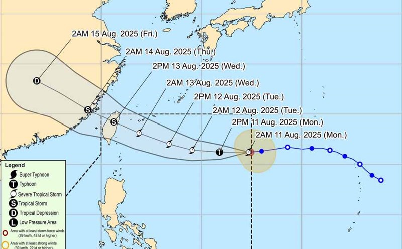
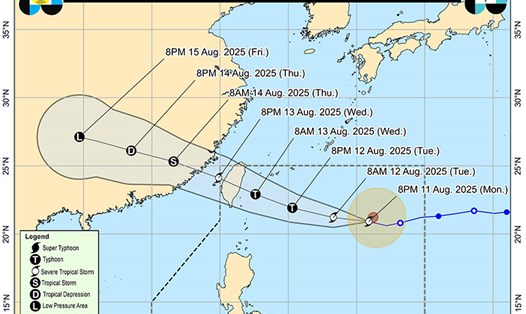
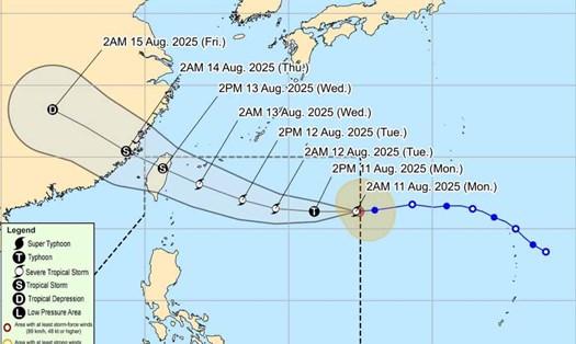
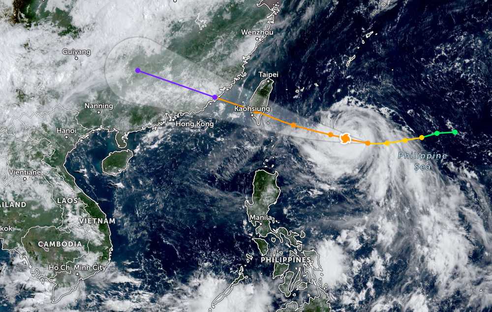
According to the latest storm information from the Philippine Atmospheric, Geophysical and Astronomical Services Administration (PAGASA), as of 3:00 a.m. on August 12 (local time), Typhoon Podul continued to strengthen near the East Sea.
The center of the storm is located at about 20.7 degrees North latitude - 129.1 degrees East longitude, 755 km east of Itbayat, Batanes. The strongest wind near the center of the storm reached 120 km/h, gusting up to 150 km/h.
The storm is moving west at a speed of 25 km/h, towards mainland Taiwan (China). The storm is expected to make landfall in Taiwan (China) and enter the East Sea in the next 24 hours.
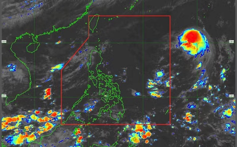
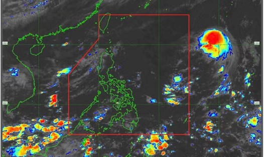
Due to the influence of the storm and monsoon in the Southwest, the Mimapora region, the Western Visayas, the Negros archipelago and the Zamboanga peninsula will have cloudy skies with scattered thunderstorms. Heavy rain can cause flooding or landslides.
According to the National Center for Hydro-Meteorological Forecasting, early this morning, August 12, the South China Sea (including Truong Sa special zone), the sea area from Lam Dong to Ca Mau, Ca Mau to An Giang and the Gulf of Thailand will have scattered showers and thunderstorms. At Huyen Tran station, there are southwest winds of level 5, sometimes level 6, gusting to level 8; Phu Quy Special Zone has strong southwest winds of level 5, sometimes level 6.
It is forecasted that during the day and night of August 12, in the Gulf of Tonkin, the southern sea area of the Central East Sea, the southern East Sea (including the Truong Sa special zone), the sea area from Lam Dong to Ca Mau, Ca Mau to An Giang and the Gulf of Thailand, there will be scattered showers and thunderstorms. During thunderstorms, there is a possibility of tornadoes, strong gusts of wind and waves 2-3 m high.
In addition, the sea area from Lam Dong to Ho Chi Minh City and the western sea area of the South China Sea will have strong southwest winds of level 5, sometimes level 6, gusting to level 7-8. Rough seas. Waves are 1.5-2.5m high.
All ships operating in the above areas are at risk of being affected by tornadoes and strong gusts of wind.
People and tourists in areas affected by the storm should pay attention to weather forecasts. Check flight schedules and follow local instructions to ensure safety.