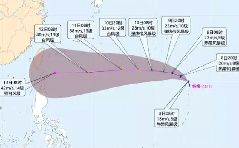
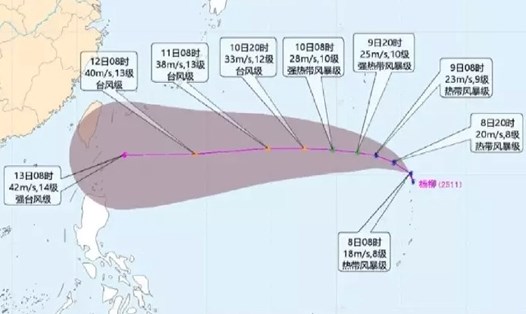
According to the latest storm information from the Joint Typhoon Warning Center (JTWC), Typhoon Podul (Philippine name: Gorio, international name: Typhoon No. 11 Japan) is moving west-northwest at a speed of 24 km/h.
Waves are up to 7.6 meters high, posing a danger to ships operating at sea.
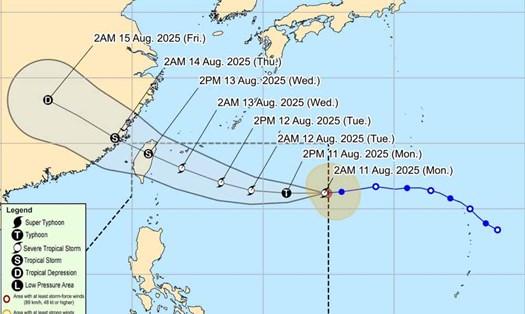
According to a newly updated bulletin from the Philippine Atmospheric, Geophysical and Astronomical Services Administration (PAGASA), at 10:00 p.m. on August 11, the center of the storm was about 910 km east of the northernmost tip of Luzon (Philippines) (20,5°N, 130.6°E).
Maximum wind speed is 110 km/h, gusting to 135 km/h. Strong winds of level 6 to level 310 km from the center of the storm.
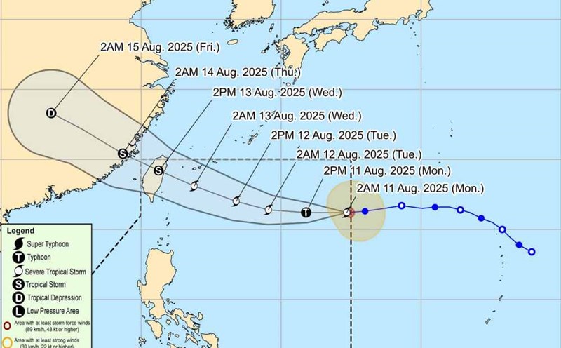
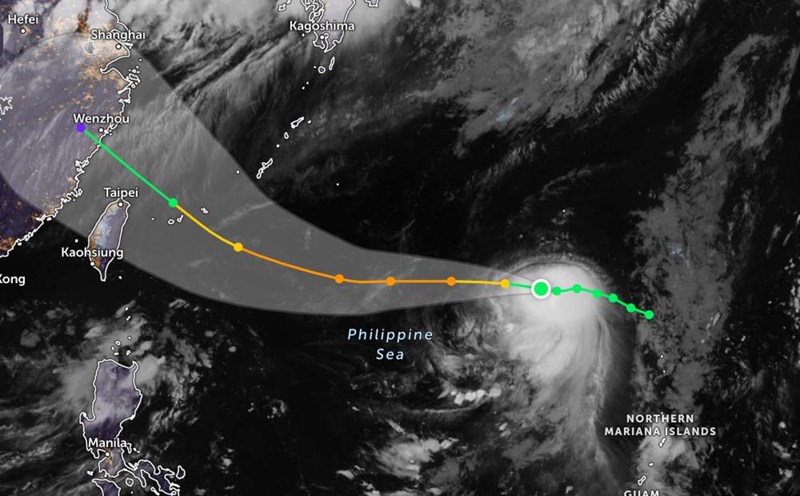
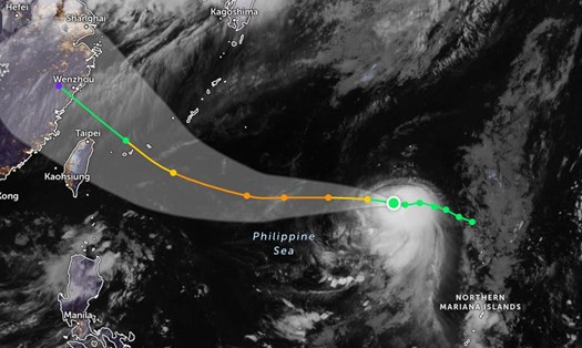
JTWC forecasts Typhoon Podul will continue to move west-northwest before making landfall on the east coast of Taiwan (China).
Typhoon Podul will continue to make a final landfall in mainland China around August 14 or 15.
The storm is forecast to reach a maximum intensity of about 140 km/h as it approaches the East Sea, before gradually weakening.
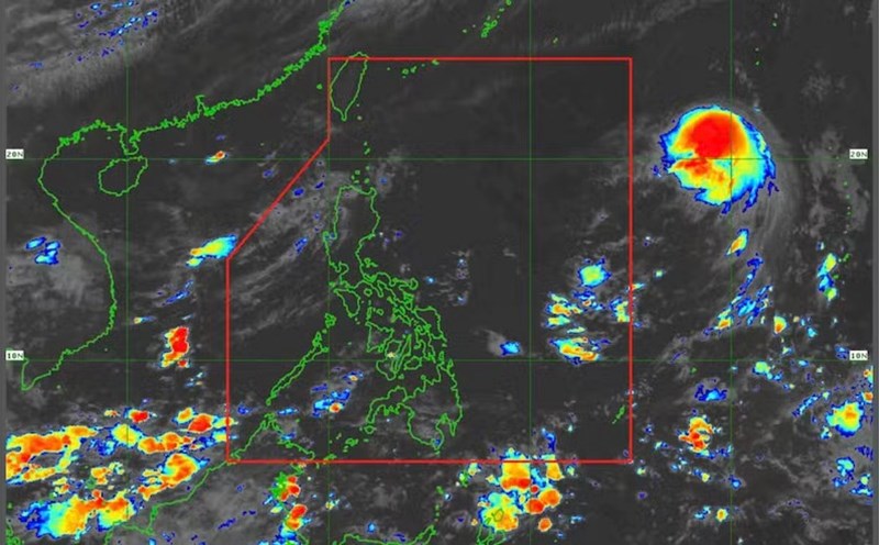
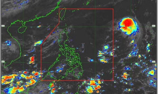
The circulation of Typhoon Podul, which carries moist air from the sea and Gulf of Thailand, could bring heavy rains to the Mekong Delta, Southeast and Central Highlands, concentrated on the afternoons of August 11 and 14, which could last until August 16. During the rain, beware of thunderstorms and local tornadoes.
From August 15, the storm circulation will affect the mountainous, midland and Delta regions of our country, with a high risk of flash floods and landslides in mountainous areas.
Tourists in Taiwan, China and surrounding areas should closely monitor forecast information, avoid going out to sea or participating in sea activities during the storm.
People in areas with high or very high risk of storms and floods need to comply with evacuation orders and instructions from local authorities.