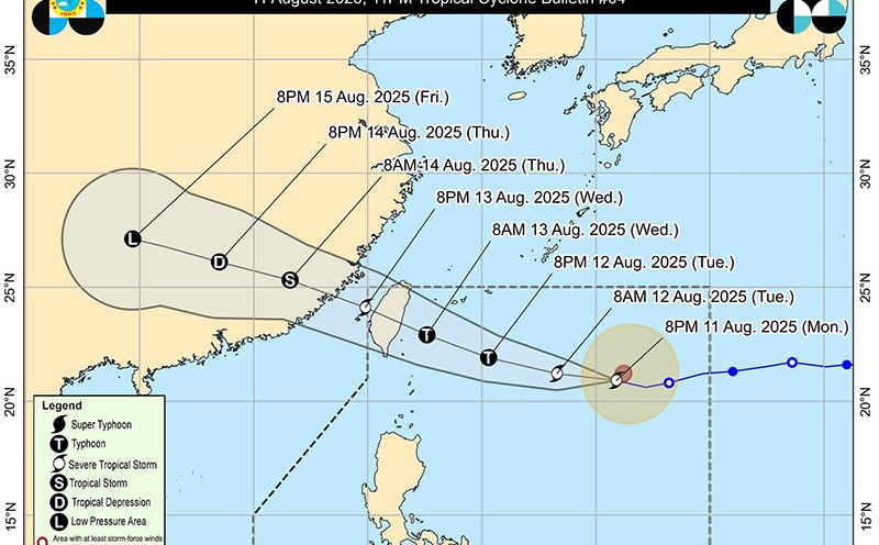
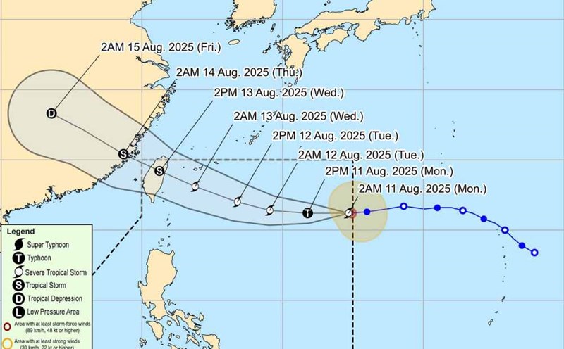
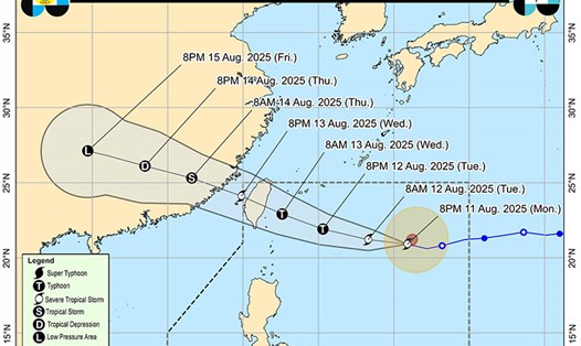
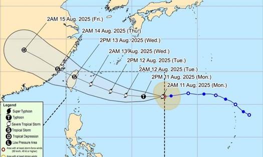
According to the latest typhoon forecast from the Joint Typhoon Warning Center (JTWC), on the morning of August 12, Typhoon Podul moved west at a speed of 26 km/h.
Tropical storm-force winds extend up to 130 km northeast and 72 km in other directions from the center.
JTWC forecasts Podul will gradually turn west-northwest in the next few hours, reaching maximum winds of 155km/h in the early morning of August 13.
Following the expected path from forecast models, Podul will make landfall in southern Taiwan (China) late on August 13, then make a second landfall in southeastern China in the early morning of August 14 with the intensity of a tropical storm.
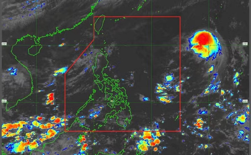
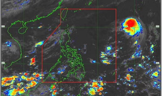
The Philippine Atmospheric, Geophysical and Astronomical Services Administration (PAGASA) is also monitoring the storm in the country's Area of Responsibility (PAR). Typhoon Podul has the local name Gorio, the center of the storm is at about 20.7 degrees North latitude; 127.9 degrees East longitude. PAGASA warns of heavy rain and strong gusts of wind in some northeastern areas of the country.
The Taiwan Meteorological Station (China) forecasts Typhoon Podul to make landfall in the Taitung or Hualien area at noon on Wednesday, August 13.
Tourists in Taiwan and the southeastern coastal region of China should closely monitor weather reports and recommendations from local authorities.
Limit outdoor activities, especially sea or near-shore tours, from the afternoon of August 12 to the end of August 14 due to the risk of strong winds and heavy rain.
Check and adjust flight schedules and ferry schedules for possible delays and cancellations. Avoid moving through areas prone to flooding and landslides as the storm approaches and during heavy rain.