According to the latest storm news from According to the Joint Typhoon Warning Center (JTWC), Typhoon Wipha is moving west-northwest at a speed of about 20 km/h (local name in the Philippines is Typhoon Crising, Typhoon No. 6 in the Japanese name and Typhoon No. 3 in Vietnam).
The highest waves near the center of the storm reached about 4.6 meters.
It is forecasted that in the next 24-36 hours, Typhoon Wipha will continue to move west-northwest.
Current environmental conditions are considered favorable for the storm to continue to strengthen.
However, the time for the storm to increase significantly will only last about 36 hours before reaching the mainland of southern China and Hong Kong Island (China).
The JWTC forecasts that if the storm is qualified to continue to strengthen, the strongest winds could reach 110-120 km/h.
After about 36 hours, as the westerly wind trough moves northeast, the subtropical high pressure will re-establish in the north and northwest. This condition caused Typhoon Wipha to change direction to the west, then west-southwest, towards the Northern region of Vietnam.
As it moves along the southern coast of China, the storm will gradually weaken due to the impact of land. This weakening process could last from 36 hours to 5 days, with the possibility of dissipating by the end of the forecast period.
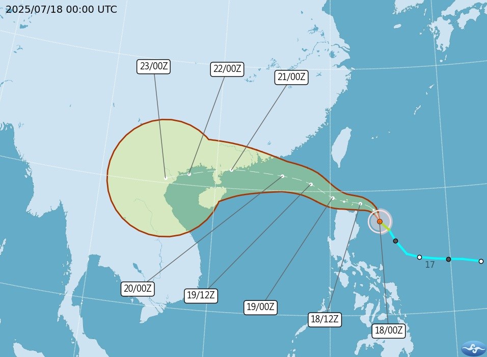
Most forecast scenarios show that Typhoon No. 3 Wipha will enter Vietnam and gradually dissipate.
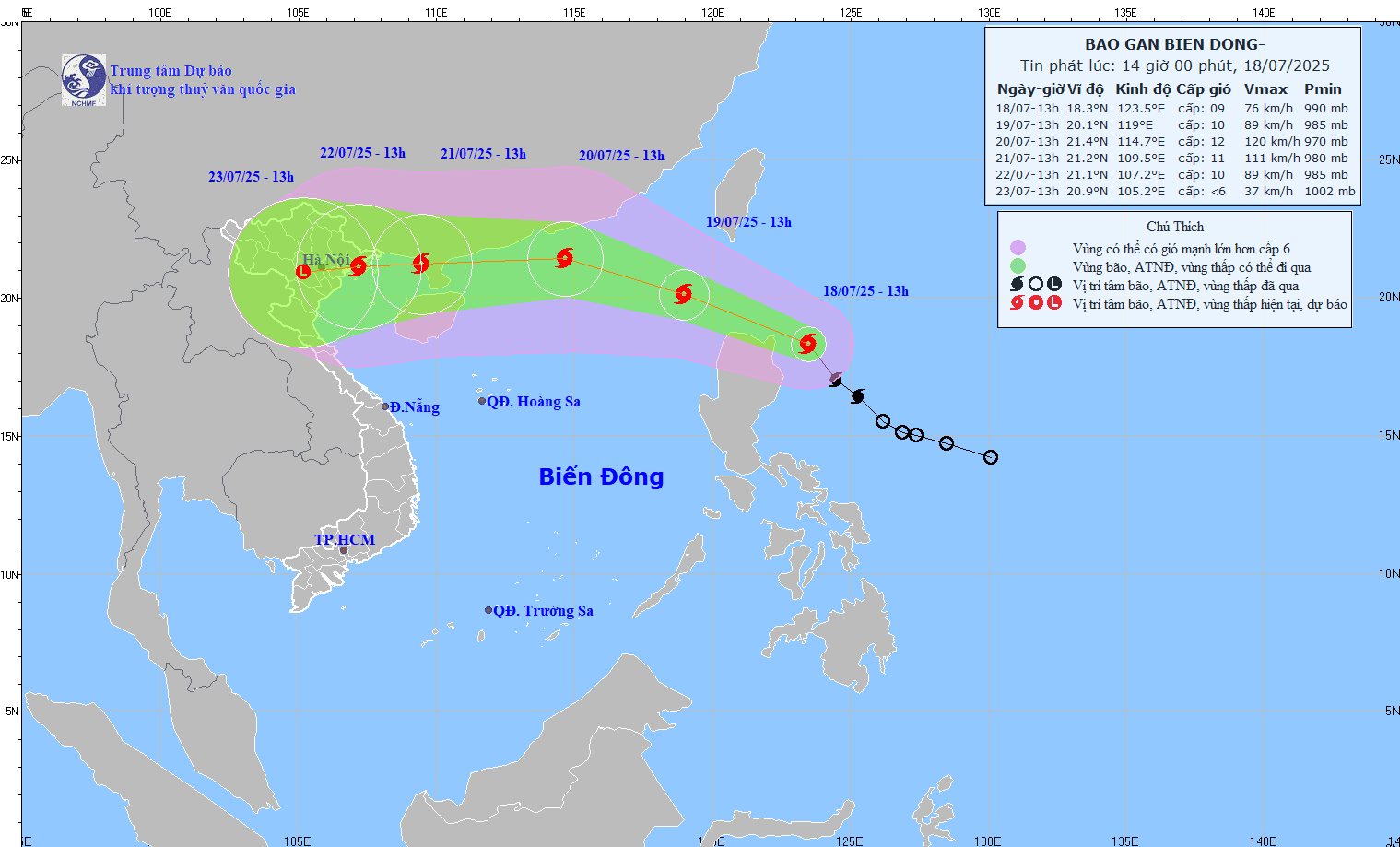
According to the National Center for Hydro-Meteorological Forecasting, by 7:00 p.m. on July 19, the storm will move in a West-Northwest direction at a speed of 20-25km/h, entering the East Sea and tending to strengthen.
The forecast location is currently at about 21.7 degrees North latitude - 118.0 degrees East longitude, in the northeastern sea of the North East Sea, about 850 km east of the Lusian Peninsula (China).
The forecast intensity is level 10, gust level 12. The dangerous area in the next 24 hours will be from latitude 18.0 to 22.5 degrees North latitude and east of longitude 116.0 degrees East longitude. Natural disaster risk level 3, applied to the eastern sea area of the North East Sea.
By 7:00 p.m. on July 20, the storm will mainly move westward, at a speed of about 20km/h and is likely to continue to strengthen. The center of the storm is forecast to be at about 21.8 degrees North latitude - 112.8 degrees East longitude, about 270 km East Northeast of the Lusian Peninsula. The intensity will increase to level 11-12, gust level 14.
By 7:00 p.m. on July 21, the storm moved to the West Southwest, speed about 20km/h and began to weaken. The center of the storm is located at about 21.1 degrees North latitude - 109.0 degrees East longitude, in the Gulf of Tonkin.
The storm continues to move in a West-Southwest direction at a speed of 10-15km/h and continues to weaken as it moves further inland.
Typhoon No. 3 Wipha tends to strengthen and approach the Southeast region of China and the North of Vietnam.
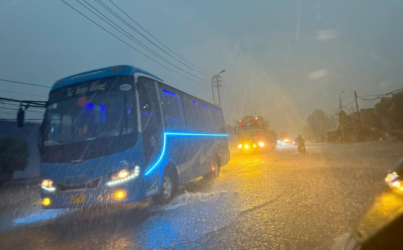
People and tourists in coastal areas in the Gulf of Tonkin need to closely monitor the next bulletins, prepare response plans in case the weather turns bad due to the impact of storm No. 3 Wipha.
Passengers need to proactively check the flight status via the airline's website or application.
There are currently no announcements of mass flight cancellations, but the possibility of flight delays or cancellations is increasing, especially from July 19-21 at airports such as Hong Kong, Guangzhou, Shenzhen in China and Manila in the Philippines.
Note that many airlines have applied free ticket/flight change support policies for flights that have been delayed or canceled between 20-21.7 due to the impact of storm No. 3.