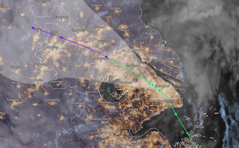
According to the Joint Typhoon Warning Center (JWTC), Typhoon No. 4 Co May (international name: Co-may) has moved deep into the mainland of Shanghai (China).
By the morning of July 31, the storm had weakened into a low pressure area.
The center of the low pressure is about 9km west of the center of Shanghai. The low pressure has been moving northwest at a speed of about 11km/h for the past 6 hours.
The remnants of Co May are expected to continue to dissipate gradually over the next 36 hours due to interaction with the mainland terrain. There is a possibility that the remnant storm will move back to the sea, but it is unlikely to develop strongly into a storm.
The low pressure caused thunderstorms across Shanghai, partly dispelling the heat that has lasted for many days here.
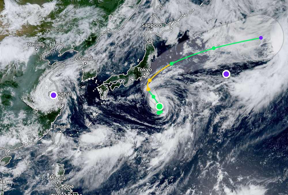
Meanwhile, Typhoon Krosa continues to strengthen at sea. On the morning of July 31, the storm moved north at a speed of about 6km/h, about 743km south-southeast of Yokosuka (Japan). The largest wave height recorded was 4.9 meters. The strongest wind near the center of the storm reached 75km/h.
Typhoon Krosa is expected to continue to strengthen in the next few days. It is forecasted that by this afternoon, July 30, the wind will increase to 85km/h. The storm will then continue to strengthen into a severe tropical storm with winds of up to 100km/h tomorrow afternoon, August 1.
The center of the storm is expected to pass through the sea southeast of Honshu Island, Japan in the next 2-3 days, then accelerate in the East - Northeast direction. Typhoon Krosa is not expected to make landfall in Japan.
According to the National Center for Hydro-Meteorological Forecasting, in the early morning of July 30, there were scattered showers and thunderstorms in the northern sea of the North East Sea. Phu Quy Special Zone has strong southwest winds of level 6, Bach Long Vi station has gusts of level 7.
It is forecasted that during the day and night of July 31, the North and Central East Sea (including Hoang Sa special zone) will have strong winds of level 6-7, gusting to level 8-9. Strong sea, waves 2.0-5.0m high.
The sea area from Gia Lai to Lam Dong has strong winds of level 6, gusting to level 7-8. Rough seas, waves 2.0-3.5m high.
In addition, on the day and night of July 31, in the Gulf of Tonkin, the North East Sea, the sea area from Ca Mau to An Giang and the Gulf of Thailand, there will be scattered showers and thunderstorms. During thunderstorms, there is a possibility of tornadoes and strong gusts of wind of level 7-8.
During the day and night of August 1, the North East Sea area (including Hoang Sa special zone) will have strong southwest winds of level 6, sometimes level 7, gusting to level 8-9. Waves are 2.0-5.0m high, with rough seas.
The Central East Sea area and the sea area from Gia Lai to Khanh Hoa will have strong southwest winds of level 6, gusting to level 7-8; waves 2.0-4.0m high, rough seas.
People and tourists in the above sea areas should pay attention to weather forecasts. Check flight schedules and follow local instructions to avoid dangerous storms.