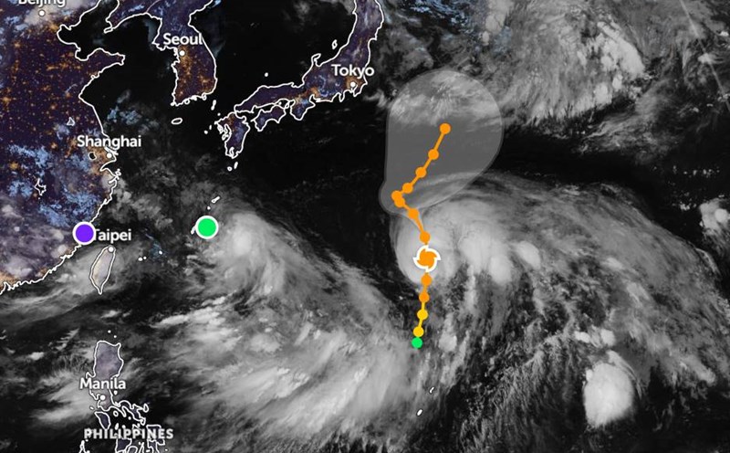
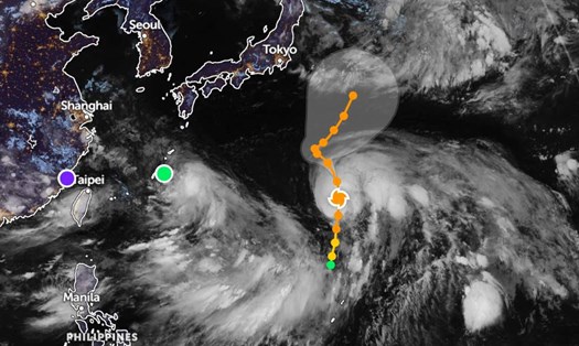
According to the typhoon forecast from the Shanghai Central Meteorological Station, Typhoon No. 4 Co May (international name: Co-may; Philippine name: Emong; Japan calls it Typhoon No. 8) made its second landfall in eastern China on the afternoon of July 30.
The storm made its first landfall in Zhejiang province in the early morning of the same day.
The strongest wind near the center of the storm is level 8 (speed 23 meters/s). The waves in the center of the storm swept through and were up to 6.1m high.
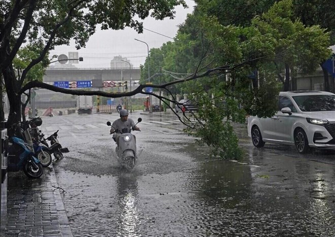
Shanghai's rainfall is expected to reach 100 mm in just 6 hours - equivalent to a month's rainfall. The government warned of the risk of flooding in many central areas.
Since Tuesday, July 29, Shanghai has temporarily closed tourist attractions and instructed fishing vessels to take shelter at the port.
On July 30, the city evacuated more than 280,000 people, canceling hundreds of flights and ferry services, and applying speed limits on roads and railways, according to Xinhua.
Although the winds are not as strong as high-altitude typhoons, Shanghai and neighboring cities are not subjective. The city government said that up to 640 flights may be canceled during the day, including 410 flights at Pho Dong airport and 230 flights at Hong Kieu airport.
In neighboring cities such as Ninh Ba, Wenzhou and Hangzhou, many flights have also been canceled or diverted. Zhoun alone canceled more than 75% of flights during the day.
All ferry routes in the city have stopped operating since the morning of July 30.
Some train lines in the area have also been suspended or have to run slowly to ensure safety.
Some parks and zoo have been temporarily closed, but Shanghai Disneyland and Legoland remain open, only temporarily suspending some outdoor games in Legoland due to bad weather.
Co-may is one of the few storms that directly hit Shanghai - which is often less directly affected by strong typhoons (which mainly go deeper into southern China).
Previously, a Tsunami warning issued after an 8.8-magnitude earthquake off the coast of Kamchatka (Russia) also raised concerns about the possibility of unusually high sea level on China's coast. However, the warning was lifted later in the day.
Co-may is forecast to continue moving northwest and then gradually weaken. In the next 36 hours, the storm will gradually dissipate.
After this time, the direction of the storm's circulation is still uncertain, however, it is likely that the remnant storm will move to the Hoang Hai Sea.
Tourists should avoid traveling or staying near the Shanghai coast during this time.
Limit travel by boat, boat and activities at sea due to large waves and strong gusts of wind.
Continuously monitor weather forecasts and instructions from local authorities to ensure safety.