According to the latest weather information from the National Center for Hydro-Meteorological Forecasting, currently (May 15), the area from Da Nang City to Lam Dong is experiencing localized thunderstorms.

Forecast for this afternoon and evening, the area from Da Nang City to Lam Dong and the South will have scattered showers and thunderstorms with common rainfall from 10-30mm, locally heavy rain over 70mm.
The Northern mountainous region in the late afternoon and tonight will also have scattered showers and thunderstorms with rainfall from 10-25mm, in some places over 50mm.
Warning in thunderstorms, there is a possibility of tornadoes, lightning, hail and strong gusts of wind. Disaster risk level due to tornadoes, lightning, hail is warned at level 1.
Notably, in the past 2 hours, many places in Quang Ngai and Lam Dong have experienced moderate to heavy rain. Some points recorded heavy rain such as: Thanh An (Quang Ngai) 70.4mm, Ba Cung 58.2mm, Ward 5 - Da Lat 65mm, Tan Thuong - Di Linh 34.3mm.
Forecast for the next 3-6 hours, Quang Ngai will continue to have rain with common rainfall from 20-40mm, in some places over 60mm; Lam Dong from 10-30mm, in some places over 50mm.
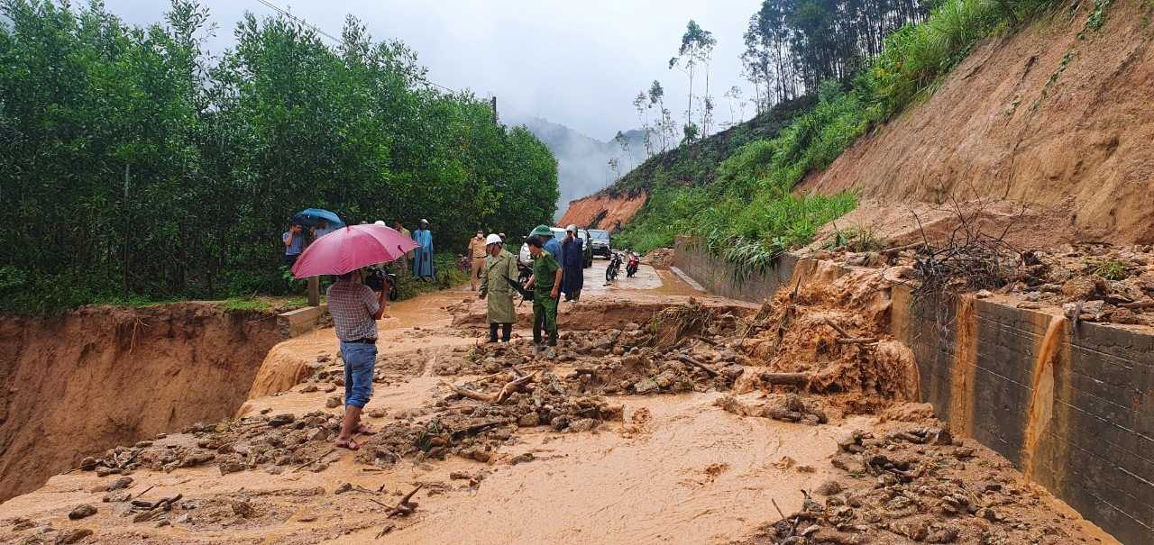
Warning in the next 6 hours, there is a risk of flash floods on small rivers and streams, landslides on slopes in many localities in Quang Ngai and Lam Dong, especially in hilly areas, slopes and streams.
People and tourists are advised to limit movement during heavy rain. Outdoor tourism, camping, and trekking activities need to closely monitor weather developments to proactively adjust schedules, avoiding the risk of flash floods and unexpected landslides.


