According to the latest storm news from the Philippine Atmospheric, Geophysical and Astronomical Services Administration (PAGASA), Typhoon Nokaen continues to operate in the Philippine Area of Responsibility (PAR).
As of 7 pm on January 18 (local time), the storm's center was located at about 15.4 degrees North latitude - 125.6 degrees East longitude, about 250 km northeast of Virac, Catanduanes.
The strongest wind near the storm center reaches 65 km/h, gusting at 80 km/h. The storm moves in the North direction at a speed of about 15 km/h. The wind radius from the storm center stretches up to 440 km.
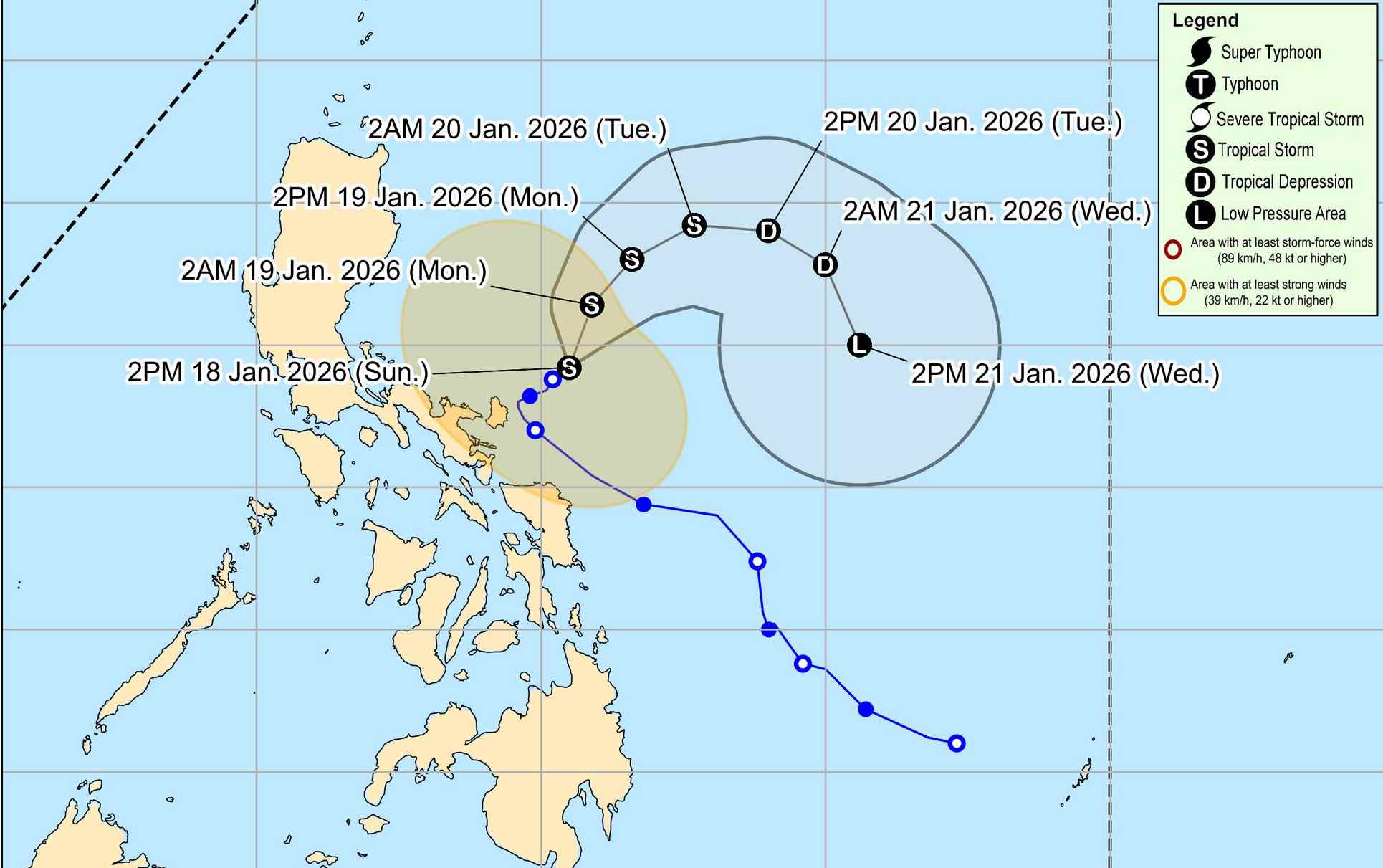
Typhoon Nokaen is forecast to move in a Northeast direction until tomorrow (January 19). After that, the typhoon is forecast to move in an arc on the sea east of Luzon. PAGASA forecasts that the direction of the storm may also change during the forecast period.
Typhoon Nokaen will maintain its tropical storm intensity as it moves over the sea area east of Luzon. After that, it is expected that the typhoon will weaken into a tropical depression on Tuesday afternoon or evening (January 20) and continue to weaken into a low pressure area on Wednesday afternoon (January 21) due to the influence of the Northeast monsoon. The possibility of weakening sooner may still occur.
In the East Sea, according to the National Center for Hydro-Meteorological Forecasting, on the day and night of January 20, the sea area east of the Northern East Sea area has strong Northeast winds at level 6, sometimes level 7, gusting at level 8-9; sea waves are 3.0 to 5.0m high, strong sea waves.
In the late afternoon and night of January 20, the western sea area of the Northern East Sea (including Hoang Sa special zone) will gradually strengthen to level 6, gusting to level 8; sea waves from 3.0 to 5.0m high, rough seas. Level of natural disaster risk at sea: level 2.
All ships operating in the above areas are at high risk of being affected by strong winds and big waves.
People and tourists who plan to visit these sea areas or areas passing through by storms should pay attention to weather forecasts. Follow local instructions to avoid dangerous storms.


