
According to storm news, the latest low pressure from the Joint Typhoon Warning Center (JTWC), two low pressures are operating near the East Sea.
As of 8 pm on July 17, the position of the low pressure center with the symbol LPA 07C (Invest 90W) is at about 8.0 degrees North latitude, 154.8 degrees East longitude, about 3,135 km east of the Northeast of Mindanao.
The strongest wind near the center of the low pressure reached 35 km/h. The low pressure is forecast to have little chance of strengthening into a tropical depression or storm in the next 24 hours.
Not far away, the low pressure bearing the symbol Invest 91W is currently operating in the Northwest Pacific region. The strongest sustained wind is about 35-45 km/h. JTWC forecasts that this low pressure is also unlikely to strengthen into a tropical depression or storm in the next 24 hours.
Meanwhile, Typhoon Elida currently has a maximum wind speed of about 100 km/h and slows down in intensity. It is forecast that in the next 24 hours, the storm may strengthen further, reaching an intensity of about 120 km/h.
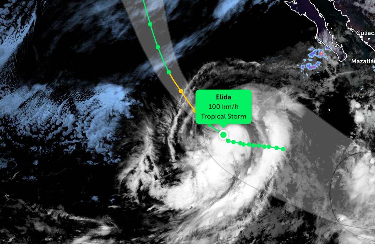
After about 36 hours, Elida is forecast to weaken as it moves into waters with lower temperatures and is affected by strong wind shear. In the next 3-4 days, the storm is likely to weaken into a post-tropical cyclone as it gradually loses its characteristics of a tropical storm.
In the East Sea, according to the National Center for Hydro-Meteorological Forecasting, on the night of July 17 and the day of July 18, the area north of the Gulf of Tonkin, the sea area from Khanh Hoa to Lam Dong has strong southwest winds of level 5, sometimes level 6, gusts of level 7-8; rough seas; waves 1.5-3.0m high.
In addition, on the night of July 17 and the day of July 18, the north of the Gulf of Tonkin, the sea area from Lam Dong to Ca Mau, from Ca Mau to An Giang, the Gulf of Thailand, and the east of the Northern East Sea area will have scattered showers and thunderstorms. In thunderstorms, there is a possibility of tornadoes, strong gusts of wind at level 7-8 and waves over 2.0m high.
Forecast for the night of July 18, the north of the Gulf of Tonkin, the sea area from Dak Lak to Lam Dong will have strong southwest winds of level 5, sometimes level 6, gusts of level 7-8, sea waves 1.5-3.0m high; rough seas; on July 19, wind activity will gradually weaken.
Level of natural disaster risk at sea: level 2. All ships operating in the above areas are at high risk of being affected by strong winds and large waves; in thunderstorms, there is a risk of tornadoes and strong gusts of wind.


