Low pressure developments in the East Sea cause heavy thunderstorms

Ninh Phương |

The low pressure in the East Sea is causing widespread thunderstorms.

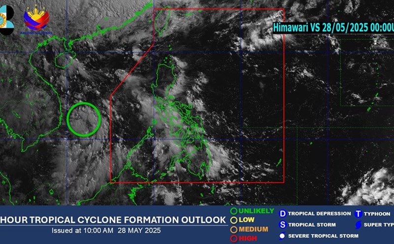
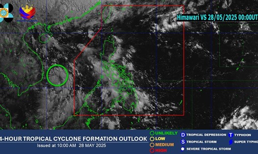
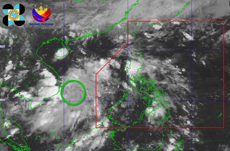
According to the new weather forecast from the Philippine Atmospheric, Geophysical and Astronomical Services Administration (PAGASA), at around 8:00 p.m. on May 28 (local time), the low pressure area being monitored in the East Sea is unlikely to strengthen into a tropical depression.

According to the National Center for Hydro-Meteorological Forecasting, the low pressure trough with an axis at about 10-13 degrees North latitude connecting with the low pressure area at 7:00 p.m. this afternoon was located at about 10.5-11.5 degrees North latitude; 110.5-111.5 degrees East longitude.

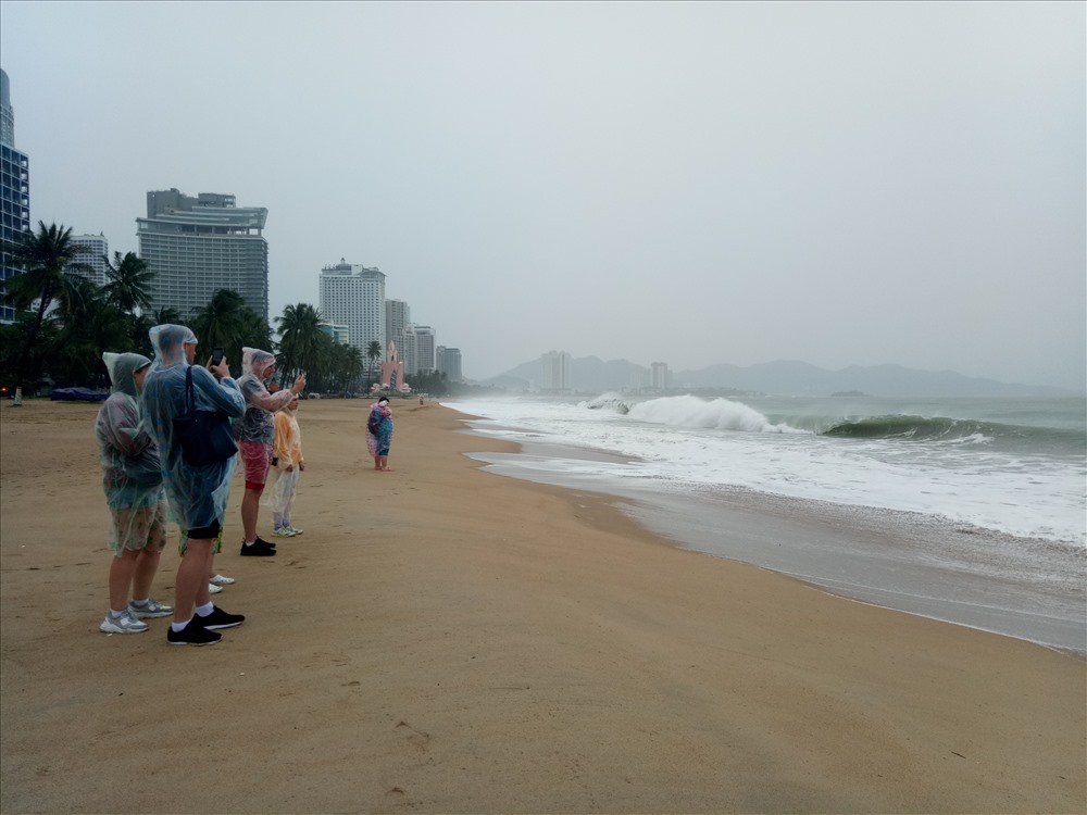
In the sea area from Binh Dinh to Khanh Hoa, the North East Sea area (including the Hoang Sa archipelago), the Central and South East Sea area (including the Truong Sa archipelago) there will be showers and thunderstorms.

It is forecasted that on the night of May 28 and May 29, in the Gulf of Tonkin, the sea area from Binh Dinh to Ca Mau, Ca Mau to Kien Giang and the Gulf of Thailand, the North East Sea (including Hoang Sa archipelago), the Central and South East Sea (including Truong Sa archipelago) will have showers and thunderstorms.

Vi tri ap thap tren Bien Dong. Du bao it co kha nang ap thap manh len thanh ap thap nhiet doi hoac phat trien thanh bao. Anh ve tinh: PAGASA
Location of the low pressure in the East Sea. It is unlikely that the low pressure will strengthen into a tropical depression or develop into a storm. Satellite photo: PAGASA

During thunderstorms, there is a possibility of tornadoes, strong gusts of wind of level 6-7, waves over 2.0m high.

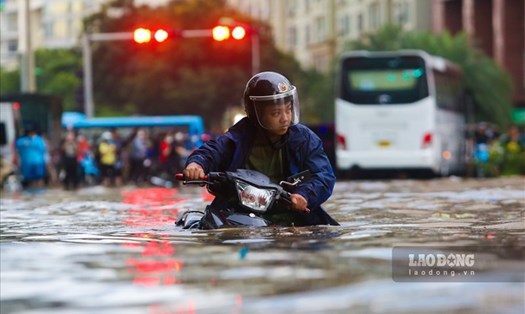
In addition, the influence of the low pressure trough connecting to the low pressure area continues to cause thunderstorms on land in the South.

All ships operating in the above areas are at risk of being affected by tornadoes and strong gusts of wind.

People and tourists, especially in areas prone to natural disasters such as mountainous areas and rivers and streams, need to closely monitor the next weather reports and proactively take measures to prevent thunderstorms, flash floods and landslides.

Tourists should limit going out to sea, postpone island tours or sea sports during thunderstorms.

Equip yourself with life jackets and necessary protective equipment if you are forced to move, and contact local authorities or tour guides to receive timely warnings.

Voi nhung du khach dang o khu vuc bien mien Trung, uu tien tham quan trong dat lien, tranh vung ven bien khi thoi tiet xau. Anh: Nguyen Linh
For tourists in the central coastal area, prioritize sightseeing inland, avoiding coastal areas during bad weather. Photo: Thuy Trang
Ninh Phương
TIN LIÊN QUAN

Developments of heavy rain falling in the North in some places exceeding 200mm, flood warning

|

Heavy rain is forecast to fall on the North and North Central regions from the afternoon of May 28. The South continues to have moderate rain, heavy rain and thunderstorms due to the influence of the low pressure trough.

Weather forecast for heavy rain due to the influence of low pressure in the East Sea

|

The low pressure continues to move over the East Sea, causing widespread rain even though it is unlikely to become a storm in the next 24 hours.

Weather forecast to warm up to 38 degrees after a cold front, prolonged rain

|

After a cold front and thunderstorms, the weather forecast for the North and North Central regions will be hot to 38 degrees Celsius.

Developments of heavy rain falling in the North in some places exceeding 200mm, flood warning

Ninh Phương |

Heavy rain is forecast to fall on the North and North Central regions from the afternoon of May 28. The South continues to have moderate rain, heavy rain and thunderstorms due to the influence of the low pressure trough.

Weather forecast for heavy rain due to the influence of low pressure in the East Sea

Chí Long |

The low pressure continues to move over the East Sea, causing widespread rain even though it is unlikely to become a storm in the next 24 hours.

Weather forecast to warm up to 38 degrees after a cold front, prolonged rain

Ninh Phương |

After a cold front and thunderstorms, the weather forecast for the North and North Central regions will be hot to 38 degrees Celsius.