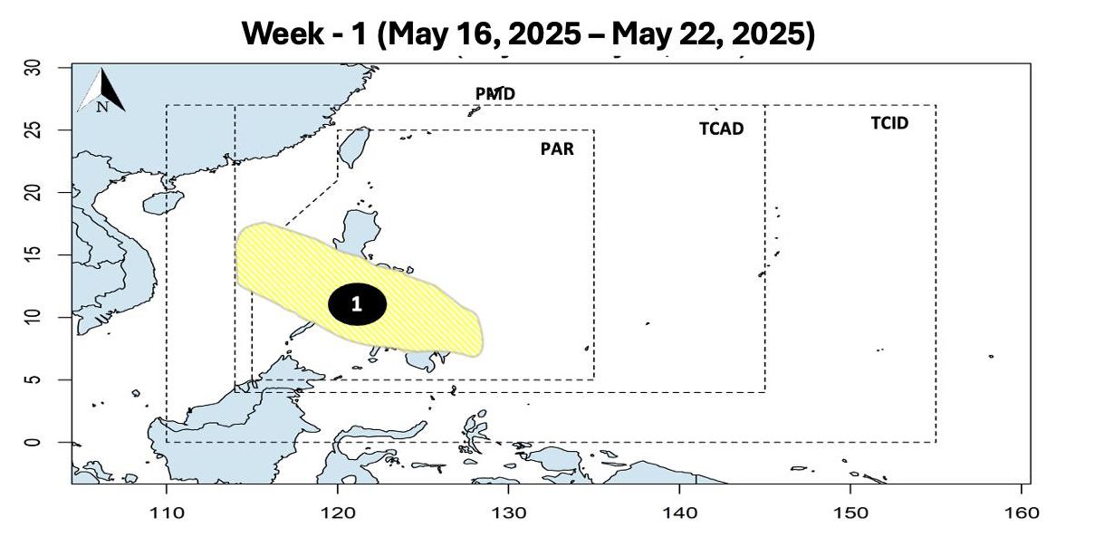
According to the Philippine Atmospheric, Geophysical and Astronomical Services Administration (PAGASA), during the week of December 19-25, a low pressure area is expected to form in the area east of Mindanao, and is expected to move through Mindanao, Visayas and southern Luzon.
The low pressure will form near the East Sea, likely moving into the East Sea, affecting the central coastal waters of our country. The possibility of this low pressure developing into a storm is forecast to be quite low.
The Philippine Meteorological Agency also forecasts that in the last week of May (from May 26 to June 6), the low pressure is still likely to become a storm when it leaves the Philippine Area of Responsibility (PAR) and enters the northern part of the East Sea.
In addition, PAGASA forecasts another low pressure area likely to form east of the PAR area in the last week of May. However, this low pressure is located quite far from the East Sea and the possibility of developing into a storm is also low.
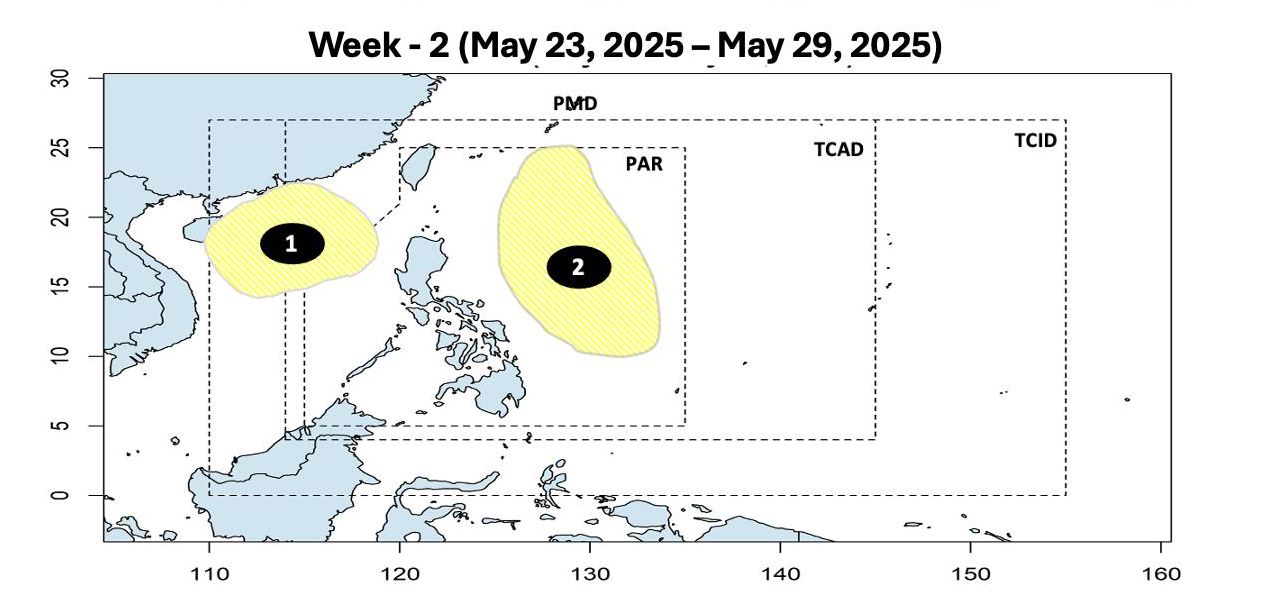
The two low pressure areas are forecast to form consecutively in the area near the East Sea in late May, signaling that the 2025 typhoon season is approaching.
According to the latest season forecast from the National Center for Hydro-Meteorological Forecasting, from May 15 to August 2025, storms/tropical depressions are likely to operate in the East Sea and affect our country at a level similar to the multi-year average (TBNN).
Accordingly, the average number of storms/tropical depressions in the East Sea during this period is 5.2 storms, of which about 2 have made landfall.
There is a possibility of dangerous weather phenomena such as thunderstorms, tornadoes, lightning, hail and strong gusts of wind occurring nationwide.
From June to August 2025, moderate and heavy rains are likely to appear in the Northern, North Central, Central Highlands and Southern regions.
With the approaching storm season, people and tourists should pay attention to weather forecasts, especially travel plans in the northern sea, islands and North Central regions to ensure flight schedules, trains and trips are not affected.


