According to the forecast of new low pressure and storm risk of the Philippine Atmospheric, Geophysical and Astronomical Services Agency (PAGASA), in the period from January 12 to January 25, a low pressure area is likely to form in the east of the Philippines, then enter the Philippine Area of Responsibility (PAR), with an average to high probability of strengthening into a tropical depression and continuing to develop in the following days.
According to the Typhoon and Low Pressure Potential Assessment bulletin published by PAGASA on January 12, no low pressure or tropical depression has been recorded at PAR in the week from January 12 to January 18.
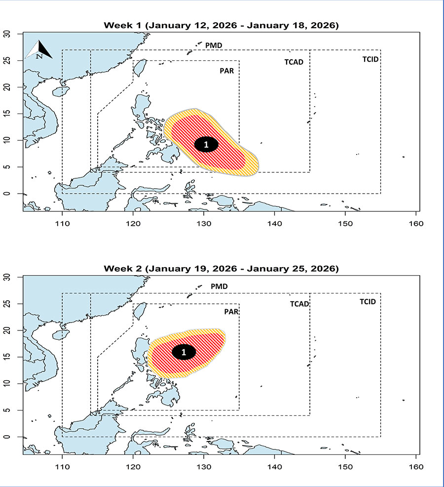
However, forecast models show that a low pressure area is likely to form in the southeast edge of PAGASA's storm forecast area, then gradually move inside PAR.
This low pressure area is forecast to head towards the Caraga and Eastern Visayas regions, with the possibility of moderate to high intensity strengthening into a tropical depression during this period.
Next week, from January 19 to January 25, PAGASA assesses that the aforementioned low pressure area or tropical depression tends to move closer to the eastern east of Visayas and southern Luzon, before changing direction and moving northeast.
In this period, the possibility of the system continuing to strengthen is still assessed at an average to high level.
If it strengthens into a tropical depression and enters PAR, the system will be named Ada according to PAGASA's list.
PAGASA forecasts that about 2 to 8 storms will enter PAR in the first 6 months of this year.
With the current forecast signals, the risk of low pressure, tropical depression and storms in the period from now until the end of January is very noteworthy.
From now until the end of January, tourists planning to visit the Philippines, especially the central and southern regions such as Eastern Visayas, Caraga and neighboring areas, need to regularly follow the forecast bulletins for low pressure, tropical depression and storms issued by PAGASA.
In Vietnam, the National Center for Hydro-Meteorological Forecasting forecasts that there is little chance of storms/tropical depressions appearing in the East Sea in January.
Tourists should proactively update on weather conditions, limit travel by sea when there are warnings of heavy rain and strong winds. Proactively prepare plans to adjust sightseeing and accommodation schedules to ensure safety.


