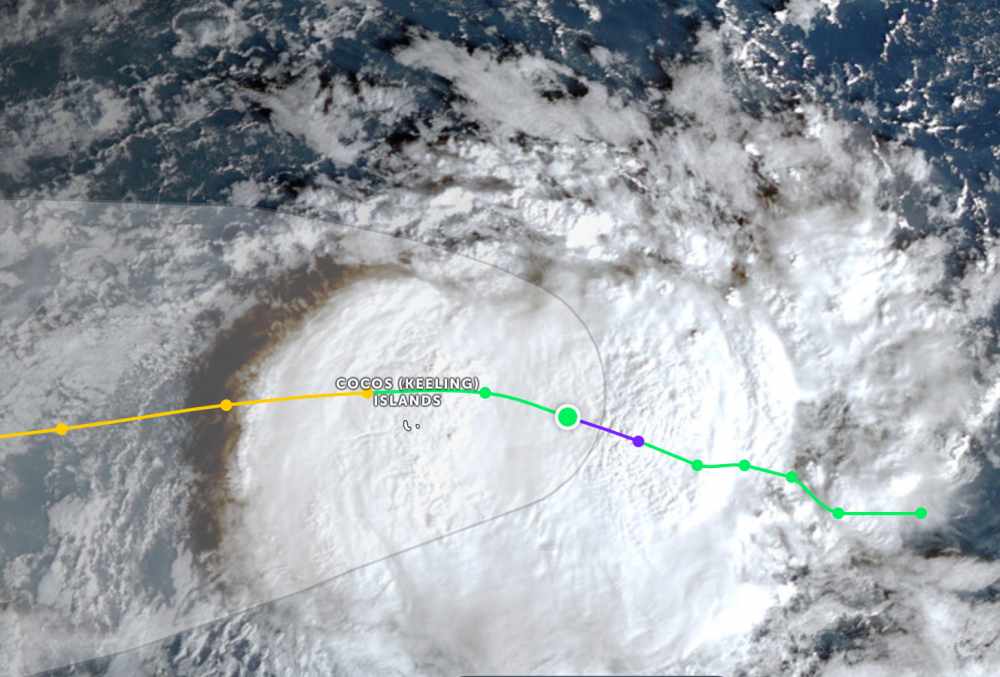
According to the latest storm information from the Joint Typhoon Warning Center (JTWC), on the morning of December 24, Typhoon Grant was located 239 km east of Cocos Islands. In the past 6 hours, the storm has been moving west-northwest at a speed of 13 km/h. The maximum wave height is 4.9 m.
The strongest wind near the center of the storm reached 75 km/h. In the next 12-24 hours, Hurricane Grant is forecast to continue moving slowly in the Northwest direction and continue to strengthen.
In the worst case scenario, the strongest wind near the center of the storm in the next 2-3 days could reach 130 km/h. Other models predict Grant will peak with winds of 100-120 km/h, then gradually weaken.
Australian Bureau of Meteorological Forecasting (BOM) weather forecaster Helen Reid predicts that grant will affect the Cocos Islands from today. People should be ready to cope with strong winds, heavy rain and floods.
Cocos Island currently has about 600 residents. To minimize the impact of the storm, people need to have a response plan before bad weather arrives.
"We expect the storm to move north of the island, not across the entire island. However, because this is a small area in the middle of the ocean, it will still be greatly affected," the expert said.
Weather forecast for heavy rain in the archipelago, with the risk of flash floods and thunderstorms. Experts predict the storm's path to the west and will pass through the archipelago tomorrow, December 25.
BOM warned that although there is currently no immediate danger, people should prepare to cope with bad weather and regularly update weather reports and recommendations from authorities.
Tourists planning to travel to these archipelagos during Christmas and New Year should consider their itinerary. Tuan follows local instructions to avoid dangerous storms.


