According to new forecast from the National Center for Hydro-Meteorological Forecasting, the tropical depression in the East Sea is likely to strengthen into a storm.
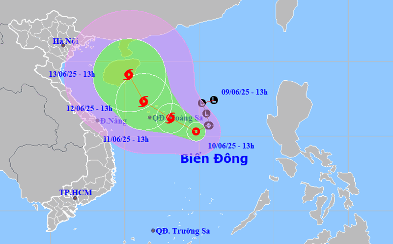
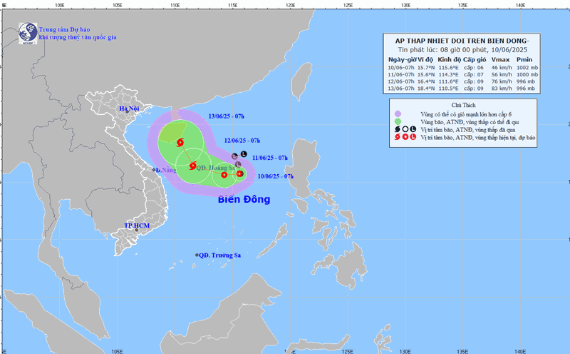
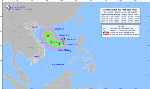
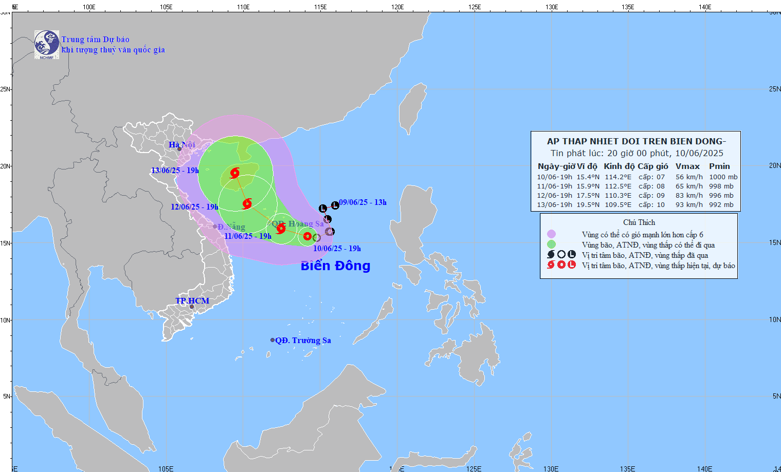
At 7:00 p.m. on June 10, the tropical depression was at 15.4 degrees North latitude; 114.2 degrees East longitude, about 300km East Southeast of Hoang Sa archipelago.
By June 12, the storm moved at a speed of about 10km/h, with an intensity of level 9 gusting to level 11 and continuing to strengthen.
The center of the storm is forecast to be at about 17.5° North latitude - 110.3° East longitude, in the sea area south-southeast of Hainan Island (China).
The danger zone will expand from 14.0 to 19.5 degrees North latitude, from 109.5 to 117.0 degrees East longitude.
Level 3 natural disaster risk for affected areas including the North East Sea (including Hoang Sa archipelago, Truong Sa), the North Central East Sea and offshore waters from Quang Tri to Quang Ngai.
Meanwhile, the China Meteorological Administration forecasts that in the next 24 hours, the tropical depression is likely to become the first storm of the year - storm No. 1. The storm will head towards the southern area of Hainan Island and the west coast of Guangdong.
The storm is expected to make landfall around Friday (13.), then gradually weaken and continue moving north of Quangzhou province into a tropical depression inland.
Meteorological experts in Taiwan (China) forecast the typhoon to make landfall south of Hainan Island on Friday morning (13.), moving west of the island and making a second landfall southwest of Zhou Peninsula on Saturday morning, then weakening and turning northeast.
Forecasts from the Japan and Korea Meteorological Agency both show that the first landfall will be south of Hainan Island (slightly to the east), then a second landfall near the Stam Giang area. The expected intensity ranges from tropical storms to strong tropical storms.
Tourists planning to visit or are staying in the Gulf of Tonkin, North Central, and southern coastal areas of China, especially Hainan Island, Guangdong and Hong Kong, should closely monitor weather forecasts in the coming days.
Tourists should limit travel by sea, avoid outdoor activities, follow local safety instructions and prepare backup plans for travel or sightseeing schedules.