According to the Philippine Atmospheric, Geophysical and Astronomical Services Administration (PAGASA), a tropical depression has formed near the East Sea, within the Philippine Area of Responsibility (PAR).
As of 11am this morning (local time), the center of the tropical depression was at about 12.6 degrees North latitude - 130.4 degrees East longitude, about 625 km east of Catarman, Northern Samar.
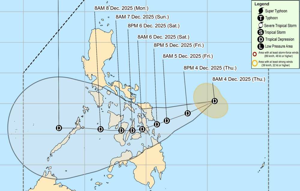
The strongest wind near the center of the tropical depression reached 45 km/h, gusting up to 55 km/h. The low pressure is moving in a West-Southwest direction towards the East Sea at a speed of 20 km/h.
PAGASA forecasts that the tropical depression will cross the Philippine mainland and enter the East Sea around December 9. During this time, the tropical depression will maintain its intensity and wind power.
Due to the influence of the tropical depression, some areas in the Philippine mainland will receive 50-100 mm of rain today and tomorrow, December 5, including Catanduanes, Albay, Sorsogon, Camarines Sur Sorsogon and Masbate, Romblon...
In the East Sea, according to the National Center for Hydro-Meteorological Forecasting, today and tonight, December 4, the North East Sea area (including Hoang Sa special zone): Northeast wind level 6-7, gust level 8-9. Strong seas. Waves are 4.0-6.0m high.
The sea area from South Quang Tri to Quang Ngai and the northern sea area of the Central East Sea: strong northeast wind level 6, gust level 7-8. Rough seas. Waves are 2.0-5.0m high.
The Gulf of Tonkin has northeast winds of level 5, sometimes level 6, gusting to level 7. Rough seas. The sea area from South Quang Tri to Ca Mau and the South East Sea (including Truong Sa special zone) will have scattered showers and thunderstorms. During thunderstorms, there is a possibility of tornadoes and strong gusts of wind.
Day and night on December 5, the North East Sea area (including Hoang Sa special zone) has strong northeast winds of level 6-7, gusts of level 8-9, waves 3.0-6.0m high, rough seas.
The Central East Sea area, the sea area west of the South East Sea area (including the sea area west of Truong Sa area) and the sea area from Khanh Hoa to Ca Mau have strong northeast winds of level 6, gusting to level 7-8, waves from 2.0-5.0m high, rough seas.
The Gulf of Tonkin and the sea area from South Quang Tri to Dak Lak will have strong northeast winds of level 5, sometimes level 6, gusting to level 7, waves 1.5-3.0m high, rough seas.
All ships operating in the above areas are at high risk of being affected by strong winds and large waves. People and tourists should avoid going to sea during this time and follow local instructions to avoid dangerous wind and rain, big waves at sea.


