According to the National Center for Hydro-Meteorological Forecasting, at 7:00 a.m. on December 3, the center of the tropical depression was at about 13.3 degrees North latitude - 111.0 degrees East longitude, in the northwest sea area of the Central East Sea.
The strongest wind near the center of the tropical depression is level 6 (39-49km/h), gusting to level 8. The tropical depression moved slowly in the South-Southwest direction, at a speed of 5-10km/h.
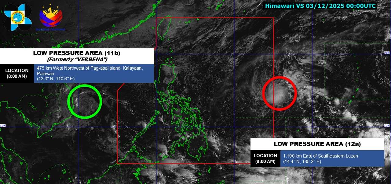
Meanwhile, the low pressure near the East Sea is moving closer to the Philippine mainland. The center of the low pressure is located at about 14.4 degrees North latitude - 135.2 degrees East longitude. The low pressure is forecast to have a high probability of developing into a tropical depression in the next 24 hours.
Forecast on December 3, the northwest area of the Central East Sea, the sea off Dak Lak - Khanh Hoa will have strong winds of level 6; gusts of level 8.Rough seas.Waves are 2.0-5.0m high.
Day and night on December 3, the North East Sea area (including Hoang Sa special zone) has northeast winds gradually increasing to level 6-7, gusting to level 8-9.Strong seas.Waves are 3.0-5.0m high.
The Gulf of Tonkin has northeast winds gradually increasing to level 6, sometimes level 7, gusting to level 8.Strong seas.Waves are 2.0-4.0m high.The sea area west of the Central East Sea, the sea area from South Quang Tri to Ca Mau will have scattered showers and thunderstorms.During thunderstorms, there is a possibility of tornadoes and strong gusts of wind.
In the afternoon and night of December 3, the sea area from South Quang Tri to Quang Ngai and the sea area north of the Central East Sea will have Northeast winds gradually increasing to level 6, gusting to level 8.Rough seas.Waves are 2.0 - 4.0m high.
Day and night on December 4, the North East Sea area (including Hoang Sa special zone) has strong northeast winds of level 6-7, gusting to level 8-9, waves 3.0-6.0m high, rough seas.The sea area north of the Central East Sea will have strong northeast winds of level 6, gusting to level 7-8, waves 3.0-5.0m high, rough seas.
The Gulf of Tonkin and the sea area from South Quang Tri to Quang Ngai will have strong northeast winds of level 5, sometimes level 6, gusting to level 7, waves 2.0-4.0m high, rough seas.The sea area from Khanh Hoa to Ca Mau will have northeast winds gradually increasing to level 6, gusting to level 7-8, waves from 2.0-4.0m high, rough seas.
The risk level of natural disasters at sea is level 2; in particular, the northwestern sea area of the Central East Sea and the sea area off Dak Lak - Khanh Hoa is level 3.
On land, this morning (December 3), in Hue, the South Central Coast and Central Highlands have scattered showers and thunderstorms, locally heavy to very heavy rain.
Rainfall from 7pm on December 2 to 8am on December 3 was over 60mm in some places such as: Tam Tra station (Da Nang) 70.6mm, Dak Gan station (Lam Dong) 81.4mm...
Forecast for the day and night of December 3, the area from South Quang Tri to Da Nang, the East of Quang Ngai to Dak Lak and Khanh Hoa will have heavy rain, rainfall 40-100mm, locally over 150mm.
Day and night on December 4, the area from South Quang Tri to Da Nang and the East of Quang Ngai will have moderate rain, heavy rain, rainfall of 40-80mm, locally over 150mm. Risk of heavy rain over 100mm/3 hours.
In addition, on the day and night of December 3, the Central and Southern highlands will have scattered showers and thunderstorms, with rainfall of 10-30mm, locally over 80mm.
People and tourists should be on guard against thunderstorms with the possibility of tornadoes, lightning, and strong gusts of wind. Heavy rain may be accompanied by flooding in low-lying areas, urban areas, industrial parks; flash floods, landslides in mountainous areas. Therefore, avoid areas where natural disasters may occur and follow local instructions to avoid dangerous storms.


