The National Center for Hydro-Meteorological Forecasting has updated the weather forecast for tonight and tomorrow (April 15) in regions across the country.
In the two days of April 15-16, hot weather continued to be maintained on a large scale, in which the Central region was still the focus with high temperatures, low humidity, and many potential health and fire hazards.
Northwest and Northern Central Highlands have localized hot weather, the highest temperature is commonly 35-36 degrees C, in some places above 36 degrees C. The relative lowest humidity is about 45-50%.
From Nghe An to Hue continues to be the area most heavily affected with intense heat, especially intense in some places. The highest temperature is commonly 37-39 degrees Celsius, in some places exceeding 39 degrees Celsius. The lowest humidity is only from 40-45%.
From Da Nang to Dak Lak (East), widespread hot sun appears, with intense heat in many places with the highest temperature of 36-38 degrees Celsius, in some places above 38 degrees Celsius. The lowest humidity fluctuates from 40-45%.
Northeast, Thanh Hoa and Southern regions have localized hot sunshine, the highest temperature in some places may exceed 35 degrees Celsius.
Prolonged heat increases the risk of fires and explosions due to increased electricity demand while air humidity is low, posing a risk of fires in residential areas as well as forest fires.
At the same time, hot weather also directly affects the health of people and tourists, easily causing dehydration, exhaustion and increasing the risk of stroke due to heat shock when exposed to high temperatures for a long time.
Weak cold air is about to cause widespread thunderstorms in the North.
Currently (April 14), a weak cold air mass in the North is moving southward, compressing a low pressure trough with an axis of about 24-27 degrees North latitude, increasing the possibility of widespread thunderstorms.
Forecast from the night of April 16 to April 17, due to the influence of cold air compressing low pressure troughs combined with wind convergence above 1,500m, the Northern region (except Lai Chau, Dien Bien) and Thanh Hoa will have rain, moderate rain, scattered thunderstorms. Common rainfall from 20-40mm, locally heavy rain over 100mm. In thunderstorms, there is a possibility of tornadoes, lightning, hail and strong gusts of wind.
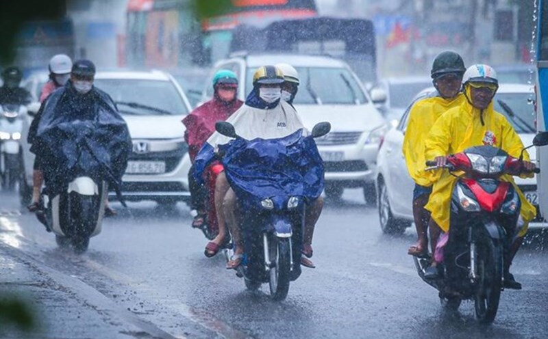
Rainstorms accompanied by dangerous weather phenomena can negatively affect life and production. Specifically, strong gusts of wind and tornadoes can break trees, blow off roofs, and damage traffic and infrastructure works. Lightning and hail also pose a risk of causing damage to property and people.
It is noteworthy that localized heavy rain in a short period of time can cause flash floods on small rivers and streams, landslides in hilly and steep areas, and flooding in low-lying areas and urban areas. People need to proactively monitor weather developments and take appropriate precautions to minimize possible damage.
Weather forecast for tonight April 14 and tomorrow April 15 nationwide
Hanoi City
Lowest temperature: 26-28 degrees C Highest temperature: 32-34 degrees C Cloudy, no rain at night, sunny day.
Southeast to south wind level 2-3.
Northwest
Lowest temperature: 23-26 degrees C Highest temperature: 33-36 degrees C Cloudy, no rain at night; hot sunny day, in some places intense heat.
Light wind.
Northeast
Lowest temperature: 24-27 degrees C Highest temperature: 31-34 degrees C Cloudy, no rain at night, sunny during the day, hot in some places.
Southeast to south wind level 2-3.
Thanh Hoa to Hue
Lowest temperature: 24-27 degrees C Highest temperature: 37-39 degrees C Cloudy, showers and thunderstorms in some places in the evening and at night; hot sunny day, especially intense in some places.
Southwest to south wind level 2-3.
South Central Coast
Lowest temperature: 24-27 degrees C Highest temperature: 32-38 degrees C Cloudy, showers and thunderstorms in some places in the evening and at night; sunny during the day, especially in the North with hot sun and intense heat.
Southeast to south wind level 2-3, tornadoes, lightning, hail and strong gusts of wind are likely to occur during thunderstorms.
Central Highlands
Lowest temperature: 21-24 degrees C Highest temperature: 33-36 degrees C Cloudy, showers and thunderstorms in some places in the evening and at night; sunny during the day, especially in the North with hot sun.
Light wind, tornadoes, lightning, hail and strong gusts of wind are likely to occur during thunderstorms.
Southern region
Lowest temperature: 24-27 degrees C Highest temperature: 32-35 degrees C Cloudy, showers and thunderstorms in some places in the evening and at night; sunny during the day, hot in some places.
Light wind, tornadoes, lightning, hail and strong gusts of wind are likely to occur during thunderstorms.
Ho Chi Minh City
Lowest temperature: 25-27 degrees C Highest temperature: 32-35 degrees C Cloudy, no rain at night, sunny during the day.
Light wind.


