The new cold air mass is strong enough to cause frost and snowfall at high mountain peaks over 1,500 m. In recent days, the Northern region has maintained a low temperature, generally below 24 degrees Celsius, cloudy and humid weather due to the impact of the cold air increasing to the east.
According to the weather forecast from the National Center for Hydro-Meteorological Forecasting, from December 8 to December 11, the North will turn to the influence of dry cold air, wind phase change causing less clouds, increasing the possibility of deep cold at night and early morning.
On December 12, the wind convergence area at an altitude of 5,000 m from Upper Laos will move to the North, causing a lot of clouds and rain.
At the same time, a strong northeast monsoon is coming down, causing temperatures to drop sharply, increasing the risk of frost and snowfall in the highlands.
According to AccuWeather, Hanoi's weather in the first three days of next week will remain at 15-26 degrees Celsius, before dropping sharply to about 12-20 degrees at the weekend. In high points such as Sa Pa, temperatures next week will range from 8-19 degrees Celsius and drop to 5-11 degrees Celsius on weekends.
In the Central region, the weather conditions for the first two days of the week are affected by the strengthening of cold air, so the sky is cloudy, with showers and thunderstorms in some places.
From December 9-11, the area from Thanh Hoa to Hue will continue to have heavy rain, with temperatures below 25 degrees Celsius, cold at night and in the morning. The South Central Coast will maintain temperatures of 26-30 degrees Celsius.
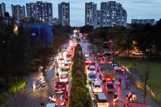
The Southern and Central Highlands regions from now until December 9 will be mainly sunny, with little rain. From December 10, easterly wind disturbances will begin to cause thunderstorms, with temperatures in the Central Highlands below 30 degrees Celsius and in the South below 33 degrees Celsius.
It is forecasted that from December 12-13, the North will welcome a very strong cold air mass, causing showers, thunderstorms and the possibility of local heavy rain. From the night of December 13-14, many places may enter a state of severe cold, with the lowest temperature in Hanoi dropping to about 10 degrees Celsius and many places in the northern mountainous region dropping below 9 degrees Celsius.
The North Central region from December 11 to 13 will have showers, heavy rain in some places, cold at night and in the morning. From December 13, the area will turn cold. Quang Tri, Hue and South Central provinces in the period of December 13-15 are likely to experience widespread heavy rain, strongly affecting people's livelihood and tourism activities.
The Central Highlands from December 9-11 and December 13-14 will maintain scattered showers, with some places having strong thunderstorms. The South will have thunderstorms in the period of 10-12.12, some places will have heavy rain.
Meanwhile, the East Sea is experiencing bad weather due to cold air. In the North East Sea area, strong northeast winds of level 6, sometimes level 7, gusting 8-9; waves 4-6 m high, rough seas.
The South East Sea area (including the sea area south of the Truong Sa area) will have scattered showers and thunderstorms. During thunderstorms, there is a possibility of tornadoes and strong gusts of wind of level 6-7.
From December 7-8, the central and southern East Sea will continue to have strong northeast winds of level 6-7, gusting to 8-9, causing waves 2-5 m high, the sea will be rough. The sea area around Hoang Sa and Truong Sa specialties is clearly affected, posing a potential danger to ships.
People, especially in high mountainous areas, need to closely monitor weather forecasts to proactively prevent severe cold, severe cold and the risk of frost.
Tourists traveling to mountainous areas such as Sa Pa, Mau Son, Fansipan should prepare cold-proof clothes and limit travel on slippery roads.
Ships need to continuously monitor strong winds in the East Sea and stay away from large waves and strong gusts in the coming days.


