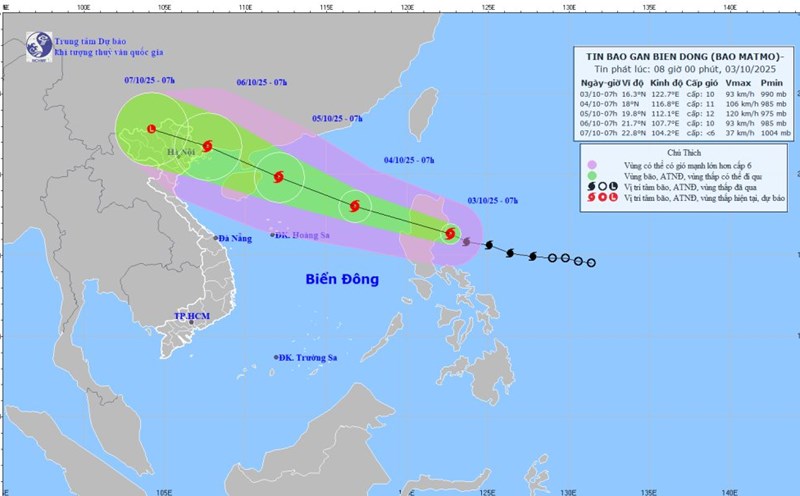
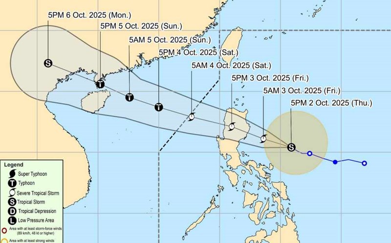
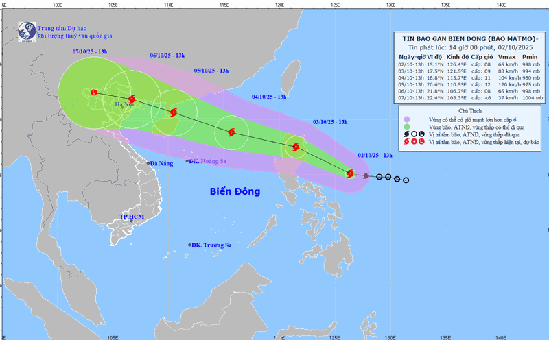
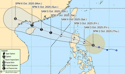
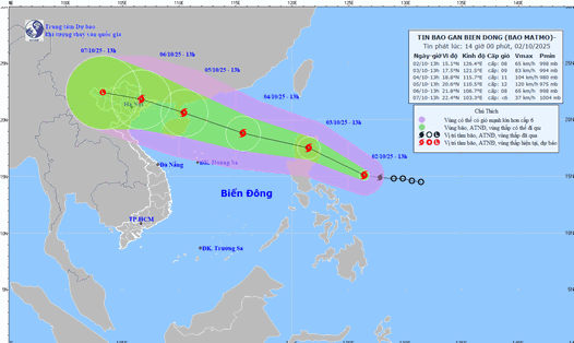
According to the latest storm news from the National Center for Hydro-Meteorological Forecasting, this afternoon, October 3, storm No. 11 Matmo entered the eastern sea area of the North East Sea.
Specifically, at 5:00 p.m., the center of the storm was at about 17.0 degrees North latitude; 120.0 degrees East longitude, in the eastern sea of the North East Sea. The strongest wind near the storm center is level 10 (89-102km/h), gusting to level 13. The storm is moving west-northwest at a speed of about 25km/h.
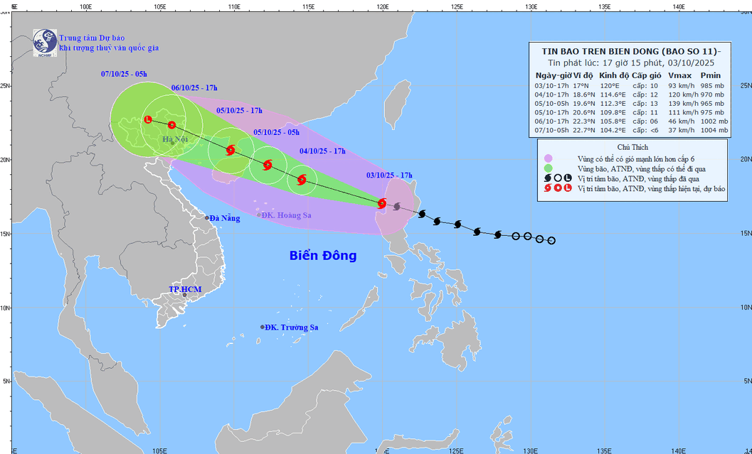
It is forecasted that in the next 24 to 72 hours, the storm will continue to move in the West Northwest direction at a speed of about 25km/h and is likely to strengthen. The expected location is about 18.6 degrees North latitude; 114.6 degrees East longitude, in the North East Sea, about 430km East Southeast of Zhou Peninsula (China). Intensity level 12, gust level 15.
At 5:00 p.m. on October 5, the storm moved in a West-Northwest direction at a speed of 20-25km/h. Location at about 20.6 degrees North latitude; 109.8 degrees East longitude, in the eastern sea of the Northern Gulf of Tonkin, about 240km East Southeast of Mong Cai (Quang Ninh). Intensity level 11, gust level 14.
At 5:00 p.m. on October 6, the storm continued to move west-northwest at a speed of about 20km/h, entering the mainland of the Northeast and gradually weakening into a tropical depression. The expected location is about 22.3 degrees North latitude; 105.8 degrees East longitude, in the mountainous provinces of the North. Intensity level 6, gust level 8.
From the next 72 to 84 hours, the tropical depression will move in the West Northwest direction, traveling about 15km per hour, moving deep into the mainland and gradually weakening into a low pressure area.
Before the development of storm Matmo, the sea area northeast of the East Sea will have strong winds of level 8-9, the area near the center of the storm will have strong winds of level 10-11, gusts of level 14, waves 4.0-6.0m high, and rough seas.
From the morning of October 4, the North East Sea area will have strong winds of level 8-10, the area near the storm center will have winds of level 11-13, gusts of level 16, waves 4.0-6.0m high, the area near the storm center will have winds of 6.0 right right right right to right, the sea will be very rough.
Ship operating in the above-mentioned dangerous areas are likely to be affected by thunderstorms, whirlwinds, strong winds and large waves.