
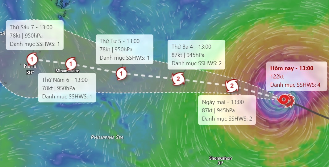
According to the National Center for Hydro-Meteorological Forecasting, in the past 24 hours, super typhoon Dolphin still maintained its main direction of movement as West-Northwest, but its intensity has shown signs of weakening. By 7:00 AM on August 2, the typhoon's center was at about 22.6 degrees North latitude; 153.7 degrees East longitude, with winds of level 15, gusting above level 17, more than 2,400km east-southeast of Okinawa (Japan).
Forecast for the next 1-2 days, the storm will continue to move in a West-Northwest direction at a speed of about 25km/h. The intensity tends to gradually decrease to level 14-15, but it is still a very strong storm.
By around July 6-7, Typhoon Dolphin is forecast to directly affect the Okinawa area (Japan), then continue to head towards the mainland east of China.
Not only affecting the storm area, Dolphin's circulation may also indirectly affect the weather in the East Sea. The meteorological agency predicts that from around August 5th, when the storm approaches the area north of Taiwan (China), southwest winds in the southern sea of the East Sea will begin to strengthen.
From July 6-7, southwest winds will be present almost throughout the North, Central and South of the East Sea, including the Hoang Sa and Truong Sa special zones, with a strong possibility of level 6-7, waves 2-4m high, causing very strong sea turbulence.
Meteorological experts recommend that tourists planning to travel to Okinawa, the eastern coastal area of China, or participate in activities in the East Sea should regularly update weather forecasts, and monitor the announcements of airlines, travel agencies and functional agencies to proactively adjust their schedules when necessary.
For tourists participating in sea tours, island tours or traveling by boat in the East Sea in the coming days, it is necessary to pay special attention to the risk of rough seas, high waves and strong winds, and limit going out to sea when there are dangerous weather warnings.
Currently, the National Center for Hydro-Meteorological Forecasting is still closely monitoring the diễn biến of storm Dolphin and will continue to update forecast bulletins in the near future.


