According to the latest storm information from the US National Hurricane Center (NHC), Erin has dropped to Category 3, with sustained winds of about 201 km/h on the morning of August 17 (local time). Tropical storm-force winds were recorded at speeds of up to 330 km/h.
Despite the reduction in intensity, this is still a strong storm and has an increasingly expanding area of influence.
Before that, Erin had undergone rapid changes: from Category 1 (120 km/h) at 11:00 a.m. on Friday (local time), it increased to Category 5 (257 km/h) just over 24 hours later, becoming one of the fastest storms ever recorded in the Atlantic.
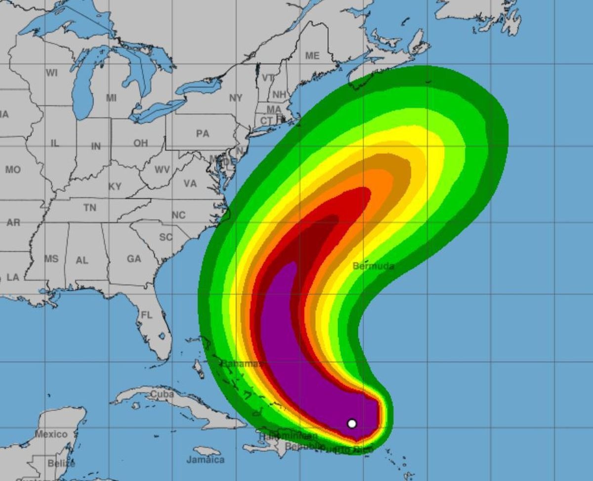
The center of the storm is currently located north of Puerto Rico and the Virgin Islands, about 241 km northeast of San Juan (Puerto Rico) and about 257 km northwest of Anguilla.
The storm is moving north into the Atlantic. Storm Erin is moving unstably but is currently moving slightly southward compared to the previous forecast. The storm is still moving west-northwest at a speed of about 24 km/h, then gradually turning north and northeast.
The center of the storm will move east of the Bahamas on August 18 (local time), then move out of Bermuda and the U.S. East Coast around mid-next week.
The NHC warns of dangerous high waves and offshore flows threatening the Bahamas coast, much of the eastern coast of the United States and Canada Atlantic, next week.
Residents and tourists on the North Carolina coast, the mid-Pacific and Bermuda should closely monitor hurricane developments due to the risk of strong winds in the first half of this week.
Several ports in Puerto Rico and the Virgin Islands have been temporarily closed to ensure maritime safety.
Tourists in Puerto Rico, the Virgin Islands, Turks and Caicos, as well as some Leeward Islands should pay special attention to heavy rain, gusts of wind, the risk of flash floods, landslides and mudslides.
Although unlikely to make landfall directly in the northeastern Caribbean, Erin is still expected to bring heavy rain, gusts of wind and rough seas. Some places may record rainfall of 50-100mm, some places up to 150mm.


