Hurricane Narelle is rapidly strengthening off the coast of Western Australia and is forecast to have serious impacts on many coastal areas in the coming days. This is one of the rare storms with the potential to simultaneously affect many states and territories of Australia - something that has not happened in about 20 years.
According to the storm forecast of the Australian Bureau of Meteorology (BOM), Typhoon Narelle has now reached level 4 - super typhoon level (equivalent to level 16 storm in Vietnam), with gusts of about 230 km/h and continuing to strengthen as it moves along the northwest coast. Notably, the storm can reach gusts of up to 275 km/h when approaching the mainland.
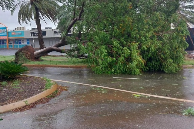
Formed from a low pressure area in the Coral Sea about 10 days ago, Hurricane Narelle made landfall in northern Australia with heavy rain, floods and strong winds before continuing its journey of more than 6,000 km from the Pacific Ocean to the Indian Ocean.
According to the weather forecast, the eye of the storm is likely to approach the Carnarvon area in the middle of March 27 before officially making landfall in Shark Bay area on the same night, with intensity level 3 but still very dangerous.
Coastal tourist towns such as Exmouth, Denham or Carnarvon are directly on the path of the storm, facing devastating winds and the risk of flash floods.
Narelle is causing significant disruptions to tourism activities in Western Australia - an area famous for its Ningaloo coast and coral reefs.
Many roads were blocked, supermarkets were closed, dozens of flights were canceled and evacuation centers were established. Local authorities also issued warnings requiring tourists to leave dangerous areas, especially Kalbarri, before the storm makes landfall.
In the context of bad weather forecasts, many tourists have proactively canceled travel plans, especially upcoming road trips.
After making landfall, the storm will gradually weaken but still cause widespread heavy rain, with forecast rainfall of up to 60 mm in Perth in two days 27-28.


