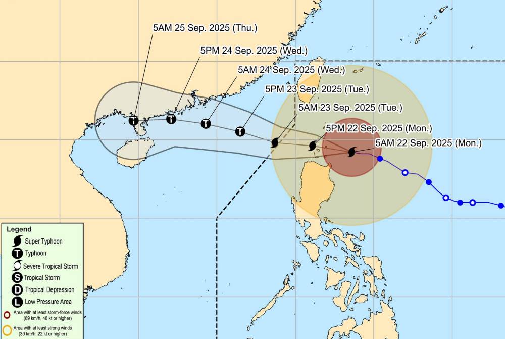
According to the latest weather forecast from the Philippine Atmospheric, Geophysical and Astronomical Services Administration, super typhoon Ragasa is approaching the northern part of the East Sea.
As of 7:00 a.m. on September 22 (local time), the center of the storm was at about 19.3 degrees North latitude - 123.2 degrees East longitude, about 180 km east of Calayan.
The strongest wind near the center of the storm reached 215 km/h, gusts up to 265 km/h. The storm is moving west at a speed of 20 km/h. Strong winds extended 600 km outside the center of the storm.
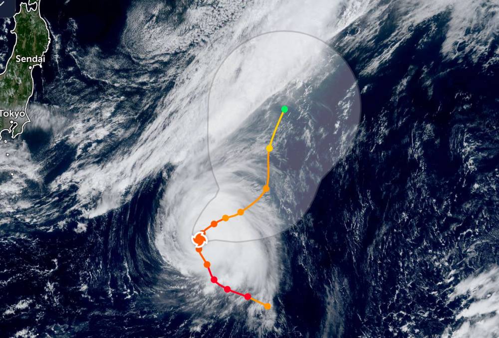
Meanwhile, super typhoon Neoguri changed direction in the Pacific Ocean.
According to the JWTC, the storm is moving from the northwest to the northwest at a speed of 17 km/h. The center of the storm is located 644 km north-northeast of Minami Tori Shima. The maximum significant wave height is 11.6 meters.
Super Typhoon Neoguri is no longer forecast to head towards the southern mainland of Japan.
According to the National Center for Hydro-Meteorological Forecasting, super typhoon Ragasa has begun to strongly affect the North East Sea basin.
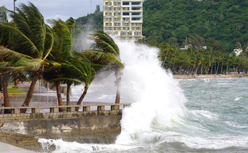
It is forecasted that on the day and night of September 22, the sea area east of the North East Sea will have winds gradually increasing to level 8-9, then increasing to level 10-14; The area near the storm's eye will have strong winds of level 15-17, gusting above level 17. The sea is rough, with waves 6.0-8 scale, and over 10.0 scale near the storm's eye.
In the Central East Sea area, there are winds of level 5, sometimes level 6; at night it increases to level 6, gusting to level 7-8, rough seas, waves 2.0-3.0m high.
In the sea area from Khanh Hoa to Ho Chi Minh City and the sea area north of the South China Sea (including the North of Truong Sa special zone), winds of level 5, sometimes level 6, gusts of level 7-8, rough seas, waves 2.0-3.0m high.
In addition, on the day and night of September 22, in the North and Central East Sea (including Hoang Sa), the North of the Gulf of Tonkin, the sea area from Gia Lai to Ca Mau, there will be scattered showers and thunderstorms; in the Northeast of the East Sea, there will be scattered showers and thunderstorms from the afternoon. During thunderstorms, there is a possibility of tornadoes, wind gusts of level 6-7 and waves over 2.0m high.
The sea area north of the North East Sea will have strong winds of level 10-14. The area near the storm center has level 16-17, gusts above level 17 and has storms. The sea is rough, with waves 6.0-8 scale, and over 10.0 scale near the storm's eye.
The southern sea area of the North East Sea (including Hoang Sa) and the Central East Sea area will have westerly to southwest winds of level 6, sometimes level 7, gusting to level 8 Legal waves 3.0-5.0m high, rough seas.
People and tourists planning to visit these coastal areas should pay attention to weather forecasts. Avoid boating at sea on days of heavy thunderstorms to ensure safety throughout the journey.