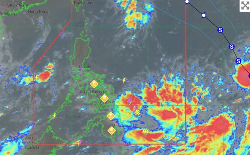
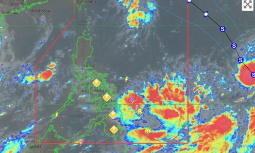
According to the latest information from the Philippine Atmospheric, Geophysical and Astronomical Services Administration (PAGASA) released at 11:00 p.m. on September 11, tropical storm Bebinca has strengthened into a strong tropical storm and is moving northwest in the waters off the Philippines.
According to the latest news, at 10:00 a.m., the storm center was determined to be at 15.4 degrees North latitude; 140.4 degrees East longitude; about 1,755 km southeast of Luzon Island or 2,010 km east of Central Luzon.
The strongest wind near the storm center reached 95km/h, gusting to 115km/h. The pressure at the storm center was 990 hPa.
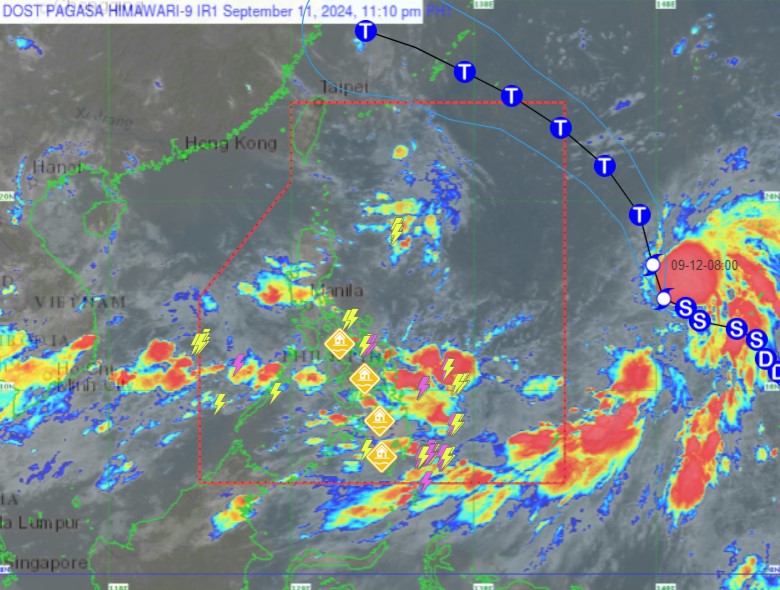
The storm is moving northwest at 25km/h and is forecast to develop into a typhoon by the evening of September 12.
The storm is forecast to continue to strengthen over the next 12 to 96 hours. Bebinca is expected to turn north-northwest tonight through tomorrow evening (September 12), then northwest through the evening of September 13. Finally, the storm is forecast to turn west-northwest for the remainder of the forecast.
The storm is expected to enter the Philippine Area of Responsibility (PAR) late Friday (September 13) and leave the area by Saturday morning (September 14).
During its path, the storm will remain far from the Philippine mainland.
Although the storm will not directly affect land, the tropical convergence zone combined with the southwest monsoon will bring moderate to heavy rains in the Mimaropa, Bicol, Visayas and northern and western Mindanao regions of the country from tomorrow.
PAGASA also warned that the seas west of Palawan and Kalayaan Islands, southeast of Palawan and eastern Mindanao will have waves 1-3 meters high in the next 24 hours.
Small boats should exercise caution when navigating these waters.
Given the complex weather situation, visitors planning to visit the above areas during this time should pay attention to monitoring and updating weather information continuously and consider their schedule to ensure their safety.