The Philippine Atmospheric and Geophysical Agency (PAGASA) has issued an updated warning for Typhoon Ferdie. According to the latest bulletin from PAGASA, the storm has now left the Philippine Area of Responsibility (PAR) this morning.
Despite leaving the waters near the Philippines, Typhoon Ferdie continues to have a significant impact on weather in the region.
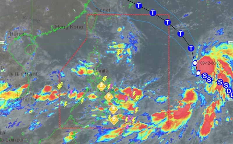
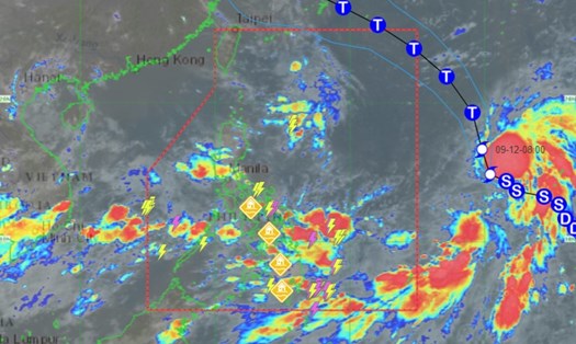
According to the latest report issued at 5:00 a.m., the center of Typhoon Ferdie is currently about 1,210 km northeast of the country's northernmost Luzon, moving west-northwest at a speed of 20 km/h. The strongest wind intensity near the center of the storm remains at 85 km/h, with gusts of up to 105 km/h.
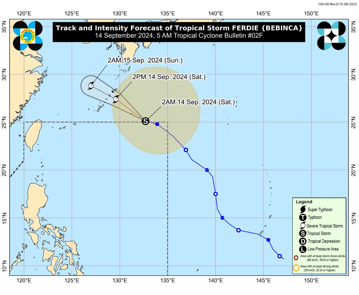
PAGASA forecasts Ferdie to continue moving northwest toward Okinawa, Japan, before crossing the East China Sea. The agency also warned that the storm has the potential to intensify into a severe tropical storm today, possibly even reaching typhoon strength when it enters the sea.
Although Ferdie has moved away from PAR, the southwest monsoon intensified by the storm is expected to bring widespread heavy rains. Affected areas include Batangas, MIMAROPA, Bicol Region, Visayas, Caraga Region, Northern Mindanao, Zamboanga Peninsula, BARMM, and Davao Region. Residents and visitors in these areas are advised to be on alert for possible flooding and landslides.
In addition, strong winds are also forecast to affect many areas, especially coastal and highland areas. Strong gusts of wind may reach hurricane force in the above areas from today until September 16.
For coastal areas, PAGASA warned of moderately rough seas with wave heights ranging from 1.0 to 4.0 meters in many coastal areas. Fishermen and seafarers, especially small boats, are advised not to venture out to sea during these dangerous weather conditions.
PAGASA continues to closely monitor the development of Typhoon Ferdie and will provide regular updates. Travelers planning to visit the above areas during this period are advised to monitor the latest weather reports and follow the instructions from local authorities to ensure safety during this time.