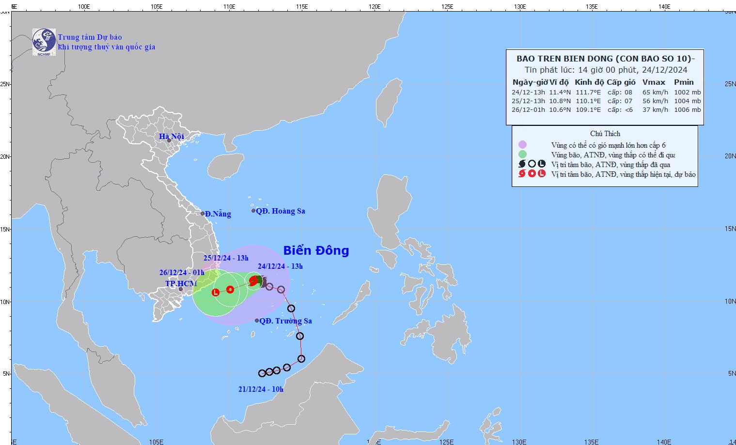
According to the latest weather forecast from the National Center for Hydro-Meteorological Forecasting, at 1:00 p.m. on December 24, the center of the storm was determined to be at approximately 11.4 degrees North latitude - 111.7 degrees East longitude, in the southwest sea area of the Central East Sea.
The strongest wind near the storm center is level 8 (62-74km/h), gusting to level 10. The storm is moving in a West Southwest direction at a speed of about 5km/h.

It is forecasted that by 1 p.m. on December 25, the storm will continue to move west-southwest at a speed of 5-10 km/h and gradually weaken into a tropical depression. The storm center is expected to be located at about 10.8 degrees North latitude - 110.1 degrees East longitude, in the sea area from Khanh Hoa to Binh Thuan.
The strongest wind near the center of the low pressure has decreased to level 6-7, gusting to level 9. Disaster risk level: level 3 for the southwestern sea area of the Central East Sea, the northwestern sea area of the South East Sea (including the northwestern sea area of Truong Sa archipelago) and the sea area from Khanh Hoa to Binh Thuan.
By 1am on December 26, the tropical depression will weaken into a low pressure area with a moving speed of about 10km/h. The center of the low pressure is expected to be at about 10.6 degrees North latitude - 109.1 degrees East longitude, over the sea from Ninh Thuan to Ba Ria - Vung Tau. Wind speed is currently below level 6, and is forecast to no longer pose a major risk.
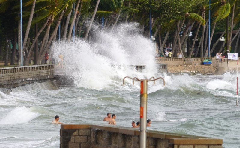
Due to the influence of the storm, the sea area southwest of the East Sea and northwest of the South East Sea (including the sea area northwest of Truong Sa archipelago) will have strong winds of level 6-7, the area near the storm center will have strong winds of level 8, gusting to level 10. Waves will be 4 to 6m high, rough seas.
The sea area from Khanh Hoa to Binh Thuan (including Phu Quy island) has strong winds of level 6, sometimes level 7, gusting to level 8-9, waves from 3 to 6m high, rough seas.
Due to the influence of storm No. 10 weakening into a tropical depression, it is forecasted that coastal areas from the Central region to Ho Chi Minh City will have moderate rain, heavy rain, and in some places very heavy rain from December 24 to 29.
In particular, residents and tourists from Ninh Thuan to Ba Ria - Vung Tau need to pay attention to weather forecasts and update the storm's direction to plan their travel schedule and outdoor activities appropriately, ensuring safety.


