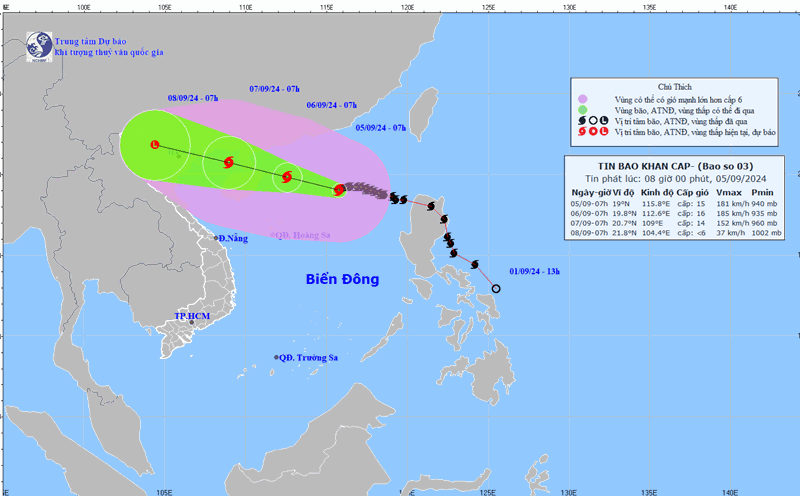
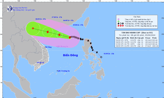
According to the new storm forecast from the National Center for Hydro-Meteorological Forecasting, at 10:00 a.m. on September 5, the center of the storm was located at approximately 19.1 degrees North latitude; 115.5 degrees East longitude, in the northern sea area of the North East Sea, approximately 490 km east of Hainan Island (China). The strongest wind near the center of the storm is level 16 (184-201 km/h), gusting to level 17, moving westward at a speed of approximately 10 km/h.
In the next 24 hours, the storm will move west-northwest at a speed of 15km/h. It is located about 550km east-southeast of Hainan Island (China). The storm intensity is level 16, gusting to level 17.
The eastern sea area of Bac Bo Gulf (including Bach Long Vy island district) has winds gradually increasing to level 6-7. From the night of September 6, the Bac Bo Gulf area (including Bach Long Vy island district, Co To) has winds gradually increasing to level 8-9, then increasing to level 10-12, the area near the storm center has winds of level 13-14, gusting to level 17; the sea is very rough.

By the morning of September 7, the storm is forecast to continue moving in a West-Northwest direction at a speed of 15-20km/h. The location is approximately 20.7 degrees North latitude; 108.3 degrees East longitude; in the northern area of the Gulf of Tonkin. At this time, the storm is forecast to be approximately 120km southeast of Quang Ninh.
Coastal areas from Quang Ninh to Thanh Hoa have winds gradually increasing to level 6-7, then increasing to level 8-9, areas near the storm center have winds of level 10-12, gusting to level 14; areas deep inland in the Northeast have strong winds of level 6-8, gusting to level 9-11.
Authorities issued a level 4 warning for the eastern part of the northern Gulf of Tonkin; a level 3 warning for the western part of the northern Gulf of Tonkin and the southern Gulf of Tonkin.
By 10:00 a.m. on September 8, the storm is likely to gradually weaken into a low pressure area at 22.0 degrees North latitude; 108.3 degrees East longitude in the Northwest region, with intensity decreasing to level 6. However, authorities still maintain it at level 3 in the Gulf of Tonkin.
From the night of September 6 to the morning of September 9, in the Northern and North Central regions, there is a possibility of heavy rain, locally very heavy rain and thunderstorms with total rainfall ranging from 100-350mm, in some places over 500mm. Heavy rain is likely to cause flooding in low-lying areas; flash floods on small rivers and streams, landslides on steep slopes.
Due to the influence of the wide storm circulation, it is necessary to be on guard against the risk of thunderstorms, tornadoes and strong gusts of wind both before and during the storm's landfall.
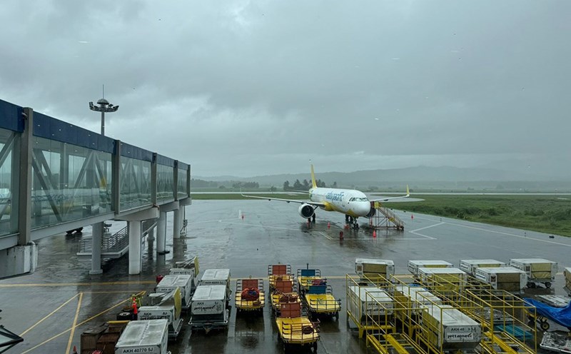
Residents and tourists should consider changing their schedules if they have flights or travel plans this weekend (September 6 - 8) to coastal localities such as Quang Ninh and Hai Phong, or areas expected to experience strong winds due to the impact of storm No. 3 such as Lang Son, Thai Binh, Nam Dinh, Ha Nam, Ninh Binh, Thanh Hoa, Hai Duong, and Hanoi.