According to information from the Philippine Atmospheric, Geophysical and Astronomical Services Administration (PAGASA), at 4:00 a.m. today, the center of Typhoon Yagi was located at about 18.9 degrees north latitude and 118.0 degrees east longitude, about 265 km northwest of Laoag City, Ilocos Norte.
The storm currently has maximum winds near its center of force 11 (103-117 km/h), gusting to force 13, and a central pressure of 980 hPa. The storm is moving west-northwest at about 10 km/h and hurricane-force winds extend up to 280 km from the center of the storm.
Despite leaving the Philippine Forecast Area (PAR), Typhoon Yagi continued to bring heavy rains to many parts of the country, with rainfall of about 100-200mm.
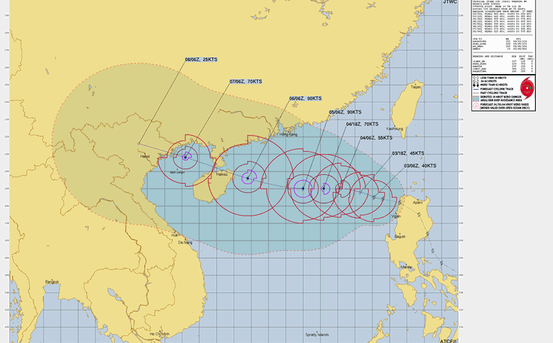
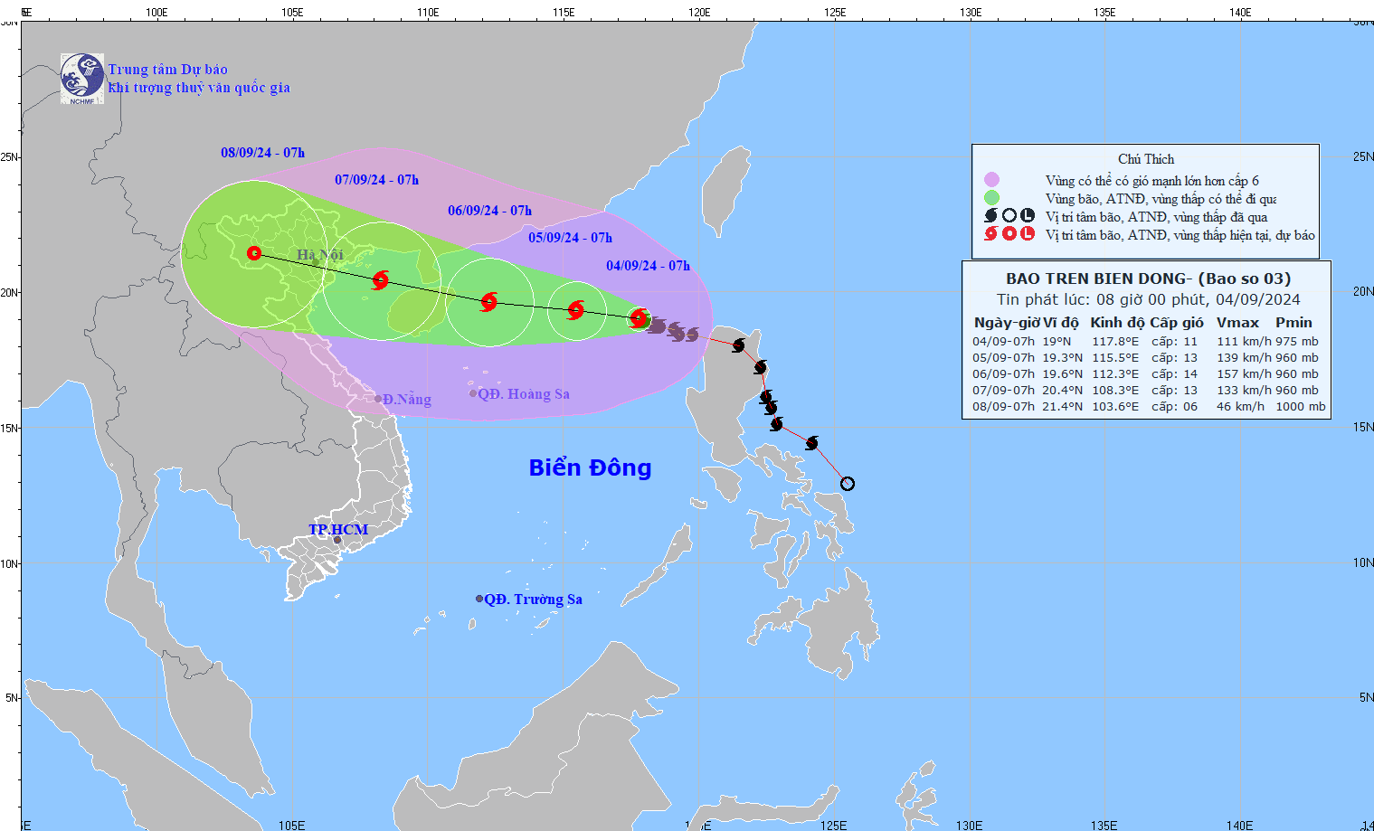
According to the latest update from the National Center for Hydro-Meteorological Forecasting, at 7:00 a.m. on September 4, the center of the storm was located at about 19.0 degrees North latitude; 117.8 degrees East longitude, in the eastern sea area of the North East Sea.
The storm is currently about 770km east of Hainan Island (China). The strongest wind near the storm's center is level 11 (103-117km/h), gusting to level 13, moving west-northwest at about 10km/h.
It is expected that at 7:00 a.m. on September 5, the center of the storm will be located at about 19.3 degrees North latitude; 115.5 degrees East longitude, about 520km east of Hainan Island (China), with the strongest wind near the center reaching level 13, gusting to level 16.
At 7:00 a.m. on September 6, the storm will be located at about 19.6 degrees North latitude; 112.3 degrees East longitude, about 180km east of Hainan Island (China), with the strongest wind near the center reaching level 14, gusting to level 17.
At 7:00 a.m. on September 7, the storm will officially enter the Gulf of Tonkin, at about 20.4 degrees North latitude; 108.3 degrees East longitude, with the strongest wind near the center reaching level 13, gusting to level 16.
At this time, level 4 warning is issued for the northern area of the North East Sea and level 3 warning is issued for the Gulf of Tonkin area.
From the next 72 to 120 hours, the storm will move mainly in the West - Northwest direction, traveling 15-20km per hour, with its intensity continuing to decrease.
The National Center for Hydro-Meteorological Forecasting also forecasts the storm's impact on the sea with strong winds of level 8-10, near the storm's eye level 11-13, gusting to level 16; rough seas and rising water, big waves.
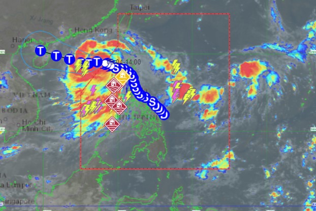
The storm's path is forecast to change compared to previous forecasts, with the area directly affected by the storm expanding to the Northwest region.
Accordingly, at 7am on September 8, the storm's eye is expected to be in the area bordering Dien Bien and Son La. The capital Hanoi is in the storm's path.
Given the complicated developments of typhoon Yagi, residents and tourists need to pay attention to updates on the storm situation, affected areas and prepare preventive measures right now.
Consider your travel schedule in the coming time, especially limit travel in the Northern and North Central regions; choose solid and safe accommodation areas and follow instructions from local authorities.
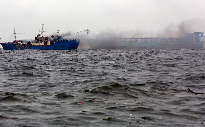
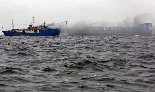
Vessels operating in these dangerous waters need to be especially vigilant against the effects of strong winds and large offshore waves up to 9-11m high.